East Candia, New Hampshire
| East Candia, New Hampshire | |
|---|---|
| Unincorporated community | |
|
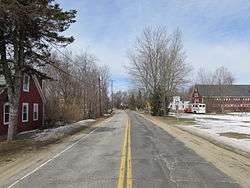
Langford Road | |
 East Candia  East Candia | |
| Coordinates: 43°02′53″N 71°14′59″W / 43.04806°N 71.24972°WCoordinates: 43°02′53″N 71°14′59″W / 43.04806°N 71.24972°W | |
| Country | United States |
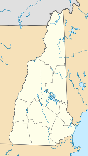
| State | New Hampshire |
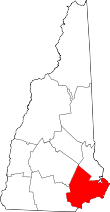
| County | Rockingham |
| Town | Candia |
| Elevation | 443 ft (135 m) |
| Time zone | Eastern (EST) (UTC-5) |
| • Summer (DST) | EDT (UTC-4) |
| ZIP code | 03040 |
| Area code(s) | 603 |
| GNIS feature ID | 871261[1] |
East Candia is an unincorporated community in the town of Candia in Rockingham County, New Hampshire.
The village, as the name suggests, is located in the eastern part of the town of Candia, close to the town border with Raymond. The community is centered upon the intersection of Langford Road and Depot Road, approximately 0.5 miles (0.8 km) south of Langford Road's intersection with New Hampshire Route 27.
East Candia has a separate ZIP code (03040) from the rest of the town of Candia.
References
This article is issued from Wikipedia - version of the 7/13/2016. The text is available under the Creative Commons Attribution/Share Alike but additional terms may apply for the media files.