Kensington, New Hampshire
| Kensington, New Hampshire | ||
|---|---|---|
|
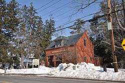
The public library | ||
| ||
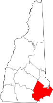
 Location in Rockingham County and the state of New Hampshire. | ||
| Coordinates: 42°55′37″N 70°56′38″W / 42.92694°N 70.94389°WCoordinates: 42°55′37″N 70°56′38″W / 42.92694°N 70.94389°W | ||
| Country | United States | |
| State | New Hampshire | |
| County | Rockingham | |
| Incorporated | 1737 | |
| Government | ||
| • Board of Selectmen |
Norman DeBoisbriand, Chair Robert Wadleigh Peter Merrill | |
| Area | ||
| • Total | 12.0 sq mi (31.0 km2) | |
| • Land | 11.9 sq mi (31.0 km2) | |
| • Water | 0.0 sq mi (0.0 km2) 0.08% | |
| Elevation | 115 ft (35 m) | |
| Population (2010) | ||
| • Total | 2,124 | |
| • Density | 180/sq mi (69/km2) | |
| Time zone | Eastern (UTC-5) | |
| • Summer (DST) | Eastern (UTC-4) | |
| ZIP code | 03833 | |
| Area code(s) | 603 | |
| FIPS code | 33-39780 | |
| GNIS feature ID | 0873636 | |
| Website |
www | |

Kensington is a town in Rockingham County, New Hampshire, United States. The population was 2,124 at the 2010 census.[1]
History
Once a parish of Hampton, Kensington was incorporated in 1737 by New Hampshire Governor Jonathan Belcher. Of the 27 towns granted by Governor Belcher, only 3 were given names, one of which was Kensington, named for Baron Kensington, owner of Kensington Palace in London.
Geography
According to the United States Census Bureau, the town has a total area of 12.0 square miles (31 km2), of which 11.9 sq mi (31 km2) is land and 0.08% is water. Kensington is home to 16 named hills of glacial drumlin origin; the highest, Indian Ground Hill, located on the town's border with South Hampton, is 305 feet (93 m) above sea level. The majority of Kensington lies within the Piscataqua River watershed, via the Exeter River. The southeast portion of town drains to Hampton Harbor via the Taylor and Hampton Falls rivers, and the southwest corner of the town drains to the Merrimack River.[2]
Demographics
| Historical population | |||
|---|---|---|---|
| Census | Pop. | %± | |
| 1790 | 800 | — | |
| 1800 | 776 | −3.0% | |
| 1810 | 781 | 0.6% | |
| 1820 | 709 | −9.2% | |
| 1830 | 717 | 1.1% | |
| 1840 | 647 | −9.8% | |
| 1850 | 700 | 8.2% | |
| 1860 | 672 | −4.0% | |
| 1870 | 642 | −4.5% | |
| 1880 | 614 | −4.4% | |
| 1890 | 547 | −10.9% | |
| 1900 | 524 | −4.2% | |
| 1910 | 417 | −20.4% | |
| 1920 | 383 | −8.2% | |
| 1930 | 438 | 14.4% | |
| 1940 | 458 | 4.6% | |
| 1950 | 542 | 18.3% | |
| 1960 | 708 | 30.6% | |
| 1970 | 1,044 | 47.5% | |
| 1980 | 1,322 | 26.6% | |
| 1990 | 1,631 | 23.4% | |
| 2000 | 1,893 | 16.1% | |
| 2010 | 2,124 | 12.2% | |
| Est. 2015 | 2,130 | [3] | 0.3% |
As of the census[5] of 2000, there were 1,893 people, 657 households, and 532 families residing in the town. The population density was 158.4 people per square mile (61.2/km²). There were 672 housing units at an average density of 56.2 per square mile (21.7/km²). The racial makeup of the town was 98.31% White, 0.11% African American, 0.21% Native American, 0.63% Asian, and 0.74% from two or more races.
There were 657 households out of which 40.3% had children under the age of 18 living with them, 72.9% were married couples living together, 5.8% had a female householder with no husband present, and 18.9% were non-families. 13.4% of all households were made up of individuals and 4.9% had someone living alone who was 65 years of age or older. The average household size was 2.88 and the average family size was 3.18.
In the town the population was spread out with 27.8% under the age of 18, 5.0% from 18 to 24, 32.0% from 25 to 44, 25.4% from 45 to 64, and 9.8% who were 65 years of age or older. The median age was 39 years. For every 100 females there were 97.6 males. For every 100 females age 18 and over, there were 100.0 males.
The median income for a household in the town was $67,344, and the median income for a family was $72,679. Males had a median income of $56,023 versus $35,278 for females. The per capita income for the town was $29,265. About 3.4% of families and 4.6% of the population were below the poverty line, including 5.1% of those under age 18 and 4.6% of those age 65 or over.
Notable people
- Dan Dailey, glass artist
- James Bruce MacQuarrie, pilot of Pan Am Flight 103 which was blown up over Lockerbie, Scotland on 21 December 1988
- Hideaki Miyamura, studio potter
- Norman Muscarello, journalist John G. Fuller wrote about Muscarello's alleged UFO sighting in his book the Incident at Exeter (1966)
References
| Wikimedia Commons has media related to Kensington, New Hampshire. |
- ↑ United States Census Bureau, American FactFinder, 2010 Census figures. Retrieved March 23, 2011.
- ↑ Foster, Debra H.; Batorfalvy, Tatianna N.; Medalie, Laura (1995). Water Use in New Hampshire: An Activities Guide for Teachers. U.S. Department of the Interior and U.S. Geological Survey.
- ↑ "Annual Estimates of the Resident Population for Incorporated Places: April 1, 2010 to July 1, 2015". Retrieved July 2, 2016.
- ↑ "Census of Population and Housing". Census.gov. Retrieved June 4, 2016.
- ↑ "American FactFinder". United States Census Bureau. Retrieved 2008-01-31.
External links
- Town of Kensington official website
- New Hampshire Economic and Labor Market Information Bureau Profile