Newmarket, New Hampshire
| Newmarket, New Hampshire | ||
|---|---|---|
|
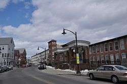
Downtown Newmarket | ||
| ||
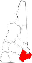
 Location in Rockingham County and the state of New Hampshire. | ||
| Coordinates: 43°04′58″N 70°56′06″W / 43.08278°N 70.93500°WCoordinates: 43°04′58″N 70°56′06″W / 43.08278°N 70.93500°W | ||
| Country | United States | |
| State | New Hampshire | |
| County | Rockingham | |
| Incorporated | 1727 | |
| Government | ||
| • Town Council |
Gary Levy, Chair Phil Nazzaro Kyle Bowden Amy Burns Dale Pike Amy Thompson Toni Weinstein | |
| • Town Administrator | Steve Fournier | |
| Area | ||
| • Total | 14.2 sq mi (36.7 km2) | |
| • Land | 12.5 sq mi (32.5 km2) | |
| • Water | 1.6 sq mi (4.2 km2) 11.43% | |
| Elevation | 39 ft (12 m) | |
| Population (2010) | ||
| • Total | 8,936 | |
| • Density | 630/sq mi (240/km2) | |
| Time zone | Eastern (UTC-5) | |
| • Summer (DST) | Eastern (UTC-4) | |
| ZIP code | 03857 | |
| Area code(s) | 603 | |
| FIPS code | 33-52340 | |
| GNIS feature ID | 0873683 | |
| Website |
www | |

Newmarket is a town in Rockingham County, New Hampshire, United States. The population was 8,936 at the 2010 census.[1] Some residents are students and employees at the nearby University of New Hampshire in Durham.
The primary settlement in town, where 5,297 people resided at the 2010 census,[1] is defined as the Newmarket census-designated place, or CDP, and is located at the junction of New Hampshire routes 108 and 152, adjacent to the Lamprey River.
History
Incorporated in 1727, Newmarket is one of six towns granted by Massachusetts in the last year of the reign of King George I. It started as a parish of Exeter, and was granted full town privileges by the legislature in 1737. It was probably named for Newmarket in Suffolk, England. The Lamprey River, running through the town, was named for John Lamprey, an early settler. For a while, the town was called Lampreyville. Newmarket was a center of the New England shipping trade with the West Indies, including importation of sugar and African slaves.[2]
Beginning with the first cotton textile mill in 1823, the Newmarket Manufacturing Company dominated the mill town's waterfront and economy with seven textile mills harnessing water power at the falls. The company had cotton shipped up from the Deep South, so its production was adversely affected by the American Civil War.[3] It built numerous support structures, including multi-family housing for workers. The company built dams upriver to create Pawtuckaway Pond in Nottingham and Mendums Pond in Barrington—during drought, the company could release a regulated flow of water from the dams into the Lamprey to run the works. The company closed in 1929.[3]
Adapted for modern commercial and residential uses, the textile mills are today listed on the National Register of Historic Places. In the 1970s, the mill served as the headquarters of the Timberland Company, during the years when it grew from a small work-boot manufacturer to a leading "urban" fashion brand. (The corporate headquarters are now located in nearby Stratham.)
Once a part of Newmarket, Newfields incorporated as a separate town in 1849.
Antique postcards
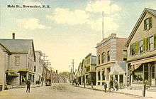
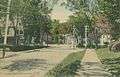 Street view c. 1910
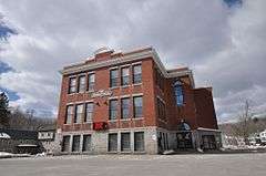
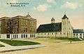 St. Mary's School c. 1912, now Newmarket Town Hall
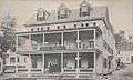 Hotel Willey in 1913
Geography
According to the United States Census Bureau, the town has a total area of 14.2 square miles (37 km2), of which 12.6 sq mi (33 km2) is land and 1.6 sq mi (4.1 km2) is water, comprising 11.43% of the town. Situated beside Great Bay, Newmarket is drained by the Lamprey River. The town's highest point is the summit of Bald Hill, at 281 feet (86 m) above sea level, near the town's southwest corner. Great Hill, with an elevation of 228 feet (69 m), rises just south of the town center.
The primary settlement, or census-designated place (CDP), within Newmarket has a total area of 2.0 sq mi (5.2 km2), of which 1.9 sq mi (4.9 km2) is land and 0.1 sq mi (0.26 km2) (4.43%) is water.
The town is crossed by New Hampshire Route 108 and New Hampshire Route 152.
Demographics
| Historical population | |||
|---|---|---|---|
| Census | Pop. | %± | |
| 1790 | 1,137 | — | |
| 1800 | 1,027 | −9.7% | |
| 1810 | 1,061 | 3.3% | |
| 1820 | 1,083 | 2.1% | |
| 1830 | 2,013 | 85.9% | |
| 1840 | 2,746 | 36.4% | |
| 1850 | 1,937 | −29.5% | |
| 1860 | 2,034 | 5.0% | |
| 1870 | 1,987 | −2.3% | |
| 1880 | 2,368 | 19.2% | |
| 1890 | 2,742 | 15.8% | |
| 1900 | 2,892 | 5.5% | |
| 1910 | 3,348 | 15.8% | |
| 1920 | 3,181 | −5.0% | |
| 1930 | 2,511 | −21.1% | |
| 1940 | 2,640 | 5.1% | |
| 1950 | 2,709 | 2.6% | |
| 1960 | 3,153 | 16.4% | |
| 1970 | 3,361 | 6.6% | |
| 1980 | 4,290 | 27.6% | |
| 1990 | 7,157 | 66.8% | |
| 2000 | 8,027 | 12.2% | |
| 2010 | 8,936 | 11.3% | |
| Est. 2015 | 8,908 | [4] | −0.3% |
As of the census of 2000, there were 8,027 people, 3,379 households, and 1,949 families residing in the town. The population density was 639.5 people per square mile (247.0/km²). There were 3,457 housing units at an average density of 106.4 persons/km² (275.4 persons/sq mi). The racial makeup of the town was 94.16% White, 0.64% African American, 0.20% Native American, 3.00% Asian, 0.00% Pacific Islander, 0.42% from other races, and 1.58% from two or more races. 1.73% of the population were Hispanic or Latino of any race.
The town of Newmarket has a small, but growing and significant, Laotian and Laotian American population, refugees and their families. Buddhist practitioners among the Laotians attend the Wat Lao Mixarayam Temple in Lowell, Massachusetts.
There were 3,379 households out of which 29.1% had children under the age of 18 living with them, 45.6% were married couples living together, 8.3% have a woman whose husband does not live with her, and 42.3% were non-families. 27.5% of all households were made up of individuals and 6.4% had someone living alone who was 65 years of age or older. The average household size was 2.37 and the average family size was 2.94.
In the town the population was spread out with 22.1% under the age of 18, 13.3% from 18 to 24, 37.2% from 25 to 44, 18.9% from 45 to 64, and 8.4% who were 65 years of age or older. The median age was 33 years. For every 100 females there were 98.4 males. For every 100 females age 18 and over, there were 95.1 males.
The median income for a household in the town was $46,058, and the median income for a family was $53,750. Males had a median income of $38,089 versus $26,375 for females. The per capita income for the town was $22,085. 8.3% of the population and 5.7% of families were below the poverty line. Out of the total people living in poverty, 11.1% are under the age of 18 and 5.5% are 65 or older.
Town center
As of the census of 2000, there were 5,124 people, 2,297 households, and 1,134 families residing in the central settlement, or census-designated place (CDP). The population density was 2,645.1 people per square mile (1,019.8/km²). There were 2,359 housing units at an average density of 469.5 persons/km² (1,217.8 persons/sq mi). The racial makeup of the town was 93.89% White, 0.84% African American, 0.25% Native American, 2.75% Asian, 0.49% from other races, and 1.78% from two or more races. 1.99% of the population were Hispanic or Latino of any race.
There were 2,297 households out of which 24.6% had children under the age of 18 living with them, 36.0% were married couples living together, 9.7% have a woman whose husband does not live with her, and 50.6% were non-families. 32.8% of all households were made up of individuals and 7.1% had someone living alone who was 65 years of age or older. The average household size was 2.22 and the average family size was 2.86.
In the settlement the population was spread out with 19.5% under the age of 18, 17.3% from 18 to 24, 37.6% from 25 to 44, 17.3% from 45 to 64, and 8.3% who were 65 years of age or older. The median age was 31 years. For every 100 females there were 97.2 males. For every 100 females age 18 and over, there were 94.3 males.
The median income for a household is $40,561, and the median income for a family was $47,553. Males had a median income of $33,977 versus $24,506 for females. The per capita income for the town was $19,841. 10.2% of the population and 6.8% of families were below the poverty line. Out of the total people living in poverty, 14.4% are under the age of 18 and 5.5% are 65 or older.
Notable people
- Emma Lenora Borden, murder trial witness in the trial of her younger sister Lizzie Andrew Borden
- John Brodhead, US congressman
- Wentworth Cheswell, first African-American elected to public office, justice of the peace
- Lynn Jennings, Olympic bronze medalist runner[6]
- George W. Kittredge, US congressman
- Bill Morrissey, folk singer-songwriter[7]
- Say Zuzu, band from Newmarket
- William B. Small, US congressman
- Henry Tufts, thief and autobiographer
Sites of interest
- Newmarket Historical Society
- The Stone Church, regionally famous music venue
References
- 1 2 United States Census Bureau, American FactFinder, 2010 Census figures. Retrieved March 23, 2011.
- ↑ New Hampshire Economic and Labor Market Information Bureau Profile
- 1 2 History of the Lamprey River Mills
- ↑ "Annual Estimates of the Resident Population for Incorporated Places: April 1, 2010 to July 1, 2015". Retrieved July 2, 2016.
- ↑ "Census of Population and Housing". Census.gov. Retrieved June 4, 2016.
- ↑ Shaughnessy, Dan (August 14, 1992). "She comes running home to open arms". Boston Globe. Boston. Retrieved October 24, 2016.
- ↑ Bliss, Gil (July 26, 2011). "Bill Morrissey, 59; folk artist traversed a range of emotions". Boston Globe. Boston. Retrieved October 24, 2016.
Further reading
External links
| Wikimedia Commons has media related to Newmarket, New Hampshire. |
- Town of Newmarket official website
- Newmarket Public Library
- History of Newmarket Manufacturing Company mill
- New Hampshire Economic and Labor Market Information Bureau Profile
- Newmarket Channel 13, community access station