Eastvale, Pennsylvania
| Eastvale, Pennsylvania | |
|---|---|
| Borough | |
|
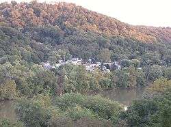
View of central Eastvale, taken from a building at Geneva College in Beaver Falls. | |
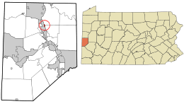
 Location in Beaver County and state of Pennsylvania | |
| Coordinates: 40°46′4″N 80°18′52″W / 40.76778°N 80.31444°WCoordinates: 40°46′4″N 80°18′52″W / 40.76778°N 80.31444°W | |
| Country | United States |
| State | Pennsylvania |
| County | Beaver |
| Incorporated | 1892 |
| Government | |
| • Type | Borough Council |
| Area | |
| • Total | 0.1 sq mi (0.3 km2) |
| Elevation | 1,063 ft (324 m) |
| Population (2010) | |
| • Total | 225 |
| • Density | 3,424.8/sq mi (1,322.3/km2) |
| Time zone | Eastern (EST) (UTC-5) |
| • Summer (DST) | EDT (UTC-4) |
| Area code(s) | 724 |
| GNIS feature ID | 1173930 [1] |

Eastvale is a borough in Beaver County, Pennsylvania, United States. The population was 225 at the 2010 census.
History
Originally known as "Fetterman,"[2] Eastvale was incorporated from parts of North Sewickley and Pulaski townships on July 1, 1892. The population was 256 at the 1900 census, the first taken since incorporation. A post office was operated in the community from 1897 to 1901, since which time Eastvale addresses have been served by the Beaver Falls post office.[3] The first bridge between Eastvale and Beaver Falls was completed in the 1880s and replaced by the current Eastvale Bridge in 1962. Eastvale's economy was long dependent on a brickworks at the borough's southern end, which closed by the mid-1970s.[2]
Geography
Eastvale is located at 40°46′4″N 80°18′52″W / 40.76778°N 80.31444°W (40.767765, -80.314579),[4] across the Beaver River from the city of Beaver Falls.[2]
According to the United States Census Bureau, the borough has a total area of 0.1 square miles (0.26 km2), of which, 0.1 square miles (0.26 km2) of it is land and 0.04 square miles (0.10 km2) of it (33.33%) is water.[4] It consists primarily of a strip of land along the Beaver River, far longer than it is wide.[5] By area, it is the smallest municipality in Beaver County.[2]
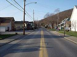
Eastvale's main street is Pennsylvania Route 588, which connects the community to Beaver Falls via a bridge at Eastvale's southern end.[5]
Demographics
| Historical population | |||
|---|---|---|---|
| Census | Pop. | %± | |
| 1900 | 256 | — | |
| 1910 | 322 | 25.8% | |
| 1920 | 429 | 33.2% | |
| 1930 | 601 | 40.1% | |
| 1940 | 573 | −4.7% | |
| 1950 | 533 | −7.0% | |
| 1960 | 513 | −3.8% | |
| 1970 | 453 | −11.7% | |
| 1980 | 379 | −16.3% | |
| 1990 | 328 | −13.5% | |
| 2000 | 293 | −10.7% | |
| 2010 | 225 | −23.2% | |
| Est. 2015 | 222 | [6] | −1.3% |
| Sources:[7][8][9] | |||
As of the census[8] of 2000, there were 293 people, 125 households, and 81 families residing in the borough. The population density was 3,424.8 people per square mile (1,257.0/km²). There were 133 housing units at an average density of 1,554.6 per square mile (570.6/km²). The racial makeup of the borough was 96.93% White, 1.71% African American, and 1.37% from other races.
There were 125 households, out of which 24.0% had children under the age of 18 living with them, 44.8% were married couples living together, 15.2% had a female householder with no husband present, and 34.4% were non-families. 31.2% of all households were made up of individuals, and 10.4% had someone living alone who was 65 years of age or older. The average household size was 2.34 and the average family size was 2.87.
In the borough the population was spread out, with 21.8% under the age of 18, 7.2% from 18 to 24, 34.8% from 25 to 44, 22.5% from 45 to 64, and 13.7% who were 65 years of age or older. The median age was 37 years. For every 100 females there were 96.6 males. For every 100 females age 18 and over, there were 99.1 males.
The median income for a household in the borough was $30,781, and the median income for a family was $31,667. Males had a median income of $27,708 versus $21,538 for females. The per capita income for the borough was $14,063. About 9.2% of families and 8.6% of the population were below the poverty line, including 13.5% of those under the age of eighteen and none of those sixty-five or over.
Public services
Education
Eastvale's children attend the schools of the Big Beaver Falls Area School District.[2] Before the district was formed by consolidation in 1958, Eastvale operated its own school district.[10]
Public safety
While Eastvale had a small volunteer fire department, fire protection in the community is the primary responsibility of the Beaver Falls Fire Department, Chief Mark Stowe.[11] This arrangement follows that of the police: Eastvale has contracted with Beaver Falls for police protection since at least 1997.[12]
Government
Eastvale is governed by a borough council with at least five members. As of the end of 2008, the council president was Pamela Cupac.[11]
References
- ↑ "Eastvale". Geographic Names Information System. United States Geological Survey. Retrieved 2009-02-20.
- 1 2 3 4 5 "Eastvale". Beaver County Bicentennial Commission. Beaver County Bicentennial Atlas. Beaver: Beaver County Bicentennial Commission, 1976.
- ↑ Bausman, Joseph H. History of Beaver County Pennsylvania and Its Centennial Celebration. New York: Knickerbocker, 1904, 849. Accessed 2009-07-19.
- 1 2 "US Gazetteer files: 2010, 2000, and 1990". United States Census Bureau. 2011-02-12. Retrieved 2011-04-23.
- 1 2 DeLorme. Pennsylvania Atlas & Gazetteer. 8th ed. Yarmouth: DeLorme, 2003, 56. ISBN 0-89933-280-3.
- ↑ "Annual Estimates of the Resident Population for Incorporated Places: April 1, 2010 to July 1, 2015". Retrieved July 2, 2016.
- ↑ "Census of Population and Housing". U.S. Census Bureau. Retrieved 11 December 2013.
- 1 2 "American FactFinder". United States Census Bureau. Retrieved 2008-01-31.
- ↑ "Incorporated Places and Minor Civil Divisions Datasets: Subcounty Resident Population Estimates: April 1, 2010 to July 1, 2012". Population Estimates. U.S. Census Bureau. Retrieved 11 December 2013.
- ↑ Pre-consolidation school districts list (PDF), Pittsburghlive.com. Accessed 2009-02-18.
- 1 2 Eastvale hires Beaver Falls Fire Department, The Beaver County Times, 2008-12-30. Accessed 2009-02-18.
- ↑ Contracted Police Services in Pennsylvania (PDF), Governor's Center for Local Government Services, 1999-04-26. Accessed 2009-02-18.
External links
| Wikimedia Commons has media related to Eastvale, Pennsylvania. |
- Eastvale, Pennsylvania is at coordinates 40°46′4″N 80°18′52″W / 40.76778°N 80.31444°W.

