Edgefield Historic District (Edgefield, South Carolina)
|
Edgefield Historic District | |
|
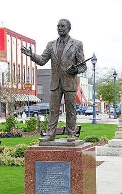
Edgefield Village Square, March 2012 | |
  | |
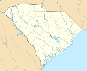
| Location | Both sides of U.S. 25 through town of Edgefield, Edgefield, South Carolina |
|---|---|
| Coordinates | 33°49′58″N 81°48′04″W / 33.83278°N 81.80111°WCoordinates: 33°49′58″N 81°48′04″W / 33.83278°N 81.80111°W |
| Area | 480 acres (190 ha) |
| Architect | Niernsee, John R. |
| Architectural style | Greek Revival, Gothic, Georgian |
| NRHP Reference # | 72001207[1] |
| Added to NRHP | March 23, 1972 |
Edgefield Historic District is a national historic district located at Edgefield, Edgefield County, South Carolina. The district encompasses 33 contributing buildings, 6 contributing sites, and 1 contributing object in the town of Edgefield. The buildings center on the landscaped village green, and includes 40 19th century buildings, three of which are house museums. There are a number of 19th century Greek Revival style homes, while others are noted for beautiful Federal style fanlights and unusual doorways. Other district properties include Victorian influenced homes and downtown commercial buildings. Five churches represent the Georgian, Victorian Gothic, and modified Gothic architectural styles. Notable buildings include the Edgefield County Courthouse, Trinity Episcopal Church and Rectory, St. Mary's Catholic Church (designed by John R. Niernsee), Halcyon Grove, Oakley Park, Carroll Hill, Blocker House, Yarborough House, and Padgett House.[2][3]
It was listed on the National Register of Historic Places in 1972.[1]
References
- 1 2 National Park Service (2010-07-09). "National Register Information System". National Register of Historic Places. National Park Service.
- ↑ Nancy R. Ruhf (December 1970, November 1971). "Edgefield Historic District" (pdf). National Register of Historic Places - Nomination and Inventory. Retrieved 20 October 2012. Check date values in:
|date=(help) - ↑ "Edgefield Historic District, Edgefield County (Edgefield)". National Register Properties in South Carolina. South Carolina Department of Archives and History. Retrieved 20 October 2012. and accompanying map


