| [3] |
Name on the Register[4] |
Image |
Date listed[5] |
Location |
City or town |
Description |
|---|
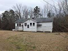
| 1 |
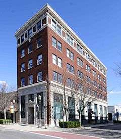
Afro-American Insurance Company Building |
|
000000001992-06-10-0000June 10, 1992
(#92000651) |
558 S. Dave Lyle Boulevard
34°55′19″N 81°02′09″W / 34.921944°N 81.035833°W / 34.921944; -81.035833 (Afro-American Insurance Company Building) |
Rock Hill |
|
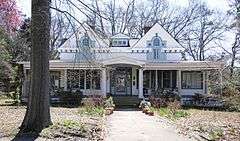
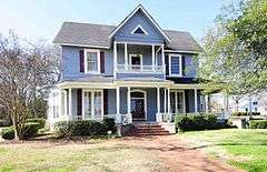
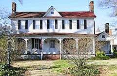
| 2 |
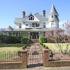
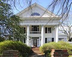
Anderson House |
|
000000001982-05-13-0000May 13, 1982
(#82003908) |
227 Oakland Ave.
34°55′54″N 81°01′34″W / 34.931667°N 81.026111°W / 34.931667; -81.026111 (Anderson House) |
Rock Hill |
Designed by architect George Franklin Barber
|
| 3 |
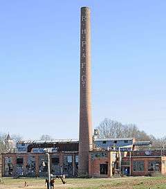
Bleachery Water Treatment Plant |
|
000000002008-03-06-0000March 6, 2008
(#08000154) |
Stewart Ave.
34°56′06″N 81°01′53″W / 34.935105°N 81.031514°W / 34.935105; -81.031514 (Bleachery Water Treatment Plant) |
Rock Hill |
|
| 4 |
Catawba Rosenwald School |
|
000000002013-07-03-0000July 3, 2013
(#13000465) |
3071 S.. Anderson Rd
34°54′43″N 80°58′35″W / 34.9119°N 80.9764°W / 34.9119; -80.9764 (Catawba Rosenwald School) |
Rock Hill |
|
| 5 |
Charlotte Avenue-Aiken Avenue Historic District |
|
000000001992-06-10-0000June 10, 1992
(#92000659) |
Roughly Aiken Ave. from College Ave. to Charlotte Ave. and Charlotte from Aiken to Union Ave.
34°56′09″N 81°01′28″W / 34.935833°N 81.024444°W / 34.935833; -81.024444 (Charlotte Avenue-Aiken Avenue Historic District) |
Rock Hill |
|
| 6 |
Ebenezer Academy |
|
000000001977-08-16-0000August 16, 1977
(#77001234) |
2132 Ebenezer Rd.
34°58′01″N 81°03′06″W / 34.966944°N 81.051667°W / 34.966944; -81.051667 (Ebenezer Academy) |
Rock Hill |
|
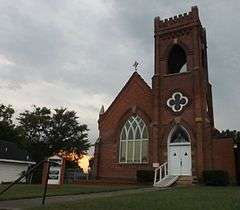
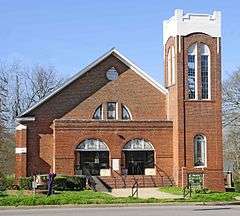
| 7 |
First Presbyterian Church |
|
000000001992-06-10-0000June 10, 1992
(#92000653) |
234 E. Main St.
34°55′25″N 81°01′31″W / 34.923611°N 81.025278°W / 34.923611; -81.025278 (First Presbyterian Church) |
Rock Hill |
|
| 8 |
Hermon Presbyterian Church |
|
000000001992-06-10-0000June 10, 1992
(#92000652) |
446 Dave Lyle Boulevard
34°55′24″N 81°02′03″W / 34.923333°N 81.034167°W / 34.923333; -81.034167 (Hermon Presbyterian Church) |
Rock Hill |
|
| 9 |
Highland Park Manufacturing Plant and Cotton Oil Complex |
|
000000001992-06-10-0000June 10, 1992
(#92000655) |
869 Standard St. and 732 and 737 E. White St.
34°55′15″N 81°00′42″W / 34.920833°N 81.011667°W / 34.920833; -81.011667 (Highland Park Manufacturing Plant and Cotton Oil Complex) |
Rock Hill |
|
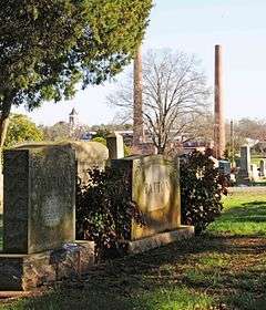
| 10 |
Laurelwood Cemetery |
|
000000002008-07-31-0000July 31, 2008
(#08000746) |
Bordered by Laurel, W. White, Stewart, and W. Main Sts.
34°55′55″N 81°01′59″W / 34.931964°N 81.032932°W / 34.931964; -81.032932 (Laurelwood Cemetery) |
Rock Hill |
|
| 11 |
Marion Street Area Historic District |
|
000000001992-06-10-0000June 10, 1992
(#92000654) |
Roughly Marion St. from Hampton St. to Center St. and Center from State St. to Marion
34°55′13″N 81°01′43″W / 34.920278°N 81.028611°W / 34.920278; -81.028611 (Marion Street Area Historic District) |
Rock Hill |
|
| 12 |
McCorkle-Fewell-Long House |
|
000000001980-08-21-0000August 21, 1980
(#80003715) |
639 College Ave.
34°56′30″N 81°01′36″W / 34.941667°N 81.026667°W / 34.941667; -81.026667 (McCorkle-Fewell-Long House) |
Rock Hill |
|
| 13 |
Mount Prospect Baptist Church |
|
000000001992-06-10-0000June 10, 1992
(#92000656) |
339 W. Black St.
34°55′45″N 81°02′08″W / 34.929167°N 81.035556°W / 34.929167; -81.035556 (Mount Prospect Baptist Church) |
Rock Hill |
|
| 14 |
Nation Ford Fish Weir |
Upload image |
000000002007-03-01-0000March 1, 2007
(#00000595) |
In the Catawba River approximately 1200 feet upstream from the Nation Ford railroad trestle
34°57′40″N 80°57′20″W / 34.96102°N 80.955616°W / 34.96102; -80.955616 (Nation Ford Fish Weir) |
Rock Hill |
|
| 15 |
People's National Bank Building |
|
000000001999-03-25-0000March 25, 1999
(#99000396) |
131-133 E. Main St.
34°55′32″N 81°01′37″W / 34.925556°N 81.026944°W / 34.925556; -81.026944 (People's National Bank Building) |
Rock Hill |
|
| 16 |
Reid Street-North Confederate Avenue Area Historic District |
Upload image |
000000001992-06-10-0000June 10, 1992
(#92000657) |
Roughly Reid St. and N. Confederate Ave. between E. Main St. and E. White St.
34°55′26″N 81°01′19″W / 34.923889°N 81.021944°W / 34.923889; -81.021944 (Reid Street-North Confederate Avenue Area Historic District) |
Rock Hill |
|
| 17 |
Rock Hill Body Company |
|
000000002008-03-06-0000March 6, 2008
(#08000155) |
601 W. Main St.
34°55′55″N 81°02′11″W / 34.931902°N 81.03651°W / 34.931902; -81.03651 (Rock Hill Body Company) |
Rock Hill |
|
| 18 |
Rock Hill Cotton Factory |
|
000000001992-06-10-0000June 10, 1992
(#92000658) |
215 Chatham St.; also 130 W. White St.
34°55′42″N 81°01′39″W / 34.928333°N 81.0275°W / 34.928333; -81.0275 (Rock Hill Cotton Factory) |
Rock Hill |
130 White represents a boundary increase of 000000002008-03-06-0000March 6, 2008
|
| 19 |
Rock Hill Downtown Historic District |
|
000000001991-06-24-0000June 24, 1991
(#91000828) |
Roughly S. Oakland Ave. from south of Peoples Pl. to E. Main St.
34°55′31″N 81°01′30″W / 34.925278°N 81.025°W / 34.925278; -81.025 (Rock Hill Downtown Historic District) |
Rock Hill |
|
| 20 |
Rock Hill Printing and Finishing Company |
Upload image |
000000002013-02-05-0000February 5, 2013
(#12001264) |
400 W. White St.
34°55′51″N 81°01′49″W / 34.930847°N 81.03018°W / 34.930847; -81.03018 (Rock Hill Printing and Finishing Company) |
Rock Hill |
|
| 21 |
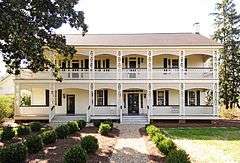
Stokes-Mayfield House |
|
000000001984-05-17-0000May 17, 1984
(#84002100) |
353 Oakland Ave.
34°56′03″N 81°01′40″W / 34.934167°N 81.027778°W / 34.934167; -81.027778 (Stokes-Mayfield House) |
Rock Hill |
|
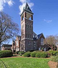
| 22 |
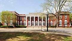
Tillman Hall |
|
000000001977-12-02-0000December 2, 1977
(#77001235) |
Oakland Ave. on the Winthrop College campus
34°56′18″N 81°01′47″W / 34.938333°N 81.029722°W / 34.938333; -81.029722 (Tillman Hall) |
Rock Hill |
|
| 23 |
US Post Office and Courthouse |
|
000000001988-01-21-0000January 21, 1988
(#87002523) |
102 Main St.
34°55′30″N 81°01′33″W / 34.925°N 81.025833°W / 34.925; -81.025833 (US Post Office and Courthouse) |
Rock Hill |
|
| 24 |
White House |
|
000000001969-12-03-0000December 3, 1969
(#69000176) |
258 E. White St.
34°55′33″N 81°01′18″W / 34.925833°N 81.021667°W / 34.925833; -81.021667 (White House) |
Rock Hill |
|
| 25 |
Winthrop College Historic District |
|
000000001987-04-23-0000April 23, 1987
(#86003469) |
Along Oakland Ave. between Cherry Rd. and Stewart Ave. on the Winthrop College campus
34°56′22″N 81°01′48″W / 34.939444°N 81.03°W / 34.939444; -81.03 (Winthrop College Historic District) |
Rock Hill |
|
| 26 |
Withers Building |
|
000000001981-08-20-0000August 20, 1981
(#81000571) |
Oakland Ave.
34°50′28″N 81°01′42″W / 34.841111°N 81.028333°W / 34.841111; -81.028333 (Withers Building) |
Rock Hill |
|

.jpg)


.jpg)
_1933.jpg)
.jpg)