| [3] |
Name on the Register[4] |
Image |
Date listed[5] |
Location |
City or town |
Description |
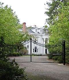
|---|
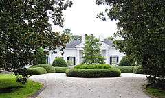
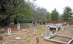
| 1 |
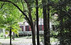
Aiken Colored Cemetery |
|
000000002007-03-19-0000March 19, 2007
(#07000182) |
Florence St. and Hampton Ave.
33°34′16″N 81°43′23″W / 33.571°N 81.722964°W / 33.571; -81.722964 (Aiken Colored Cemetery) |
Aiken |
|
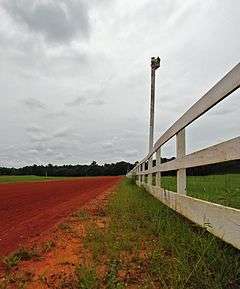
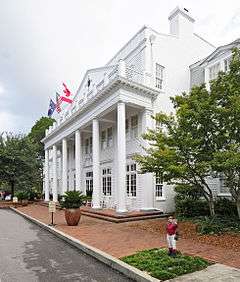
| 2 |
Aiken Mile Track |
|
000000001985-05-09-0000May 9, 1985
(#85000991) |
Banks Mill Rd.
33°32′39″N 81°41′57″W / 33.544167°N 81.699167°W / 33.544167; -81.699167 (Aiken Mile Track) |
Aiken |
|
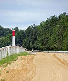
| 3 |
Aiken Training Track |
|
000000001985-05-09-0000May 9, 1985
(#85000992) |
Two Notch Rd.
33°32′35″N 81°42′30″W / 33.543056°N 81.708333°W / 33.543056; -81.708333 (Aiken Training Track) |
Aiken |
|
| 4 |
Aiken Winter Colony Historic District I |
|
000000001984-11-27-0000November 27, 1984
(#84000484) |
Off U.S. Routes 1/78
33°32′59″N 81°44′29″W / 33.549722°N 81.741389°W / 33.549722; -81.741389 (Aiken Winter Colony Historic District I) |
Aiken |
|
| 5 |
Aiken Winter Colony Historic District II |
|
000000001984-11-27-0000November 27, 1984
(#84000498) |
Roughly bounded by railroad tracks, Colleton and 3rd Aves., and Laurens, South Boundary, and Marion Sts.
33°33′16″N 81°43′15″W / 33.554444°N 81.720833°W / 33.554444; -81.720833 (Aiken Winter Colony Historic District II) |
Aiken |
|
| 6 |
Aiken Winter Colony Historic District III |
|
000000001984-11-27-0000November 27, 1984
(#84000508) |
Roughly bounded by Edgefield Ave., Highland Park Dr., Fauburg, and Greenville St.
33°33′47″N 81°43′40″W / 33.563056°N 81.727778°W / 33.563056; -81.727778 (Aiken Winter Colony Historic District III) |
Aiken |
|
| 7 |
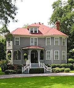
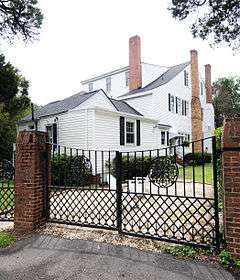
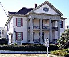
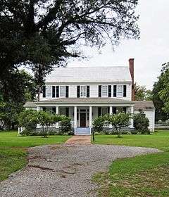
Chancellor James P. Carroll House |
|
000000001977-11-23-0000November 23, 1977
(#77001209) |
112 Gregg Ave.
33°33′59″N 81°45′28″W / 33.566389°N 81.757778°W / 33.566389; -81.757778 (Chancellor James P. Carroll House) |
Aiken |
|
| 8 |
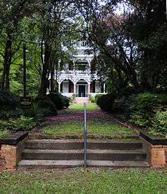
The Cedars |
|
000000001993-06-17-0000June 17, 1993
(#93000539) |
U.S. Route 278, 0.3 miles east of South Carolina Highway 125
33°25′38″N 81°52′50″W / 33.427222°N 81.880556°W / 33.427222; -81.880556 (The Cedars) |
Beech Island |
|
| 9 |
Chinaberry |
|
000000001982-04-29-0000April 29, 1982
(#82003826) |
441 York St., SE.
33°33′11″N 81°43′18″W / 33.553056°N 81.721667°W / 33.553056; -81.721667 (Chinaberry) |
Aiken |
|
| 10 |
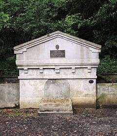
Coker Spring |
|
000000001978-01-18-0000January 18, 1978
(#78002490) |
Coker Spring Rd.
33°32′59″N 81°43′37″W / 33.549722°N 81.726944°W / 33.549722; -81.726944 (Coker Spring) |
Aiken |
|
| 11 |
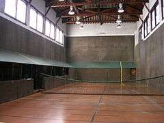
Court Tennis Building |
|
000000001984-11-27-0000November 27, 1984
(#84000513) |
Newberry and Park Sts.
33°33′34″N 81°43′17″W / 33.559444°N 81.721389°W / 33.559444; -81.721389 (Court Tennis Building) |
Aiken |
|
| 12 |
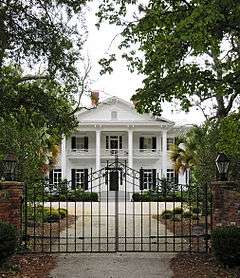
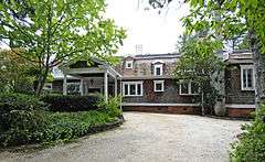
Crossways |
|
000000001997-06-04-0000June 4, 1997
(#97000536) |
450 E. Boundary St.
33°32′46″N 81°41′27″W / 33.546111°N 81.690833°W / 33.546111; -81.690833 (Crossways) |
Aiken |
|
| 13 |
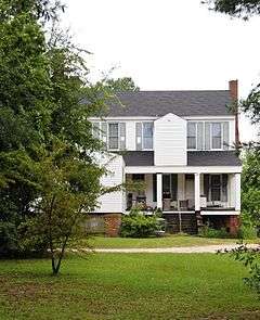
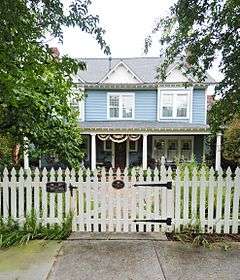
Dawson-Vanderhorst House |
|
000000001976-06-29-0000June 29, 1976
(#76001685) |
Northeast of Aiken at the junction of Wire and New Bridge Rds.
33°34′49″N 81°40′57″W / 33.580278°N 81.6825°W / 33.580278; -81.6825 (Dawson-Vanderhorst House) |
Aiken |
|
| 14 |
Fort Moore-Savano Town Site |
Upload image |
000000001973-08-14-0000August 14, 1973
(#73001670) |
West of Beech Island on the Savannah River[6]
33°25′53″N 81°54′37″W / 33.431389°N 81.910278°W / 33.431389; -81.910278 (Fort Moore-Savano Town Site) |
Beech Island |
|
| 15 |
Georgia Avenue-Butler Avenue Historic District |
|
000000001984-04-05-0000April 5, 1984
(#84002017) |
Georgia and Butler Aves. and Martintown Rd.
33°30′15″N 81°57′52″W / 33.504167°N 81.964444°W / 33.504167; -81.964444 (Georgia Avenue-Butler Avenue Historic District) |
North Augusta |
|
| 16 |
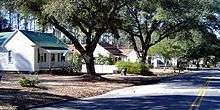
Graniteville Historic District |
|
000000001978-06-02-0000June 2, 1978
(#78002491) |
South Carolina Highway 19 and Gregg St.
33°34′03″N 81°48′24″W / 33.5675°N 81.806667°W / 33.5675; -81.806667 (Graniteville Historic District) |
Graniteville |
|
| 17 |
Charles Hammond House |
|
000000001973-10-02-0000October 2, 1973
(#73001672) |
908 Martintown Rd., W.
33°31′33″N 81°58′47″W / 33.525833°N 81.979722°W / 33.525833; -81.979722 (Charles Hammond House) |
North Augusta |
|
| 18 |
Hickman Mill Historic District |
|
000000002016-02-23-0000February 23, 2016
(#16000046) |
Bounded by Marshall, Canal, and Hard Streets, and Horse Creek
33°33′54″N 81°48′33″W / 33.564912°N 81.809036°W / 33.564912; -81.809036 (Hickman Mill Historic District) |
Graniteville |
|
| 19 |
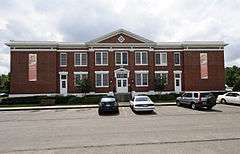
Immanuel School |
|
000000002009-06-03-0000June 3, 2009
(#09000389) |
120 York St., NE
33°33′38″N 81°43′03″W / 33.560578°N 81.717586°W / 33.560578; -81.717586 (Immanuel School) |
Aiken |
|
| 20 |
Joye Cottage |
|
000000001980-09-29-0000September 29, 1980
(#80003651) |
463 Whiskey Rd. and 129 1st Ave.
33°33′12″N 81°43′25″W / 33.553333°N 81.723611°W / 33.553333; -81.723611 (Joye Cottage) |
Aiken |
|
| 21 |
Legare-Morgan House |
|
000000001977-09-22-0000September 22, 1977
(#77001210) |
241 Lauren St., SW.
33°33′23″N 81°43′30″W / 33.556389°N 81.725°W / 33.556389; -81.725 (Legare-Morgan House) |
Aiken |
|
| 22 |
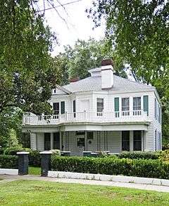
Lookaway Hall |
|
000000001992-08-13-0000August 13, 1992
(#92000962) |
103 W. Forest Ave.
33°29′56″N 81°58′08″W / 33.498889°N 81.968889°W / 33.498889; -81.968889 (Lookaway Hall) |
North Augusta |
|
| 23 |
Britton Mims Place |
Upload image |
000000001997-06-04-0000June 4, 1997
(#97000539) |
229 Edgefield Rd.
33°31′27″N 81°56′59″W / 33.524167°N 81.949722°W / 33.524167; -81.949722 (Britton Mims Place) |
North Augusta |
|
| 24 |
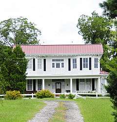
Oakland Plantation |
|
000000002011-08-19-0000August 19, 2011
(#10001219) |
2930 Storm Branch Rd.
33°26′59″N 81°50′17″W / 33.449722°N 81.838056°W / 33.449722; -81.838056 (Oakland Plantation) |
Beech Island vicinity |
|
| 25 |
Phelps House |
|
000000001974-06-10-0000June 10, 1974
(#74001819) |
Barnwell Ave.
33°33′56″N 81°43′29″W / 33.565556°N 81.724722°W / 33.565556; -81.724722 (Phelps House) |
Aiken |
|
| 26 |
Pickens House |
|
000000001983-05-19-0000May 19, 1983
(#83002182) |
101 Gregg Ave.
33°33′55″N 81°45′39″W / 33.565278°N 81.760833°W / 33.565278; -81.760833 (Pickens House) |
Aiken |
|
| 27 |
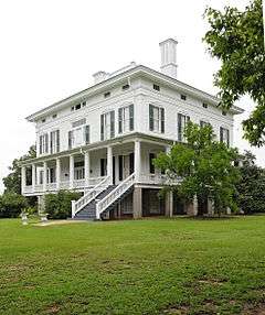
Redcliffe |
|
000000001973-05-08-0000May 8, 1973
(#73001671) |
1.5 miles northeast of Beech Island on South Carolina Highway 125
33°24′58″N 81°52′56″W / 33.416111°N 81.882222°W / 33.416111; -81.882222 (Redcliffe) |
Beech Island |
|
| 28 |
Rosemary Hall |
|
000000001975-04-28-0000April 28, 1975
(#75001685) |
804 Carolina Ave.
33°29′49″N 81°58′12″W / 33.496944°N 81.97°W / 33.496944; -81.97 (Rosemary Hall) |
North Augusta |
|
| 29 |
St. Mary Help of Christians Church |
|
000000001982-03-25-0000March 25, 1982
(#82003827) |
York St. and Park Ave.
33°33′28″N 81°43′11″W / 33.557778°N 81.719722°W / 33.557778; -81.719722 (St. Mary Help of Christians Church) |
Aiken |
|
| 30 |
St. Thaddeus Episcopal Church |
|
000000001984-11-27-0000November 27, 1984
(#84000518) |
Pendleton and Richland Sts.
33°33′41″N 81°43′30″W / 33.561389°N 81.725°W / 33.561389; -81.725 (St. Thaddeus Episcopal Church) |
Aiken |
|
| 31 |
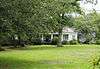
Salley Historic District |
|
000000002000-10-27-0000October 27, 2000
(#00000554) |
Bounded by Pine, Ferguson, Poplar, and Aldrich Sts.
33°33′56″N 81°18′17″W / 33.565556°N 81.304722°W / 33.565556; -81.304722 (Salley Historic District) |
Salley |
|
| 32 |
Silver Bluff |
Upload image |
000000001977-11-01-0000November 1, 1977
(#77001211) |
Silver Bluff Rd. on the Savannah River[7]
33°18′38″N 81°50′38″W / 33.310556°N 81.843889°W / 33.310556; -81.843889 (Silver Bluff) |
Jackson |
|
| 33 |
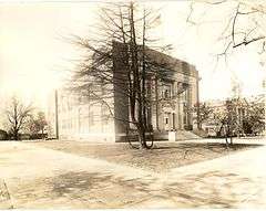
US Court House-Aiken, South Carolina |
|
000000002003-12-10-0000December 10, 2003
(#03001288) |
223 Park Ave., SE.
33°33′32″N 81°43′23″W / 33.558889°N 81.723056°W / 33.558889; -81.723056 (US Court House-Aiken, South Carolina) |
Aiken |
|
| 34 |
Vaucluse Mill Village Historic District |
|
000000001996-05-07-0000May 7, 1996
(#96000494) |
South Carolina Highway 191, 3 miles north of Graniteville and 6 miles west of Aiken
33°36′54″N 81°48′12″W / 33.615°N 81.803333°W / 33.615; -81.803333 (Vaucluse Mill Village Historic District) |
Vaucluse |
|
| 35 |
B.C. Wall House |
|
000000001992-11-27-0000November 27, 1992
(#92001632) |
1008 West Ave.
33°30′08″N 81°58′18″W / 33.502222°N 81.971667°W / 33.502222; -81.971667 (B.C. Wall House) |
North Augusta |
|
| 36 |
Warren Mill |
Upload image |
000000002016-09-27-0000September 27, 2016
(#16000678) |
Cty. Rd. P-1201 & SC 421
Coordinates missing |
Warrenville |
|
| 37 |
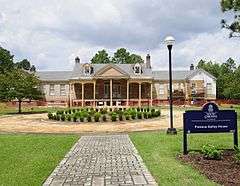
Warrenville Elementary School |
|
000000002002-05-22-0000May 22, 2002
(#02000560) |
115 Timmerman St.
33°32′53″N 81°48′24″W / 33.548056°N 81.806667°W / 33.548056; -81.806667 (Warrenville Elementary School) |
Warrenville |
|
| 38 |
Whitehall |
|
000000001984-11-27-0000November 27, 1984
(#84000527) |
902 Magnolia St.
33°32′31″N 81°43′11″W / 33.541944°N 81.719722°W / 33.541944; -81.719722 (Whitehall) |
Aiken |
|
| 39 |
Willcox's |
|
000000001982-03-19-0000March 19, 1982
(#82003828) |
Colleton Ave.
33°33′25″N 81°43′19″W / 33.556944°N 81.721944°W / 33.556944; -81.721944 (Willcox's) |
Aiken |
|
| 40 |
Zubly Cemetery |
|
000000002002-01-28-0000January 28, 2002
(#01001548) |
Forrest Dr.
33°24′20″N 81°54′02″W / 33.405556°N 81.900556°W / 33.405556; -81.900556 (Zubly Cemetery) |
Beech Island |
|