Elba, Alabama
| Elba, Alabama | |
|---|---|
| City | |
|
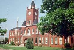
Coffee County Courthouse in Elba | |
| Nickname(s): The City of Flowing Wells | |
 Location in Coffee County and the state of Alabama | |
| Coordinates: 31°25′2″N 86°4′38″W / 31.41722°N 86.07722°W | |
| Country | United States |
| State | Alabama |
| County | Coffee |
| Settled | Early 1830s |
| Incorporated | April 13, 1853 |
| Government | |
| • Type | City Council/Mayor |
| • Mayor | Mickey Murdock |
| Area | |
| • Total | 15.4 sq mi (39.9 km2) |
| • Land | 15.3 sq mi (39.7 km2) |
| • Water | 0.08 sq mi (0.2 km2) |
| Elevation | 194 ft (59 m) |
| Population (2010) | |
| • Total | 3,940 |
| • Density | 257/sq mi (99.2/km2) |
| Time zone | Central (CST) (UTC-6) |
| • Summer (DST) | CDT (UTC-5) |
| ZIP code | 36323 |
| Area code(s) | 334 |
| FIPS code | 01-23296 |
| GNIS feature ID | 0117908 |
| Website |
www |
Elba is a city in Coffee County, Alabama, United States. At the time of the 2010 U.S. census, its population was 3,940.[1] Elba is part of the Enterprise micropolitan statistical area. Elba is the official county seat of Coffee County, though there are two county courthouses, with the other one being located in the town of Enterprise.
History
The town which eventually became Elba originated near a ferry across the Pea River in the early 1830s. Originally called Bridgeville, a U.S. post office was established in the town by 1841. In 1851, a lottery to determine a new name for the town was held. One citizen had been reading a biography of Napoleon Bonaparte, and his suggestion of "Elba" as its name was the winner when it was drawn from a hat before any of the other suggestions. Elba became the county seat of Coffee County in 1852.[2]
A logging railroad first reached Elba on March 20, 1892, with the first permanent rail line arriving in October 1898. The "Dorsey Trailer Company" was constructed at the end of this railroad line, and this company manufactured the highway trailers that served on railroads and highways starting with the piggyback railroad or containerized cargo boom of the second half of the 20th century. The new railroad line ended in West Elba, where the "New Town" industrial section of the town was located. The Seaboard System Railroad ceased all railroad service to Elba, including freight service, on November 27, 1984.[3]
The Pea River is an essential component of the history of Elba. The river was originally called the Talakatchee River by the Creek Indians. (In the Creek language, talak means "pea", and hatchee means "small river".) The Pea River frequently flooded, causing great damage to the town. The Lincoln flood of 1865, named for the assassination of Abraham Lincoln in the same year, was the first to destroy the town. Another devastating flood occurred in 1929 when the river crested at a depth of 43.5 feet (13.3 m) early on March 15. Airplanes were used to drop supplies to the completely inundated town. There was only one death from the flood, an African-American man named "Phoe" Larkins. A child born at the Elba Hotel during this flood was named "Noah Tucker" after the biblical character Noah. Vivian Harper received the Theodore N. Vail Silver Medal for her heroic actions during the flood.[3]
A levee was built around the town in 1930. Flood gates were erected and drainage systems improved. Floods continued, however, with especially severe inundations in 1938, 1959 and 1975. The worst flood ever recorded in Elba occurred in 1990, with a river crest of 48 feet (15 m). The levee broke and Whitewater Creek overflowed into the town. Elba was completely flooded for four days, and the town was nearly destroyed. More floods struck Elba in 1994 and 1998.[3]
Geography
Elba is located in western Coffee County at 31°25′2″N 86°4′39″W / 31.41722°N 86.07750°W (31.417263, -86.077442).[4]
According to the U.S. Census Bureau, the city has a total area of 15.4 square miles (39.9 km2), of which 15.3 square miles (39.7 km2) is land and 0.077 square miles (0.2 km2), or 0.52%, is water.[5]
Elba is located beside the banks of the Pea River.
Climate
The climate in this area is characterized by hot, humid summers and generally mild to cool winters. According to the Köppen Climate Classification system, Elba has a humid subtropical climate, abbreviated "Cfa" on climate maps.[6]
Demographics
| Historical population | |||
|---|---|---|---|
| Census | Pop. | %± | |
| 1880 | 222 | — | |
| 1890 | 285 | 28.4% | |
| 1900 | 635 | 122.8% | |
| 1910 | 1,079 | 69.9% | |
| 1920 | 1,681 | 55.8% | |
| 1930 | 2,523 | 50.1% | |
| 1940 | 2,363 | −6.3% | |
| 1950 | 2,936 | 24.2% | |
| 1960 | 4,321 | 47.2% | |
| 1970 | 4,634 | 7.2% | |
| 1980 | 4,355 | −6.0% | |
| 1990 | 4,011 | −7.9% | |
| 2000 | 4,185 | 4.3% | |
| 2010 | 3,940 | −5.9% | |
| Est. 2015 | 3,903 | [7] | −0.9% |
| U.S. Decennial Census[8] 2013 Estimate[9] | |||
As of the census[10] of 2010, there were 3,940 people, 1,547 households, and 991 families residing in the city. The population density was 257 inhabitants per square mile (99/km2). There were 1,772 housing units at an average density of 115 per square mile (44/km2). The racial makeup of the city was 62.1% White, 34.3% Black or African American, 1.2% Native American, 0.3% Asian, 0.2% Pacific Islander, 0.8% from other races, and 1.2% from two or more races. 1.1% of the population were Hispanic or Latino of any race.
There were 1,547 households out of which 25.3% had children under the age of 18 living with them, 39.9% were married couples living together, 19.8% had a female householder with no husband present, and 35.9% were non-families. 32.6% of all households were made up of individuals and 15.5% had someone living alone who was 65 years of age or older. The average household size was 2.34 and the average family size was 2.97.
In the city the population was spread out with 22.0% under the age of 18, 8.1% from 18 to 24, 24.9% from 25 to 44, 25.4% from 45 to 64, and 19.6% who were 65 years of age or older. The median age was 40.9 years. For every 100 females there were 98.0 males. For every 100 females age 18 and over, there were 110.9 males.
The median income for a household in the city was $28,975, and the median income for a family was $32,065. Males had a median income of $31,652 versus $21,786 for females. The per capita income for the city was $14,878. About 27.6% of families and 27.1% of the population were below the poverty line, including 40.4% of those under age 18 and 17.8% of those age 65 or over.
Education
Public education is provided by the Elba City Public School District. There are two schools in the city:
- Elba High School (grades 7 through 12)
- Elba Elementary School (grades K through 6)
Media
- Radio stations
- WELB 1350 AM (Classic Country and Southern Gospel)
- WVVL 101.1 FM (Country)
Notable people
- Robert D. Bullard, "Father of Environmental Justice"; Dean, School of Public Affairs, Texas Southern University
- James E. "Big Jim" Folsom, only Coffee County native to become governor of Alabama
- Troy King, Alabama Attorney General from 2004 to 2011
- Ronald McKinnon, National Football League player
- Cornelia Ellis Wallace, the second wife of Governor George C. Wallace, Jr., and the First Lady of Alabama from 1971 to 1978
References
- ↑ "Geographic Identifiers: 2010 Demographic Profile Data (G001): Elba city, Alabama". U.S. Census Bureau, American Factfinder. Retrieved June 6, 2014.
- ↑ Sanford, William (September 23, 2009). "Elba". Encyclopedia of Alabama. Retrieved 21 January 2010.
- 1 2 3 "History of Elba". City of Elba website. Retrieved 21 January 2010.
- ↑ "US Gazetteer files: 2010, 2000, and 1990". United States Census Bureau. 2011-02-12. Retrieved 2011-04-23.
- ↑ "Geographic Comparison Table- Alabama". American Fast Facts. United States Census Bureau.
- ↑ Climate Summary for Elba, Alabama
- ↑ "Annual Estimates of the Resident Population for Incorporated Places: April 1, 2010 to July 1, 2015". Retrieved July 2, 2016.
- ↑ "U.S. Decennial Census". Census.gov. Retrieved June 6, 2013.
- ↑ "Annual Estimates of the Resident Population: April 1, 2010 to July 1, 2013". Retrieved June 3, 2014.
- ↑ "American FactFinder". United States Census Bureau. Retrieved 2015-07-18.
External links
Coordinates: 31°25′02″N 86°04′39″W / 31.417263°N 86.077442°W
Municipalities and communities of Coffee County, Alabama, United States | ||
|---|---|---|
| Cities | 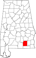 | |
| Towns | ||
| Unincorporated communities | ||
| Footnotes | ‡This populated place also has portions in an adjacent county or counties | |