Elgin, Nebraska
| Elgin, Nebraska | |
|---|---|
| City | |
|
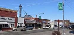
Downtown Elgin: west side of 2nd Street, looking north from Cedar Street | |
 Location of Elgin, Nebraska | |
| Coordinates: 41°59′1″N 98°4′54″W / 41.98361°N 98.08167°WCoordinates: 41°59′1″N 98°4′54″W / 41.98361°N 98.08167°W | |
| Country | United States |
| State | Nebraska |
| County | Antelope |
| Area[1] | |
| • Total | 0.71 sq mi (1.84 km2) |
| • Land | 0.71 sq mi (1.84 km2) |
| • Water | 0 sq mi (0 km2) |
| Elevation | 1,926 ft (587 m) |
| Population (2010)[2] | |
| • Total | 661 |
| • Estimate (2012[3]) | 645 |
| • Density | 931.0/sq mi (359.5/km2) |
| Time zone | Central (CST) (UTC-6) |
| • Summer (DST) | CDT (UTC-5) |
| ZIP code | 68636 |
| Area code(s) | 402 |
| FIPS code | 31-14730[4] |
| GNIS feature ID | 0829047[5] |
Elgin is a city in Antelope County, Nebraska, United States. The population was 661 at the 2010 census.
History
Elgin was platted in 1887 when the railroad was extended to that point. Its name was chosen at random from a postal directory, after the city of Elgin, Illinois.[6][7][8]
Geography
Elgin is located at 41°59′1″N 98°4′54″W / 41.98361°N 98.08167°W (41.983744, -98.081696).[9]
According to the United States Census Bureau, the city has a total area of 0.71 square miles (1.84 km2), all of it land.[1]
Demographics
| Historical population | |||
|---|---|---|---|
| Census | Pop. | %± | |
| 1900 | 451 | — | |
| 1910 | 606 | 34.4% | |
| 1920 | 854 | 40.9% | |
| 1930 | 917 | 7.4% | |
| 1940 | 853 | −7.0% | |
| 1950 | 820 | −3.9% | |
| 1960 | 881 | 7.4% | |
| 1970 | 917 | 4.1% | |
| 1980 | 807 | −12.0% | |
| 1990 | 731 | −9.4% | |
| 2000 | 735 | 0.5% | |
| 2010 | 661 | −10.1% | |
| Est. 2015 | 632 | [10] | −4.4% |
2010 census
As of the census[2] of 2010, there were 661 people, 307 households, and 194 families residing in the city. The population density was 931.0 inhabitants per square mile (359.5/km2). There were 364 housing units at an average density of 512.7 per square mile (198.0/km2). The racial makeup of the city was 98.5% White, 0.8% from other races, and 0.8% from two or more races. Hispanic or Latino of any race were 0.9% of the population.
There were 307 households of which 21.8% had children under the age of 18 living with them, 53.7% were married couples living together, 6.2% had a female householder with no husband present, 3.3% had a male householder with no wife present, and 36.8% were non-families. 35.2% of all households were made up of individuals and 23.4% had someone living alone who was 65 years of age or older. The average household size was 2.15 and the average family size was 2.75.
The median age in the city was 49.8 years. 21% of residents were under the age of 18; 5% were between the ages of 18 and 24; 16.7% were from 25 to 44; 26.3% were from 45 to 64; and 31% were 65 years of age or older. The gender makeup of the city was 46.7% male and 53.3% female.
2000 census
As of the census[4] of 2000, there were 735 people, 333 households, and 208 families residing in the city. The population density was 1,025.1 people per square mile (394.1/km²). There were 372 housing units at an average density of 518.8 per square mile (199.5/km²). The racial makeup of the city was 99.59% White, and 0.41% from two or more races.
There were 333 households out of which 26.1% had children under the age of 18 living with them, 55.3% were married couples living together, 5.1% had a female householder with no husband present, and 37.5% were non-families. 35.7% of all households were made up of individuals and 24.3% had someone living alone who was 65 years of age or older. The average household size was 2.20 and the average family size was 2.88.
In the city the population was spread out with 23.9% under the age of 18, 5.0% from 18 to 24, 20.7% from 25 to 44, 21.2% from 45 to 64, and 29.1% who were 65 years of age or older. The median age was 45 years. For every 100 females there were 90.9 males. For every 100 females age 18 and over, there were 87.6 males.
As of 2000 the median income for a household in the city was $29,833, and the median income for a family was $38,250. Males had a median income of $26,827 versus $17,361 for females. The per capita income for the city was $15,724. About 3.4% of families and 5.5% of the population were below the poverty line, including none of those under age 18 and 11.3% of those age 65 or over.
Media
A weekly newspaper, The Elgin Review, is published in Elgin.
Education
Elgin High School, Pope John High School, and St. Boniface Elementary School are located in the city.
References
- 1 2 "US Gazetteer files 2010". United States Census Bureau. Retrieved 2012-06-24.
- 1 2 "American FactFinder". United States Census Bureau. Retrieved 2012-06-24.
- ↑ "Population Estimates". United States Census Bureau. Retrieved 2013-05-29.
- 1 2 "American FactFinder". United States Census Bureau. Retrieved 2008-01-31.
- ↑ "US Board on Geographic Names". United States Geological Survey. 2007-10-25. Retrieved 2008-01-31.
- ↑ "Elgin, Antelope County". Center for Advanced Land Management Information Technologies. University of Nebraska. Retrieved 29 July 2014.
- ↑ Fitzpatrick, Lillian L. (1960). Nebraska Place-Names. University of Nebraska Press. p. 15.
- ↑ Chicago and North Western Railway Company (1908). A History of the Origin of the Place Names Connected with the Chicago & North Western and Chicago, St. Paul, Minneapolis & Omaha Railways. p. 68.
- ↑ "US Gazetteer files: 2010, 2000, and 1990". United States Census Bureau. 2011-02-12. Retrieved 2011-04-23.
- ↑ "Annual Estimates of the Resident Population for Incorporated Places: April 1, 2010 to July 1, 2015". Retrieved July 2, 2016.
- ↑ "Census of Population and Housing". Census.gov. Retrieved June 4, 2015.
External links
Municipalities and communities of Antelope County, Nebraska, United States | ||
|---|---|---|
| Cities | ||
| Villages | ||
| Townships | ||
| Footnotes | ‡This populated place also has portions in an adjacent county or counties | |