Elizabeth, Minnesota
| Elizabeth, Minnesota | |
|---|---|
| City | |
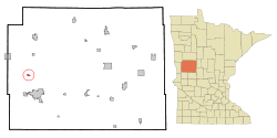 Location of Elizabeth, Minnesota | |
| Coordinates: 46°22′45″N 96°7′46″W / 46.37917°N 96.12944°W | |
| Country | United States |
| State | Minnesota |
| County | Otter Tail |
| Area[1] | |
| • Total | 0.37 sq mi (0.96 km2) |
| • Land | 0.37 sq mi (0.96 km2) |
| • Water | 0 sq mi (0 km2) |
| Elevation | 1,250 ft (381 m) |
| Population (2010)[2] | |
| • Total | 173 |
| • Estimate (2013[3]) | 174 |
| • Density | 467.6/sq mi (180.5/km2) |
| Time zone | Central (CST) (UTC-6) |
| • Summer (DST) | CDT (UTC-5) |
| ZIP code | 56533 |
| Area code(s) | 218 |
| FIPS code | 27-18566 |
| GNIS feature ID | 0643253[4] |
Elizabeth is a city in Otter Tail County, Minnesota, United States. The population was 173 at the 2010 census.[5]
History
Elizabeth was platted in 1872, and named for Elizabeth Niggler, the wife of an early settler.[6] A post office was established under the name Elizabethtown in 1871, and the name was changed to Elizabeth in 1882.[7]
Geography
According to the United States Census Bureau, the city has a total area of 0.37 square miles (0.96 km2), all of it land.[1]
Demographics
| Historical population | |||
|---|---|---|---|
| Census | Pop. | %± | |
| 1880 | 128 | — | |
| 1890 | 135 | 5.5% | |
| 1900 | 186 | 37.8% | |
| 1910 | 169 | −9.1% | |
| 1920 | 204 | 20.7% | |
| 1930 | 164 | −19.6% | |
| 1940 | 176 | 7.3% | |
| 1950 | 168 | −4.5% | |
| 1960 | 168 | 0.0% | |
| 1970 | 188 | 11.9% | |
| 1980 | 195 | 3.7% | |
| 1990 | 152 | −22.1% | |
| 2000 | 172 | 13.2% | |
| 2010 | 173 | 0.6% | |
| Est. 2015 | 173 | [8] | 0.0% |
| U.S. Decennial Census[9] 2013 Estimate[10] | |||
2010 census
As of the census[2] of 2010, there were 173 people, 66 households, and 49 families residing in the city. The population density was 467.6 inhabitants per square mile (180.5/km2). There were 84 housing units at an average density of 227.0 per square mile (87.6/km2). The racial makeup of the city was 93.6% White, 2.9% African American, 1.7% Native American, 0.6% Asian, and 1.2% from two or more races.
There were 66 households of which 30.3% had children under the age of 18 living with them, 65.2% were married couples living together, 4.5% had a female householder with no husband present, 4.5% had a male householder with no wife present, and 25.8% were non-families. 19.7% of all households were made up of individuals and 3% had someone living alone who was 65 years of age or older. The average household size was 2.62 and the average family size was 3.08.
The median age in the city was 43.8 years. 24.3% of residents were under the age of 18; 5.1% were between the ages of 18 and 24; 24.3% were from 25 to 44; 34.7% were from 45 to 64; and 11.6% were 65 years of age or older. The gender makeup of the city was 54.9% male and 45.1% female.
2000 census
As of the census of 2000, there were 172 people, 72 households, and 42 families residing in the city. The population density was 473.5 people per square mile (184.5/km²). There were 85 housing units at an average density of 234.0 per square mile (91.2/km²). The racial makeup of the city was 98.26% White, 1.16% Native American, and 0.58% from two or more races.
There were 72 households out of which 31.9% had children under the age of 18 living with them, 47.2% were married couples living together, 9.7% had a female householder with no husband present, and 40.3% were non-families. 30.6% of all households were made up of individuals and 11.1% had someone living alone who was 65 years of age or older. The average household size was 2.39 and the average family size was 3.05.
In the city the population was spread out with 26.2% under the age of 18, 7.0% from 18 to 24, 31.4% from 25 to 44, 24.4% from 45 to 64, and 11.0% who were 65 years of age or older. The median age was 38 years. For every 100 females there were 112.3 males. For every 100 females age 18 and over, there were 104.8 males.
The median income for a household in the city was $33,438, and the median income for a family was $38,333. Males had a median income of $28,750 versus $20,625 for females. The per capita income for the city was $13,841. About 2.1% of families and 8.0% of the population were below the poverty line, including 6.0% of those under the age of eighteen and none of those sixty five or over.
Climate
The Köppen Climate Classification subtype for this climate is "Dfb". (Warm Summer Continental Climate).[11]
| Climate data for Elizabeth, Minnesota | |||||||||||||
|---|---|---|---|---|---|---|---|---|---|---|---|---|---|
| Month | Jan | Feb | Mar | Apr | May | Jun | Jul | Aug | Sep | Oct | Nov | Dec | Year |
| Average high °C (°F) | 17 (−8) |
22 (−6) |
36 (2) |
54 (12) |
68 (20) |
77 (25) |
82 (28) |
81 (27) |
70 (21) |
57 (14) |
37 (3) |
23 (−5) |
52 (11.1) |
| Average low °C (°F) | −2 (−19) |
3 (−16) |
17 (−8) |
32 (0) |
45 (7) |
55 (13) |
60 (16) |
57 (14) |
48 (9) |
36 (2) |
21 (−6) |
6 (−14) |
31.5 (−0.2) |
| Average precipitation mm (inches) | 0.9 (23) |
0.7 (18) |
1.2 (30) |
2.1 (53) |
3.0 (76) |
4.2 (107) |
3.4 (86) |
3.0 (76) |
2.4 (61) |
1.7 (43) |
1.1 (28) |
0.7 (18) |
24.3 (617) |
| Average precipitation days | 9 | 7 | 8 | 9 | 11 | 12 | 9 | 9 | 9 | 7 | 8 | 8 | 106 |
| Source: Weatherbase [12] | |||||||||||||
References
- 1 2 "US Gazetteer files 2010". United States Census Bureau. Retrieved 2012-11-13.
- 1 2 "American FactFinder". United States Census Bureau. Retrieved 2012-11-13.
- ↑ "Population Estimates". United States Census Bureau. Retrieved 2014-06-09.
- ↑ "US Board on Geographic Names". United States Geological Survey. 2007-10-25. Retrieved 2008-01-31.
- ↑ "2010 Census Redistricting Data (Public Law 94-171) Summary File". American FactFinder. U.S. Census Bureau, 2010 Census. Retrieved 23 April 2011.
- ↑ Upham, Warren (1920). Minnesota Geographic Names: Their Origin and Historic Significance. Minnesota Historical Society. p. 394.
- ↑ "Otter Tail County". Jim Forte Postal History. Retrieved 28 July 2015.
- ↑ "Annual Estimates of the Resident Population for Incorporated Places: April 1, 2010 to July 1, 2015". Retrieved July 2, 2016.
- ↑ United States Census Bureau. "Census of Population and Housing". Retrieved February 12, 2014.
- ↑ "Annual Estimates of the Resident Population: April 1, 2010 to July 1, 2013". Retrieved June 9, 2014.
- ↑ Climate Summary for Elizabeth, Minnesota
- ↑ "Weatherbase.com". Weatherbase. 2013. Retrieved on June 16, 2013.
Municipalities and communities of Otter Tail County, Minnesota, United States | ||
|---|---|---|
| Cities | 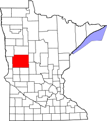 | |
| Townships |
| |
| Unincorporated communities | ||
| Indian reservation | ||
| Ghost towns | ||
| Footnotes | ‡This populated place also has portions in an adjacent county or counties | |
Coordinates: 46°22′47″N 96°07′45″W / 46.37972°N 96.12917°W