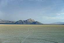
Empire, Nevada
| Empire, Nevada | |
|---|---|
| Census-designated place & Ghost town | |
 Location of Empire, Nevada | |
| Coordinates: 40°34′32″N 119°20′28″W / 40.57556°N 119.34111°WCoordinates: 40°34′32″N 119°20′28″W / 40.57556°N 119.34111°W | |
| Country | United States |
| State | Nevada |
| Area | |
| • Total | 5.1 sq mi (13.3 km2) |
| • Land | 5.1 sq mi (13.3 km2) |
| • Water | 0.0 sq mi (0.0 km2) |
| Population (2010) | |
| • Total | 217 |
| • Density | 42/sq mi (16/km2) |
| Time zone | Pacific (PST) (UTC-8) |
| • Summer (DST) | PDT (UTC-7) |
| ZIP codes | 89405 |
| Area code(s) | 775 |
| FIPS code | 32-23700 |
Empire is a census-designated place (CDP) and Ghost town in Washoe County, Nevada, United States. The population was 217 at the 2010 census.[1] A former company town for United States Gypsum Corporation, Empire was once home to more than 750 people. It is part of the Reno–Sparks Metropolitan Statistical Area. Prior to the 2010 census, Empire was part of the Gerlach–Empire census-designated place. The nearest town, Nixon, is 60 miles (97 km) to the south on a reservation owned by the Pyramid Lake Paiute Tribe.
Geography
According to the United States Census Bureau, the Empire CDP has a total area of 5.1 square miles (13.3 km2), all land.[1] Its elevation is 4,040 feet (1,230 m) above sea level.
Economy
The economy of Empire focuses on tourism in the nearby Black Rock Desert, and hunting. Gypsum mining was the historic staple of the local economy until 2011. Empire was the classic company town of the United States Gypsum Corporation (USG). All residents of Empire worked for USG, and USG owns the properties and buildings. The Empire gypsum mine was one of the longest continually operating mines in the US, operating for 88 years from 1923 to 2011. Most mines were shut down during World War II as resources were diverted to the war. It was determined that gypsum was an "essential", resource and the mine was never closed during that period. The town had a church, a public pool, a 9-hole golf course, a post office (89405), and Empire Airport for light planes. There was also a day-care facility for the employees of Empire, and a convenience store with a gas station—the only store for more than 50 miles (80 km).
The gypsum plant in Empire closed its doors on January 31, 2011, eliminating 95 jobs.[2][3] Residents with children were allowed to continue inhabiting their company homes through June 20, 2011, the end of the school year. After that date, Empire effectively became a ghost town. In response, the local ZIP Code, 89405, was also discontinued. Two USG employees remain to maintain the property.
Since 1991, Burning Man, a week long countercultural festival with 51,454 participants (as of 2010), has been held nearby. Due to the appearance and actions of many of the participants, local enthusiasm is mixed, but the event is responsible for around 20% of the sales at the few commercial establishments in the area, which include the closest permanent fuel and grocery stops to the event site. The Black Rock Desert is also the site of many other recreational activities, organized and otherwise, throughout the year.[4]
History
Empire was founded in 1923; in that year miners formed a tent city while mining a claim originally established by the Pacific Portland Cement Company in 1910. U.S. Gypsum has owned the town since 1948, which reached a maximum population of 750 in the early 1960s. But when the recession forced the company to shut the plant in 2011, the town was unable to survive.[2][3]
On June 3, 2016, it was reported that the town and the mine were sold for $10.25 million.[5]
Transportation
Primary highway access to Empire is provided by State Route 447.
The town has an airfield, suitable only for light planes. The airfield is dirt, but light towers at a baseball field directly adjacent to and in line with the eastern end of the runway make approaches from or departures in that direction hazardous. It should not be used unless under emergency.
Climate
| Climate data for Empire, Nevada (Elevation 3,980ft) | |||||||||||||
|---|---|---|---|---|---|---|---|---|---|---|---|---|---|
| Month | Jan | Feb | Mar | Apr | May | Jun | Jul | Aug | Sep | Oct | Nov | Dec | Year |
| Record high °F (°C) | 64 (18) |
68 (20) |
75 (24) |
82 (28) |
97 (36) |
103 (39) |
102 (39) |
102 (39) |
104 (40) |
89 (32) |
74 (23) |
64 (18) |
104 (40) |
| Average high °F (°C) | 43.1 (6.2) |
48.2 (9) |
54.6 (12.6) |
64.3 (17.9) |
74.4 (23.6) |
83.7 (28.7) |
92.7 (33.7) |
90.4 (32.4) |
85.5 (29.7) |
70.2 (21.2) |
54.1 (12.3) |
44.1 (6.7) |
67.1 (19.5) |
| Average low °F (°C) | 21.5 (−5.8) |
24.8 (−4) |
29.2 (−1.6) |
35.7 (2.1) |
43.3 (6.3) |
50.2 (10.1) |
57.6 (14.2) |
54.0 (12.2) |
48.0 (8.9) |
37.4 (3) |
26.7 (−2.9) |
22.1 (−5.5) |
37.5 (3.1) |
| Record low °F (°C) | −3 (−19) |
−1 (−18) |
12 (−11) |
20 (−7) |
23 (−5) |
30 (−1) |
37 (3) |
41 (5) |
32 (0) |
16 (−9) |
7 (−14) |
−6 (−21) |
−6 (−21) |
| Average precipitation inches (mm) | 0.96 (24.4) |
0.52 (13.2) |
0.64 (16.3) |
0.61 (15.5) |
0.74 (18.8) |
0.54 (13.7) |
0.14 (3.6) |
0.12 (3) |
0.20 (5.1) |
0.62 (15.7) |
0.35 (8.9) |
1.12 (28.4) |
6.56 (166.6) |
| Average snowfall inches (cm) | 2.4 (6.1) |
1.8 (4.6) |
1.1 (2.8) |
0.1 (0.3) |
0.1 (0.3) |
0 (0) |
0 (0) |
0 (0) |
0 (0) |
0 (0) |
0 (0) |
1.6 (4.1) |
7.0 (17.8) |
| Source: The Western Regional Climate Center[6] | |||||||||||||
References
- 1 2 "Geographic Identifiers: 2010 Demographic Profile Data (G001): Empire CDP, Nevada". U.S. Census Bureau, American Factfinder. Retrieved January 16, 2013.
- 1 2 Huffington Post: "Empire, Nevada Completely Wiped Out By Recession", June 22, 2011.
- 1 2 Bruder, Jessica (June 11, 2011). "Slump in construction industry creates a Sheetrock ghost town". The Christian Science Monitor. Yahoo! News. Retrieved June 12, 2011.
- ↑ Fulbright, Leslie (August 28, 2005), "A warmer welcome, Residents of small Nevada town profit from annual counter cultural festival", San Francisco Chronicle
- ↑ Kane, Jenny. "Gypsum mine, town of Empire sold for $10.25M". Reno Gazette Journal. Retrieved 2016-06-03.
- ↑ "Seasonal Temperature and Precipitation Information". Western Regional Climate Center. Retrieved April 10, 2013.
Municipalities and communities of Washoe County, Nevada, United States | ||
|---|---|---|
| Cities | 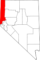 | |
| CDPs | ||
| Unincorporated communities | ||
| Indian reservation | ||
| Indian colony | ||
| Ghost towns | ||