Sparks, Nevada
| Sparks, Nevada | |
|---|---|
| City | |
|
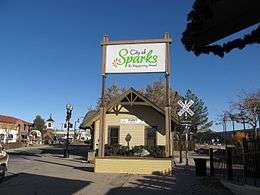
Victorian Square in Sparks | |
| Nickname(s): The Rail City, City Of Promise | |
| Motto: "It's Happening Here!" | |
 Location in Washoe county | |
| Coordinates: 39°33′16″N 119°44′8″W / 39.55444°N 119.73556°WCoordinates: 39°33′16″N 119°44′8″W / 39.55444°N 119.73556°W | |
| Country |
|
| State |
|
| County | Washoe |
| Founded | 1904 |
| Incorporated | March 15, 1905 |
| Named for | John Sparks |
| Government | |
| • Type | Council-manager |
| • Mayor | Geno Martini (R) |
| Area | |
| • Total | 93.0 km2 (35.9 sq mi) |
| • Land | 92.6 km2 (35.8 sq mi) |
| • Water | 0.4 km2 (0.2 sq mi) |
| Elevation | 1,345 m (4,413 ft) |
| Population (2010) | |
| • Total | 90,264 |
| • Density | 970/km2 (2,500/sq mi) |
| Time zone | PST (UTC-8) |
| • Summer (DST) | PDT (UTC-7) |
| ZIP codes | 89431–89436 |
| Area code(s) | 775 |
| FIPS code | 32-68400 |
| GNIS feature ID | 0856391 |
| Website |
cityofsparks |
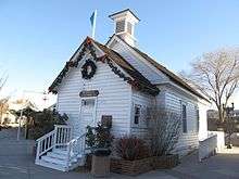
Nevada Historical Marker | |
| Reference no. | 88 |
Sparks is a city in Washoe County, Nevada, United States. It was founded in 1904 and incorporated on March 15, 1905, and is located just east of Reno. The 2010 U.S. Census Bureau population count was 90,264.[1] It is the fifth most populous city in Nevada.
Sparks is located within the Reno–Sparks metropolitan area.
History
In the early historical period, the area that is now Sparks was inhabited by the Washoe people. Euro-American settlement of the area began in the early 1850s, and the population density in the area remained very low until 1904 when the Southern Pacific Railroad built a switch yard and maintenance sheds there. The city that sprung up around them was first called Harriman after E. H. Harriman, president of the Southern Pacific. The city was quickly renamed Sparks after John Sparks, the Governor of Nevada at that time.[2][3]

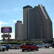
Sparks remained a small town until the 1950s, when economic growth in Reno triggered a housing boom north of the railroad in the area of Sparks. During the 1970s, the area south of the railroad started to fill up with warehouses and light industry. In 1984, the tower for the Nugget Casino Resort was finished, giving Sparks its first, and currently only, high-rise casino.[4] In 1996, the redevelopment effort of the B Street business district across from the Nugget that started in the early 1980s took a step forward with the opening of a multi-screen movie complex and the construction of a plaza area. This area, now known as Victorian Square, is a pedestrian-friendly district that hosts many open-air events.[2]
Under direction of the U.S. Environmental Protection Agency, a comprehensive dynamic water quality computer model, the DSSAM Model, was developed (Earth Metrics, 1987) to analyze impacts of a variety of land use and stormwater management decisions throughout the 3,120-square-mile (8,100 km2) Truckee River basin; this model was used to develop a set of surface runoff stormwater management measures for Sparks in the 1980s.[5]
Geography and climate
According to the U.S. Census Bureau, Sparks has a total area of 35.9 square miles (93.0 km2), of which 35.8 square miles (92.6 km2) is land and 0.15 square miles (0.4 km2), or 0.47%, is water.[1] Stormwater surface runoff from the city drains into the Truckee River, a sensitive waterway that empties into Pyramid Lake, which has no outlet and is the habitat of two endangered species.
Sparks has a semi-arid climate. Due to frequent low humidity, especially in the summer, daily temperature ranges are fairly wide. The average January temperatures are a maximum of 48.3 °F (9.1 °C) and a minimum of 23.5 °F (−4.7 °C). Average July temperatures are a maximum of 91.7 °F (33.2 °C) and a minimum of 53.6 °F (12.0 °C). There are an average of 52.3 days with highs of 90 °F (32 °C) and an average of 141.7 days with lows of 32 °F (0 °C). The record high temperature was 108 °F (42 °C) on July 11, 2002, and the record low temperature was −19 °F (−28 °C) on February 4, 2001.
Average annual precipitation in Sparks is 7.82 inches (199 mm). There are an average of 48 days with measurable precipitation. The wettest year was 1998 with 15.07 inches (383 mm) and the driest was 1990 with 4.65 inches (118 mm). The most precipitation in one month was 3.81 inches (97 mm) in December 2005, including the most precipitation in 24 hours (1.61 inches (41 mm)) on December 31.
Average snowfall per year is 7.0 inches (180 mm). The most snow in one year was 21.0 inches (530 mm) in 2008 and the most snow in one month was 19.6 inches (500 mm) in February 1990.[6]
Average monthly temperatures and precipitation
| Climate data for Sparks, Nevada | |||||||||||||
|---|---|---|---|---|---|---|---|---|---|---|---|---|---|
| Month | Jan | Feb | Mar | Apr | May | Jun | Jul | Aug | Sep | Oct | Nov | Dec | Year |
| Average high °F (°C) | 47 (8) |
53 (12) |
59 (15) |
65 (18) |
74 (23) |
84 (29) |
92 (33) |
90 (32) |
83 (28) |
71 (22) |
56 (13) |
47 (8) |
68.4 (20.1) |
| Average low °F (°C) | 23 (−5) |
26 (−3) |
31 (−1) |
35 (2) |
42 (6) |
48 (9) |
53 (12) |
51 (11) |
44 (7) |
35 (2) |
28 (−2) |
23 (−5) |
36.6 (2.8) |
| Average precipitation inches (mm) | 1.12 (28.4) |
0.97 (24.6) |
0.86 (21.8) |
0.60 (15.2) |
0.63 (16) |
0.47 (11.9) |
0.28 (7.1) |
0.32 (8.1) |
0.41 (10.4) |
0.63 (16) |
0.91 (23.1) |
1.13 (28.7) |
8.33 (211.3) |
| Source: [7] | |||||||||||||
Demographics
| Historical population | |||
|---|---|---|---|
| Census | Pop. | %± | |
| 1910 | 2,500 | — | |
| 1920 | 3,238 | 29.5% | |
| 1930 | 4,508 | 39.2% | |
| 1940 | 5,318 | 18.0% | |
| 1950 | 8,203 | 54.2% | |
| 1960 | 16,618 | 102.6% | |
| 1970 | 24,187 | 45.5% | |
| 1980 | 40,780 | 68.6% | |
| 1990 | 53,667 | 31.6% | |
| 2000 | 66,346 | 23.6% | |
| 2010 | 90,264 | 36.1% | |
| Est. 2015 | 96,094 | [8] | 6.5% |
| source:[9] | |||
As of the census of 2010, there were 90,264 people, 33,502 households, and 22,598 families residing in the city. The population density was 3,761 inhabitants per square mile (1,452/km2). There were 36,455 housing units at an average density of 1,519/sq mi (586/km2). The racial makeup of the city was 74.5% White, 2.6% African American, 1.2% Native American, 5.9% Asian, 0.6% Pacific Islander, 11.2% from other races, and 4.0% from two or more races. Hispanic or Latino of any race were 26.3% of the population.[10]
There were 33,502 households out of which 36.5% had children under the age of 18 living with them, 47.7% were headed by married couples living together, 13.0% had a female householder with no husband present, and 32.5% were non-families. Of all households 24.3% were made up of individuals and 8.3% were someone living alone who was 65 years of age or older.[10]
In the city the population was spread out with 25.8% under the age of 18, 9.7% from 18 to 24, 27.7% from 25 to 44, 25.6% from 45 to 64, and 11.3% who were 65 years of age or older. For every 100 females there were 97.8 males. For every 100 females age 18 and over, there were 94.7 males.[10]
In 2011 the estimated median income for a household in the city was $50,568, and the median income for a family was $57,905. About 10.9% of families and 13.4% of the population were below the poverty line, including 21.2% of those under age 18 and 9.4% of those age 65 or over.[11]
Arts and culture
Cultural events include the Best in the West Nugget Rib Cook-off.[12]
Tourist attractions include the Great Basin Brewing Company, and Nugget Casino Resort.[13]
Parks and recreation
Sparks Marina Park was established on a naturally occurring aquifer in Sparks. Aquatic activities include windsurfing, sailing, swimming, scuba diving, fishing and boating. The surrounding park includes walking paths, a dog park, volleyball courts, playgrounds, picnic areas, showers, and a concession stand.[14]
The Mustang Ranch, described as "Nevada's most infamous brothel", has operated at various locations east of Sparks since 1967.[15]
Education
Public schools
Sparks is served by the Washoe County School District. Schools located within the city include Edward C. Reed High School and Sparks High School.[16]
Private schools
Excel Christian School is a K to 12 school located in Sparks.
Transportation

The Regional Transportation Commission of Washoe County (RTC) operates an extensive city bus system that services a majority of the cities of Reno and Sparks.
Sparks is served by the nearby Reno–Tahoe International Airport.
Rail
The Union Pacific Railroad runs east-west through the center of Sparks. The Union Pacific has a significant rail yard south of I-80, just south and adjacent to the Nugget Hotel/Casino towers in downtown Sparks, and is a central part of the area's industrial park. Passenger rail service to the Sparks Amtrak Station ended in 2009.
Roads
Interstate 80 runs east-west through the center of Sparks. State Route 445 (Pyramid Way), El Rancho Drive, Sullivan Lane, Rock Boulevard, Sparks Boulevard, Vista Boulevard, and State Route 659 (McCarran Blvd) are the city's major north-south thoroughfares. Pyramid Way runs from Nugget Avenue in downtown Sparks to Pyramid Lake, about 35 miles north of the city, and has been designated a Nevada Scenic Byway.
The city of Sparks will soon be connected directly to south Reno by a massive road construction project known as the Southeast Connector. It is a northerly extension of Veterans Parkway to the Sparks Boulevard at Greg Street. It will serve as an expressway, with only 2 signaled intersections along its 5.5 mile stretch (one at Pembroke Drive and one at Mira Loma Drive), and constitute a major arterial connection between Reno and Sparks. It will provide an alternative route to existing, overcrowded routes such as the 395/580 freeway, Rock Boulevard, and McCarran Boulevard. Construction began in late 2013, and its completion is expected in 2017, but the project is currently ahead of both schedule and budget.
Sparks is also gearing up for the record of decision on a major, $1.1 billion (estimated) arterial road project, one that will turn a large portion of Pyramid Highway through nearby Spanish Springs into a controlled access, high speed arterial road that connects directly with the US 395 freeway via a complex interchange at the current Parr Boulevard connection. This will directly connect Spanish Springs, a major population center (parts of which are annexed with the city of Sparks), located in the valley just north of Sparks, with the existing Reno/Sparks freeway system which consists currently of Interstate 80 and US 395. This project will also offer more direct freeway system and inter-valley connections to and from Sun Valley, another major population center of the Reno/Sparks metropolitan statistical area. Sun Valley is located just north of Reno and just west of Spanish Springs, and is home to nearly 20,000 residents as of the 2010 census.
Notable people
- Mädchen Amick, actress on Twin Peaks and Witches of East End.
- T. J. Bell, motor sport driver.
- Scott Cousins, professional baseball player.
- Brian Crane, syndicated cartoonist of Pickles.
- Jim Gibbons, former Governor of Nevada.
- David S. Loeb, businessman, co-founder of Countrywide and IndyMac.
- Jena Malone, actress, The Hunger Games, Pride & Prejudice.
- Jake McGee, professional baseball player.
- Brian Retterer, NCAA champion swimmer.
- Karl Rove, political activist, lobbyist, pundit, and Deputy White House Chief of Staff.
- Dan Serafini, professional baseball player with Naranjeros de Hermosillo.
- Josh Weston, adult film star.
References
- 1 2 "Geographic Identifiers: 2010 Demographic Profile Data (G001): Sparks city, Nevada". U.S. Census Bureau, American Factfinder. Retrieved January 16, 2013.
- 1 2 Toll, David W. (October 2002). The Complete Nevada Traveler: The Affectionate and Intimately Detailed Guidebook to the Most Interesting State in America. Reno: University of Nevada Press. pp. 68–69. ISBN 978-0-940936-12-6.
- ↑ Myrick, David F. (2007). Railroads of Nevada and Eastern California: The southern roads. Reno: University of Nevada Press. p. 868. ISBN 978-0-87417-194-5.
- ↑ Kling, Dwayne; Melton, Rollan (August 2010). The Rise of the Biggest Little City: An Encyclopedic History of Reno Gaming, 1931-1981. Reno: University of Nevada Press. p. 3. ISBN 978-0-87417-829-6.
- ↑ C.M.Hogan, Marc Papineau et al. Development of a dynamic water quality simulation model for the Truckee River, Earth Metrics Inc., Environmental Protection Agency Technology Series, Washington D.C. (1987)
- ↑ "SPARKS, NEVADA - Climate Summary". Wrcc.dri.edu. Retrieved 2013-01-16.
- ↑ "Monthly Averages for Sparks, NV (89431)". The Weather Channel. Retrieved October 18, 2012.
- ↑ "Annual Estimates of the Resident Population for Incorporated Places: April 1, 2010 to July 1, 2015". Retrieved July 2, 2016.
- ↑ Moffatt, Riley. Population History of Western U.S. Cities & Towns, 1850–1990. Lanham: Scarecrow, 1996, 158.
- 1 2 3 "Profile of General Population and Housing Characteristics: 2010 Demographic Profile Data (DP-1): Sparks city, Nevada". U.S. Census Bureau, American Factfinder. Retrieved January 16, 2013.
- ↑ "Selected Economic Characteristics: 2011 American Community Survey 1-Year Estimates (DP03): Sparks city, Nevada". U.S. Census Bureau, American Factfinder. Retrieved January 16, 2013.
- ↑ Sonner, Scott (May 31, 2005). "Sparks sets lineup for annual cook-off". Las Vegas Review-Journal (AP). Retrieved 2009-09-07.
- ↑ Robison, Mark (7 April 2014). "Reno Rebirth: Beer, liquor makers grow in Nevada". Retrieved 7 April 2014.
- ↑ "Helms Lake at Sparks Marina Park". City of Sparks, Nevada. Retrieved March 2015. Check date values in:
|access-date=(help) - ↑ "Nevada's Most Infamous Brothel, Mustang Ranch, Back In Business". FOX News. August 5, 2007.
- ↑ "Schools". Washoe County School District. Retrieved January 16, 2013.
Further reading
- Earth Metrics Inc, C.M. Hogan, Marc Papineau, et al. Development of a dynamic water quality simulation model for the Truckee River, Environmental Protection Agency Technology Series, Washington D.C. (1987)
External links
Municipalities and communities of Washoe County, Nevada, United States | ||
|---|---|---|
| Cities | 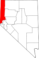 | |
| CDPs | ||
| Unincorporated communities | ||
| Indian reservation | ||
| Indian colony | ||
| Ghost towns | ||