Ethel, Missouri
| Ethel, Missouri | |
|---|---|
| City | |
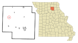 Location of Ethel, Missouri | |
| Coordinates: 39°53′38″N 92°44′22″W / 39.89389°N 92.73944°WCoordinates: 39°53′38″N 92°44′22″W / 39.89389°N 92.73944°W | |
| Country | United States |
| State | Missouri |
| County | Macon |
| Area[1] | |
| • Total | 0.23 sq mi (0.60 km2) |
| • Land | 0.23 sq mi (0.60 km2) |
| • Water | 0 sq mi (0 km2) |
| Elevation | 830 ft (253 m) |
| Population (2010)[2] | |
| • Total | 62 |
| • Estimate (2012[3]) | 62 |
| • Density | 269.6/sq mi (104.1/km2) |
| Time zone | Central (CST) (UTC-6) |
| • Summer (DST) | CDT (UTC-5) |
| ZIP code | 63539 |
| Area code(s) | 660 |
| FIPS code | 29-22672[4] |
| GNIS feature ID | 0735601[5] |
Ethel is a city in Macon County, Missouri, United States. The population was 62 at the 2010 census, at which time it was a town.
History
Ethel had its start in 1888 when the Atchison, Topeka and Santa Fe Railway was extended to that point.[6] An early variant name was "Ratliff".[7]
A post office called Ethel has been in operation since 1890.[8] On July 26, 2011 the United States Postal Service announced plans to permanently close the Ethel post office as part of a nationwide restructuring plan.[9]
Geography
Ethel is located at 39°53′38″N 92°44′22″W / 39.89389°N 92.73944°W (39.893961, -92.739557).[10] According to the United States Census Bureau, the city has a total area of 0.23 square miles (0.60 km2), all of it land.[1]
Demographics
| Historical population | |||
|---|---|---|---|
| Census | Pop. | %± | |
| 1900 | 397 | — | |
| 1910 | 423 | 6.5% | |
| 1920 | 329 | −22.2% | |
| 1930 | 359 | 9.1% | |
| 1940 | 317 | −11.7% | |
| 1950 | 226 | −28.7% | |
| 1960 | 149 | −34.1% | |
| 1970 | 162 | 8.7% | |
| 1980 | 145 | −10.5% | |
| 1990 | 71 | −51.0% | |
| 2000 | 100 | 40.8% | |
| 2010 | 62 | −38.0% | |
| Est. 2015 | 61 | [11] | −1.6% |
2010 census
As of the census[2] of 2010, there were 62 people, 36 households, and 17 families residing in the city. The population density was 269.6 inhabitants per square mile (104.1/km2). There were 54 housing units at an average density of 234.8 per square mile (90.7/km2). The racial makeup of the city was 98.4% White and 1.6% from two or more races. Hispanic or Latino of any race were 1.6% of the population.
There were 36 households of which 8.3% had children under the age of 18 living with them, 44.4% were married couples living together, 2.8% had a female householder with no husband present, and 52.8% were non-families. 50.0% of all households were made up of individuals and 33.3% had someone living alone who was 65 years of age or older. The average household size was 1.72 and the average family size was 2.41.
The median age in the city was 60.5 years. 6.5% of residents were under the age of 18; 1.5% were between the ages of 18 and 24; 19.3% were from 25 to 44; 33.9% were from 45 to 64; and 38.7% were 65 years of age or older. The gender makeup of the city was 56.5% male and 43.5% female.
2000 census
As of the census[4] of 2000, there were 100 people, 46 households, and 28 families residing in the town. The population density was 419.3 people per square mile (160.9/km²). There were 55 housing units at an average density of 230.6/sq mi (88.5/km²). The racial makeup of the town was 97.00% White and 3.00% Native American.
There were 46 households out of which 17.4% had children under the age of 18 living with them, 43.5% were married couples living together, 15.2% had a female householder with no husband present, and 39.1% were non-families. 32.6% of all households were made up of individuals and 17.4% had someone living alone who was 65 years of age or older. The average household size was 2.17 and the average family size was 2.61.
In the town the population was spread out with 16.0% under the age of 18, 7.0% from 18 to 24, 15.0% from 25 to 44, 38.0% from 45 to 64, and 24.0% who were 65 years of age or older. The median age was 54 years. For every 100 females there were 81.8 males. For every 100 females age 18 and over, there were 71.4 males.
The median income for a household in the town was $22,500, and the median income for a family was $25,000. Males had a median income of $50,833 versus $27,500 for females. The per capita income for the town was $16,126. There were 15.4% of families and 18.6% of the population living below the poverty line, including 80.0% of under eighteens and 9.1% of those over 64.
References
- 1 2 "US Gazetteer files 2010". United States Census Bureau. Archived from the original on January 24, 2012. Retrieved 2012-07-08.
- 1 2 "American FactFinder". United States Census Bureau. Retrieved 2012-07-08.
- ↑ "Population Estimates". United States Census Bureau. Archived from the original on June 17, 2013. Retrieved 2013-05-30.
- 1 2 "American FactFinder". United States Census Bureau. Archived from the original on September 11, 2013. Retrieved 2008-01-31.
- ↑ "US Board on Geographic Names". United States Geological Survey. 2007-10-25. Retrieved 2008-01-31.
- ↑ Eaton, David Wolfe (1916). How Missouri Counties, Towns and Streams Were Named. The State Historical Society of Missouri. p. 192.
- ↑ "Macon County Place Names, 1928–1945". The State Historical Society of Missouri. Archived from the original on June 24, 2016. Retrieved October 30, 2016.
- ↑ "Post Offices". Jim Forte Postal History. Retrieved 30 October 2016.
- ↑ "Expanded Access List". U.S. Postal Service. 2011-07-26. Archived from the original on September 25, 2011. Retrieved 2011-07-26.
- ↑ "US Gazetteer files: 2010, 2000, and 1990". United States Census Bureau. 2011-02-12. Retrieved 2011-04-23.
- ↑ "Annual Estimates of the Resident Population for Incorporated Places: April 1, 2010 to July 1, 2015". Retrieved July 2, 2016.
- ↑ "Census of Population and Housing". Census.gov. Archived from the original on May 11, 2015. Retrieved June 4, 2015.
Municipalities and communities of Macon County, Missouri, United States | ||
|---|---|---|
| Cities | 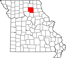 | |
| Townships | ||
| CDP | ||
| Other unincorporated communities | ||
| Ghost towns | ||