Ewan, New Jersey
| Ewan, New Jersey | |
|---|---|
| Unincorporated community | |
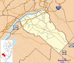 Ewan, New Jersey 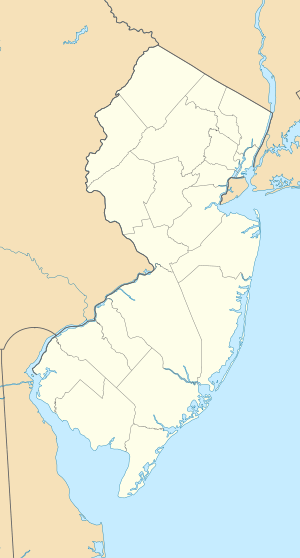 Ewan, New Jersey  Ewan, New Jersey Ewan's location in Gloucester County (Inset: Gloucester County in New Jersey) | |
| Coordinates: 39°41′55″N 75°11′10″W / 39.69861°N 75.18611°WCoordinates: 39°41′55″N 75°11′10″W / 39.69861°N 75.18611°W | |
| Country |
|
| State |
|
| County | Gloucester |
| Township | Harrison |
| Elevation[1] | 35 m (115 ft) |
| Time zone | Eastern (EST) (UTC-5) |
| • Summer (DST) | EDT (UTC-4) |
| ZIP code | 08025[2][3] |
| GNIS feature ID | 876244[1] |
Ewan is an unincorporated community located within Harrison Township, in Gloucester County, New Jersey, United States.[1][4] The area is served by the United States Postal Service as ZIP code 08025.[2]
The community is located east of Raccoon Creek and Ewan Lake, near the intersection of Ewan Road and Clems Run Road, 2.0 miles (3.2 km) south-southwest of Richwood and 3.5 miles (5.6 km) southeast of Mullica Hill.[5]
References
- 1 2 3 Feature Detail Report for: Ewan, Geographic Names Information System. Accessed January 1, 2015.
- 1 2 Look Up a ZIP Code for Ewan, NJ, United States Postal Service. Accessed January 1, 2015.
- ↑ Zip Codes, State of New Jersey. Accessed January 1, 2015.
- ↑ Locality Search, State of New Jersey. Accessed January 1, 2015.
- ↑ N 39.69861 W 75.18611, ACME Mapper. Accessed January 2, 2015.

This article is issued from Wikipedia - version of the 6/8/2016. The text is available under the Creative Commons Attribution/Share Alike but additional terms may apply for the media files.