East Greenwich Township, New Jersey
| East Greenwich Township, New Jersey | |
|---|---|
| Township | |
| Township of East Greenwich | |
|
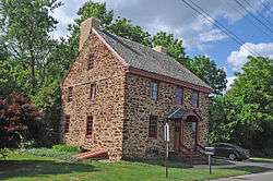
Death of the Fox Inn | |
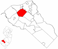 East Greenwich Township highlighted in Gloucester County. Inset map: Gloucester County highlighted in the State of New Jersey. | |
 Census Bureau map of East Greenwich Township, New Jersey | |
| Coordinates: 39°47′26″N 75°14′26″W / 39.790519°N 75.240592°WCoordinates: 39°47′26″N 75°14′26″W / 39.790519°N 75.240592°W[1][2] | |
| Country |
|
| State |
|
| County |
|
| Incorporated | February 10, 1881 |
| Government[3] | |
| • Type | Township |
| • Body | Township Committee |
| • Mayor | Dale L. Archer (term ends December 31, 2016)[4][5] |
| • Clerk | Susan Costill[6] |
| Area[1] | |
| • Total | 14.922 sq mi (38.649 km2) |
| • Land | 14.440 sq mi (37.400 km2) |
| • Water | 0.482 sq mi (1.249 km2) 3.23% |
| Area rank |
175th of 566 in state 12th of 24 in county[1] |
| Elevation[7] | 62 ft (19 m) |
| Population (2010 Census)[8][9][10] | |
| • Total | 9,555 |
| • Estimate (2015)[11] | 10,380 |
| • Rank |
249th of 566 in state 11th of 24 in county[12] |
| • Density | 661.7/sq mi (255.5/km2) |
| • Density rank |
418th of 566 in state 17th of 24 in county[12] |
| Time zone | Eastern (EST) (UTC-5) |
| • Summer (DST) | Eastern (EDT) (UTC-4) |
| ZIP code | 08056 - Mickleton[13] |
| Area code(s) | 856 Exchanges: 224, 423, 467, 478[14] |
| FIPS code | 3401519180[1][15][16] |
| GNIS feature ID | 0882141[1][17] |
| Website |
www |
East Greenwich Township is a township in Gloucester County, New Jersey, United States. As of the 2010 United States Census, the township's population was 9,555,[8][9][10] reflecting an increase of 4,125 (+76.0%) from the 5,430 counted in the 2000 Census, which had in turn increased by 172 (+3.3%) from the 5,258 counted in the 1990 Census.[18]
East Greenwich Township was created by an act of the New Jersey Legislature on February 10, 1881, from the eastern part of Greenwich Township and the western part of Mantua Township.[19]
Geography
According to the United States Census Bureau, the township had a total area of 14.922 square miles (38.649 km2), including 14.440 square miles (37.400 km2) of land and 0.482 square miles (1.249 km2) of water (3.23%).[1][2]
Unincorporated communities, localities and place names located partially or completely within the township include Clarksboro, Hendricksons Mills, Mickleton, Middleton, Mount Royal, Tomlins, Warringtons Mills and Wolfert.[20]
Demographics
| Historical population | |||
|---|---|---|---|
| Census | Pop. | %± | |
| 1890 | 1,259 | — | |
| 1900 | 1,323 | 5.1% | |
| 1910 | 1,406 | 6.3% | |
| 1920 | 1,483 | 5.5% | |
| 1930 | 2,031 | 37.0% | |
| 1940 | 2,121 | 4.4% | |
| 1950 | 2,336 | 10.1% | |
| 1960 | 2,722 | 16.5% | |
| 1970 | 3,280 | 20.5% | |
| 1980 | 4,144 | 26.3% | |
| 1990 | 5,258 | 26.9% | |
| 2000 | 5,430 | 3.3% | |
| 2010 | 9,555 | 76.0% | |
| Est. 2015 | 10,380 | [11][21] | 8.6% |
| Population sources: 1890-2000[22] 1890-1920[23] 1890[24] 1890-1910[25] 1910-1930[26] 1930-1990[27] 2000[28][29] 2010[8][9][10] | |||
Census 2010
At the 2010 United States Census, there were 9,555 people, 3,262 households, and 2,645 families residing in the township. The population density was 661.7 per square mile (255.5/km2). There were 3,405 housing units at an average density of 235.8 per square mile (91.0/km2). The racial makeup of the township was 88.45% (8,451) White, 5.86% (560) Black or African American, 0.14% (13) Native American, 3.61% (345) Asian, 0.05% (5) Pacific Islander, 0.59% (56) from other races, and 1.31% (125) from two or more races. Hispanics or Latinos of any race were 3.02% (289) of the population.[8]
There were 3,262 households, of which 41.5% had children under the age of 18 living with them, 70.4% were married couples living together, 7.3% had a female householder with no husband present, and 18.9% were non-families. 14.9% of all households were made up of individuals, and 6.3% had someone living alone who was 65 years of age or older. The average household size was 2.89 and the average family size was 3.22.[8]
In the township, 27.3% of the population were under the age of 18, 6.2% from 18 to 24, 29.1% from 25 to 44, 26.9% from 45 to 64, and 10.5% who were 65 years of age or older. The median age was 37.6 years. For every 100 females there were 96.9 males. For every 100 females age 18 and over, there were 94.3 males.[8]
The Census Bureau's 2006-2010 American Community Survey showed that (in 2010 inflation-adjusted dollars) median household income was $98,295 (with a margin of error of +/- $13,759) and the median family income was $109,375 (+/- $12,449). Males had a median income of $90,476 (+/- $9,127) versus $50,431 (+/- $6,983) for females. The per capita income for the borough was $38,234 (+/- $3,245). About 3.4% of families and 4.0% of the population were below the poverty line, including 5.2% of those under age 18 and 3.0% of those age 65 or over.[30]
Census 2000
As of the 2000 United States Census[15] there were 5,430 people, 1,901 households, and 1,515 families residing in the township. The population density was 368.1 people per square mile (142.1/km²). There were 1,971 housing units at an average density of 133.6 per square mile (51.6/km²). The racial makeup of the township was 94.68% White, 3.26% African American, 0.13% Native American, 0.64% Asian, 0.24% from other races, and 1.05% from two or more races. Hispanic or Latino of any race were 1.40% of the population.[28][29]
There were 1,901 households out of which 35.9% had children under the age of 18 living with them, 68.9% were married couples living together, 7.5% had a female householder with no husband present, and 20.3% were non-families. 17.4% of all households were made up of individuals and 8.8% had someone living alone who was 65 years of age or older. The average household size was 2.77 and the average family size was 3.12.[28][29]
In the township the population was spread out with 25.0% under the age of 18, 6.5% from 18 to 24, 27.0% from 25 to 44, 26.5% from 45 to 64, and 14.9% who were 65 years of age or older. The median age was 41 years. For every 100 females there were 91.3 males. For every 100 females age 18 and over, there were 88.3 males.[28][29]
The median income for a household in the township was $65,701, and the median income for a family was $74,455. Males had a median income of $51,662 versus $31,619 for females. The per capita income for the township was $25,345. About 2.6% of families and 3.9% of the population were below the poverty line, including 4.2% of those under age 18 and 4.0% of those age 65 or over.[28][29]
Government
Local government
East Greenwich Township is governed under the Township form of government. The five-member Township Committee is elected directly by the voters at-large in partisan elections to serve three-year terms of office on a staggered basis, with either one or two seats coming up for election each year as part of the November general election in a three-year cycle.[3][31] At an annual reorganization meeting, the Township Committee selects one of its members to serve as Mayor and another as Deputy Mayor.
As of 2016, East Greenwich Township Committee members are Mayor Dale L. Archer (R, term on committee ends December 31, 2018; term as mayor ends 2016), Deputy Mayor James R. Philbin Jr. (R, term on committee and as deputy mayor ends 2016), Stephen V. Bottiglieri (R, 2016), Richard Schober (R, 2017) and Robert Tice (R, 2017).[4][32][33][34][35][36]
Federal, state and county representation
East Greenwich Township is split between the 1st and 2nd Congressional Districts[37] and is part of New Jersey's 3rd state legislative district.[9][38][39] Prior to the 2010 Census, all of East Greenwich Township had been part of the 1st Congressional District, a change made by the New Jersey Redistricting Commission that took effect in January 2013, based on the results of the November 2012 general elections.[40] The split placed 7,747 residents living in the township's north and east in the 1st District, while 1,808 residents in the southwestern portion of the township were placed in the 2nd District.[37][41]
New Jersey's First Congressional District is represented by Donald Norcross (D, Camden).[42] New Jersey's Second Congressional District is represented by Frank LoBiondo (R, Ventnor City).[43] New Jersey is represented in the United States Senate by Cory Booker (D, Newark, term ends 2021)[44] and Bob Menendez (D, Paramus, 2019).[45][46]
For the 2016–2017 session (Senate, General Assembly), the 3rd Legislative District of the New Jersey Legislature is represented in the State Senate by Stephen M. Sweeney (D, West Deptford Township) and in the General Assembly by John J. Burzichelli (D, Paulsboro) and Adam Taliaferro (D, Woolwich Township).[47] The Governor of New Jersey is Chris Christie (R, Mendham Township).[48] The Lieutenant Governor of New Jersey is Kim Guadagno (R, Monmouth Beach).[49]
Gloucester County is governed by a Board of Chosen Freeholders, whose seven members are elected at-large to three-year terms of office on a staggered basis in partisan elections, with two or three seats coming up for election each year. At a reorganization meeting held each January, the Board selects a Freeholder Director and a Deputy Freeholder Director from among its members. As of 2016, Gloucester County's Freeholders are Freeholder Director Robert M. Damminger (D, West Deptford Township; term ends December 31, 2018),[50] Deputy Freeholder Director Giuseppe "Joe" Chila (D, Woolwich Township; 2018),[51] Lyman J. Barnes (D, Logan Township; 2017),[52] Daniel Christy (D, Washington Township; 2016),[53] Frank J. DiMarco (D, Deptford Township; 2016),[54] Heather Simmons (D, Glassboro; 2017)[55] and Jim Jefferson (D, Woodbury; 2017).[56][57][58][59] Constitutional officers elected countywide are County Clerk James N. Hogan,[60] Surrogate Helene M. Reed (Monroe Township)[61] and Sheriff Carmel Morina (Greenwich Township).[62][63][58]
Politics
As of March 23, 2011, there were a total of 6,416 registered voters in East Greenwich, of which 2,088 (32.5%) were registered as Democrats, 1,285 (20.0%) were registered as Republicans and 3,042 (47.4%) were registered as Unaffiliated. There was one voter registered to another party.[64]
In the 2012 presidential election, Republican Mitt Romney received 53.4% of the vote (2,752 cast), ahead of Democrat Barack Obama with 45.6% (2,346 votes), and other candidates with 1.0% (52 votes), among the 5,185 ballots cast by the township's 7,019 registered voters (35 ballots were spoiled), for a turnout of 73.9%.[65][66] In the 2008 presidential election, Republican John McCain received 50.6% of the vote (2,319 cast), ahead of Democrat Barack Obama with 47.7% (2,186 votes) and other candidates with 0.7% (32 votes), among the 4,580 ballots cast by the borough's 5,869 registered voters, for a turnout of 78.0%.[67] In the 2004 presidential election, Republican George W. Bush received 55.0% of the vote (2,062 ballots cast), outpolling Democrat John Kerry with 43.6% (1,633 votes) and other candidates with 0.6% (29 votes), among the 3,749 ballots cast by the borough's 4,723 registered voters, for a turnout percentage of 79.4.[68]
In the 2013 gubernatorial election, Republican Chris Christie received 71.5% of the vote (2,348 cast), ahead of Democrat Barbara Buono with 26.9% (884 votes), and other candidates with 1.5% (50 votes), among the 3,359 ballots cast by the township's 7,070 registered voters (77 ballots were spoiled), for a turnout of 47.5%.[69][70] In the 2009 gubernatorial election, Republican Chris Christie received 52.7% of the vote (1,636 ballots cast), ahead of Democrat Jon Corzine with 37.0% (1,148 votes), Independent Chris Daggett with 8.7% (269 votes) and other candidates with 0.5% (14 votes), among the 3,103 ballots cast by the borough's 6,096 registered voters, yielding a 50.9% turnout.[71]
Education
Public school students in Kindergarten through sixth grade attend the East Greenwich Township School District. The schools in the district (with 2010-11 enrollment data from the National Center for Education Statistics[72]) are Jeffrey Clark School, located on Quaker Road,[73] which had an enrollment of 480 students in grades K-2 and Samuel Mickle School, located on Kings Highway,[74] which served 529 students in grades 3-6.[75]
Public school students in seventh through twelfth grades are educated by the Kingsway Regional School District, which also serves students from South Harrison Township, Swedesboro and Woolwich Township, with the addition of students from Logan Township who attend as part of a sending/receiving relationship in which tuition is paid on a per-pupil basis by the Logan Township School District.[76][77] As of the 2011-12 school year, the district's two schools had an enrollment of 2,060 students and 154.0 classroom teachers (on an FTE basis), for a student–teacher ratio of 13.38:1.[78] Schools in the district (with 2011-12 enrollment data from the National Center for Education Statistics[79]) are Kingsway Regional Middle School[80] with 871 students in grades 7-8 and Kingsway Regional High School[81] with 1,189 students in grades 9-12.[82] Under a 2011 proposal, Kingsway would merge with its constituent member's K-6 districts to become a full K-12 district, with various options for including Logan Township as part of the consolidated district.[83]
Transportation
Roads and highways
As of May 2010, the township had a total of 76.53 miles (123.16 km) of roadways, of which 47.44 miles (76.35 km) were maintained by the municipality, 23.68 miles (38.11 km) by Gloucester County, 0.75 miles (1.21 km) by the New Jersey Department of Transportation and 4.66 miles (7.50 km) by the New Jersey Turnpike Authority.[84]
The New Jersey Turnpike passes through in the southeast, but the closest interchange is Interchange 2 in neighboring Woolwich. Interstate 295 and U.S. Route 130 passes thorough with Exit 17 straddling the border between the municipality and neighboring Greenwich.
The major county highway to pass through is County Road 551.
Public transportation
New Jersey Transit bus service is available to Philadelphia on the 401 route.[85][86]
Notable people
People who were born in, residents of, or otherwise closely associated with East Greenwich Township include:
- Danielson Famile (1995–present), family indie rock band.[87]
- George Gill Green (1842–1925), patent medicine manufacturer.[88]
- Martin A. Herman (born 1939), politician who served in the New Jersey General Assembly, where he represented the 3nd Legislative District from 1974 to 1986, and was later appointed as a judge in New Jersey Superior Court in Gloucester County.[89]
- Hardy Richardson (1855-1931), Major League Baseball player.[90]
See also
References
- 1 2 3 4 5 6 2010 Census Gazetteer Files: New Jersey County Subdivisions, United States Census Bureau. Accessed May 21, 2015.
- 1 2 US Gazetteer files: 2010, 2000, and 1990, United States Census Bureau. Accessed September 4, 2014.
- 1 2 2012 New Jersey Legislative District Data Book, Rutgers University Edward J. Bloustein School of Planning and Public Policy, March 2013, p. 19.
- 1 2 Mayor and Township Committee, East Greenwich Township. Accessed July 5, 2016.
- ↑ 2016 New Jersey Mayors Directory, New Jersey Department of Community Affairs. Accessed June 14, 2016.
- ↑ Township Clerk, East Greenwich Township. Accessed July 5, 2016.
- ↑ U.S. Geological Survey Geographic Names Information System: Township of East Greenwich, Geographic Names Information System. Accessed March 5, 2013.
- 1 2 3 4 5 6 DP-1 - Profile of General Population and Housing Characteristics: 2010 for East Greenwich township, Gloucester County, New Jersey, United States Census Bureau. Accessed July 9, 2013.
- 1 2 3 4 Municipalities Grouped by 2011-2020 Legislative Districts, New Jersey Department of State, p. 2. Accessed January 6, 2013.
- 1 2 3 Profile of General Demographic Characteristics: 2010 for East Greenwich township, New Jersey Department of Labor and Workforce Development. Accessed July 9, 2013.
- 1 2 PEPANNRES - Annual Estimates of the Resident Population: April 1, 2010 to July 1, 2015 - 2015 Population Estimates for New Jersey municipalities, United States Census Bureau. Accessed May 22, 2016.
- 1 2 GCT-PH1 Population, Housing Units, Area, and Density: 2010 - State -- County Subdivision from the 2010 Census Summary File 1 for New Jersey, United States Census Bureau. Accessed July 9, 2013.
- ↑ Look Up a ZIP Code for Mickleton, NJ, United States Postal Service. Accessed November 6, 2012.
- ↑ Area Code Lookup - NPA NXX for Mickleton, NJ, Area-Codes.com. Accessed September 4, 2013.
- 1 2 American FactFinder, United States Census Bureau. Accessed September 4, 2014.
- ↑ A Cure for the Common Codes: New Jersey, Missouri Census Data Center. Accessed October 27, 2012.
- ↑ US Board on Geographic Names, United States Geological Survey. Accessed September 4, 2014.
- ↑ Table 7. Population for the Counties and Municipalities in New Jersey: 1990, 2000 and 2010, New Jersey Department of Labor and Workforce Development, February 2011. Accessed July 9, 2013.
- ↑ Snyder, John P. The Story of New Jersey's Civil Boundaries: 1606-1968, Bureau of Geology and Topography; Trenton, New Jersey; 1969. p. 138. Accessed October 25, 2012.
- ↑ Locality Search, State of New Jersey. Accessed April 28, 2015.
- ↑ Census Estimates for New Jersey April 1, 2010 to July 1, 2015, United States Census Bureau. Accessed May 22, 2016.
- ↑ Barnett, Bob. "Population Data for Gloucester County Municipalities, 1800 - 2000, WestJersey.org, January 6, 2011. Accessed August 6, 2011.
- ↑ Compendium of censuses 1726-1905: together with the tabulated returns of 1905, New Jersey Department of State, 1906. Accessed September 4, 2013.
- ↑ Porter, Robert Percival. Preliminary Results as Contained in the Eleventh Census Bulletins: Volume III - 51 to 75, p. 98. United States Census Bureau, 1890. Accessed September 4, 2013.
- ↑ Thirteenth Census of the United States, 1910: Population by Counties and Minor Civil Divisions, 1910, 1900, 1890, United States Census Bureau, p. 336. Accessed May 7, 2012.
- ↑ Fifteenth Census of the United States : 1930 - Population Volume I, United States Census Bureau, p. 716. Accessed March 7, 2012.
- ↑ New Jersey Resident Population by Municipality: 1930 - 1990, Workforce New Jersey Public Information Network. Accessed June 28, 2015.
- 1 2 3 4 5 Census 2000 Profiles of Demographic / Social / Economic / Housing Characteristics for East Greenwich township, New Jersey, United States Census Bureau. Accessed July 9, 2013.
- 1 2 3 4 5 DP-1: Profile of General Demographic Characteristics: 2000 - Census 2000 Summary File 1 (SF 1) 100-Percent Data for East Greenwich township, Gloucester County, New Jersey, United States Census Bureau. Accessed July 9, 2013.
- ↑ DP03: Selected Economic Characteristics from the 2006-2010 American Community Survey 5-Year Estimates for East Greenwich township, Gloucester County, New Jersey, United States Census Bureau. Accessed July 9, 2013.
- ↑ "Forms of Municipal Government in New Jersey", p. 7. Rutgers University Center for Government Studies. Accessed June 3, 2015.
- ↑ 2015 Municipal Data Sheet, East Greenwich Township. Accessed July 5, 2016.
- ↑ Gloucester County 2016 Official Directory, Gloucester County, New Jersey. Accessed July 5, 2016.
- ↑ General Election November 3, 2015 Unofficial Results, Gloucester County, New Jersey Clerk, updated November 9, 2015. Accessed July 5, 2016.
- ↑ 2014 General Election Unofficial Results, Gloucester County, New Jersey Clerk, updated November 13, 2014. Accessed July 5, 2016.
- ↑ 2013 General Election November 5, 2013 Summary Report Gloucester County, Gloucester County, New Jersey Clerk, updated March 10, 2014. Accessed July 5, 2016.
- 1 2 Plan Components Report, New Jersey Redistricting Commission, December 23, 2011. Accessed January 6, 2013.
- ↑ 2016 New Jersey Citizen's Guide to Government, p. 56, New Jersey League of Women Voters. Accessed July 20, 2016.
- ↑ Districts by Number for 2011-2020, New Jersey Legislature. Accessed January 6, 2013.
- ↑ 2011 New Jersey Citizen's Guide to Government, p. 56, New Jersey League of Women Voters. Accessed May 22, 2015.
- ↑ New Jersey Congressional Districts 2012-2012: East Greenwich Map, New Jersey Department of State. Accessed January 3, 2013.
- ↑ Directory of Representatives: New Jersey, United States House of Representatives. Accessed January 5, 2012.
- ↑ Directory of Representatives: New Jersey, United States House of Representatives. Accessed January 5, 2012.
- ↑ About Cory Booker, United States Senate. Accessed January 26, 2015. "He now owns a home and lives in Newark's Central Ward community."
- ↑ Biography of Bob Menendez, United States Senate, January 26, 2015. "He currently lives in Paramus and has two children, Alicia and Robert."
- ↑ Senators of the 114th Congress from New Jersey. United States Senate. Accessed January 26, 2015. "Booker, Cory A. - (D - NJ) Class II; Menendez, Robert - (D - NJ) Class I"
- ↑ Legislative Roster 2016-2017 Session, New Jersey Legislature. Accessed January 17, 2016.
- ↑ "About the Governor". State of New Jersey. Retrieved 2010-01-21.
- ↑ "About the Lieutenant Governor". State of New Jersey. Retrieved 2010-01-21.
- ↑ Robert M. Damminger, Gloucester County, New Jersey. Accessed February 3, 2016.
- ↑ Giuseppe (Joe) Chila, Gloucester County, New Jersey. Accessed February 3, 2016.
- ↑ Lyman Barnes, Gloucester County, New Jersey. Accessed February 3, 2016.
- ↑ Daniel Christy, Gloucester County, New Jersey. Accessed February 3, 2016.
- ↑ Frank J. DiMarco, Gloucester County, New Jersey. Accessed February 3, 2016.
- ↑ Heather Simmons, Gloucester County, New Jersey. Accessed February 3, 2016.
- ↑ Jim Jefferson, Gloucester County, New Jersey. Accessed February 3, 2016.
- ↑ Board of Freeholders, Gloucester County, New Jersey. Accessed February 3, 2016.
- 1 2 2014 Gloucester County Official Directory, Gloucester County, New Jersey. Accessed September 12, 2014.
- ↑ 2014 County Data Sheet, Gloucester County, New Jersey. Accessed September 12, 2014.
- ↑ James N. Hogan, Gloucester County, New Jersey. Accessed February 3, 2016.
- ↑ Surrogate Helene M. Reed, Gloucester County, New Jersey. Accessed February 3, 2016.
- ↑ Sheriff Carmel M. Morina, Gloucester County, New Jersey. Accessed February 3, 2016.
- ↑ Row Officers, Gloucester County, New Jersey. Accessed February 3, 2016.
- ↑ Voter Registration Summary - Gloucester, New Jersey Department of State Division of Elections, March 23, 2011. Accessed November 6, 2012.
- ↑ "Presidential General Election Results - November 6, 2012 - Gloucester County" (PDF). New Jersey Department of Elections. March 15, 2013. Retrieved December 24, 2014.
- ↑ "Number of Registered Voters and Ballots Cast - November 6, 2012 - General Election Results - Gloucester County" (PDF). New Jersey Department of Elections. March 15, 2013. Retrieved December 24, 2014.
- ↑ 2008 Presidential General Election Results: Gloucester County, New Jersey Department of State Division of Elections, December 23, 2008. Accessed November 6, 2012.
- ↑ 2004 Presidential Election: Gloucester County, New Jersey Department of State Division of Elections, December 13, 2004. Accessed November 6, 2012.
- ↑ "Governor - Gloucester County" (PDF). New Jersey Department of Elections. January 29, 2014. Retrieved December 24, 2014.
- ↑ "Number of Registered Voters and Ballots Cast - November 5, 2013 - General Election Results - Gloucester County" (PDF). New Jersey Department of Elections. January 29, 2014. Retrieved December 24, 2014.
- ↑ 2009 Governor: Gloucester County, New Jersey Department of State Division of Elections, December 31, 2009. Accessed November 6, 2012.
- ↑ School Data for the East Greenwich Township School District, National Center for Education Statistics. Accessed November 6, 2012.
- ↑ Jeffrey Clark School, East Greenwich Township School District. Accessed July 24, 2013.
- ↑ Samuel Mickle School, East Greenwich Township School District. Accessed July 24, 2013.
- ↑ New Jersey School Directory for the East Greenwich Township School District, New Jersey Department of Education. Accessed July 24, 2013.
- ↑ Kingsway Regional School District 2015 Report Card Narrative, New Jersey Department of Education. Accessed May 27, 2016. "Kingsway is situated in a predominately rural/suburban area, with more than 20,000 people residing within its 52 square mile border. The District includes the Borough of Swedesboro and the Townships of South Harrison, East Greenwich, and Woolwich. Though not part of the District, students from Logan Township attend Kingsway High School through a send/receive relationship as paid tuition students."
- ↑ School Profile, Kingsway Regional School District. Accessed December 9, 2014. "The District includes Swedesboro and the Townships of South Harrison, East Greenwich and Woolwich. Though not part of the District, students from Logan Township attend Kingsway High School through a send/receive relationship as paid tuition students."
- ↑ District information for Kingsway Regional School District, National Center for Education Statistics. Accessed December 9, 2014.
- ↑ School Data for the Kingsway Regional School District, National Center for Education Statistics. Accessed December 9, 2014.
- ↑ Kingsway Regional Middle School, Kingsway Regional School District. Accessed December 9, 2014.
- ↑ Kingsway Regional High School, Kingsway Regional School District. Accessed December 9, 2014.
- ↑ New Jersey School Directory for the Kingsway Regional School District, New Jersey Department of Education. Accessed December 9, 2014.
- ↑ Forand, Rebecca. "Kingsway districts may see change", Gloucester County Times, April 7, 2011. Accessed December 9, 2014. "A study is being planned to evaluate the fiscal feasibility of the regionalization of the school districts associated with the Kingsway Regional district, and the impact of continuing or severing the current relationship the district has with Logan Township. Woolwich township, Swedesboro, East Greenwich Township and South Harrison Township all currently feed their elementary students to the Kingsway Regional district for middle and high school, with Logan Township sending students to the high school on a tuition basis. The study will address the fiscal feasibility of regionalizing Kingsway, East Greenwich, South Harrison and Swedesboro-Woolwich."
- ↑ Gloucester County Mileage by Municipality and Jurisdiction, New Jersey Department of Transportation, May 2010. Accessed July 18, 2014.
- ↑ Gloucester County Bus / Rail Connections, New Jersey Transit, backed up by the Internet Archive as of July 26, 2010. Accessed November 6, 2012.
- ↑ South Jersey Transit Guide, Cross County Connection, as of April 1, 2010. Accessed December 15, 2014.
- ↑ Schwabsky, Barry. "MUSIC; Being Weird Is Not a Bar To Promoting Christianity", The New York Times, April 16, 2000. Accessed April 28, 2015. "So it was no small compliment when Richard Gehr, a writer for the music magazine Spin, declared a band, the Danielson Famile, based in tiny Clarksboro, 'the most joyously eccentric group of performers to ascend the New Jersey Turnpike since Sun Ra's Arkestra.'"
- ↑ "The opera house built on medicine: Woodbury's G.G. Green Block ", Hidden New Jersey, December 14, 2012. Accessed April 28, 2015. "Born in nearby Clarksboro, George Gill Green left the University of Pennsylvania medical school in 1864 to fight in the Civil War with the 142nd Illinois Regiment."
- ↑ McIntosh, Sandra. "Herman Confirmed As Gloucester County Judge", The Philadelphia Inquirer, October 24, 1986. Accessed September 9, 2016. "Martin A. Herman, a former Democratic assemblyman, was confirmed yesterday by the New Jersey Senate as state Superior Court judge in Gloucester County.... Herman, a resident of Mickleton, was born in Philadelphia and graduated from Temple University in 1960 and Temple's law school in 1963."
- ↑ Hardy Richardson Stats, Baseball Almanac. Accessed April 28, 2015. "Hardy Richardson was born on Saturday, April 21, 1855, in Clarksboro, New Jersey."
External links
| Wikimedia Commons has media related to East Greenwich Township, New Jersey. |
- East Greenwich Township website
- East Greenwich Township School District
- East Greenwich Township School District's 2014–15 School Report Card from the New Jersey Department of Education
- School Data for the East Greenwich Township School District, National Center for Education Statistics
- East Greenwich forum
- East Greenwich Township Republican Club
 |
Greenwich Township | Paulsboro | West Deptford Township | |
| Logan Township | |
|||
| ||||
| | ||||
| Woolwich Township | Harrison Township | Mantua Township |
