Monroeville, New Jersey
| Monroeville, New Jersey | |
|---|---|
| Unincorporated community | |
 Monroeville, New Jersey  Monroeville, New Jersey 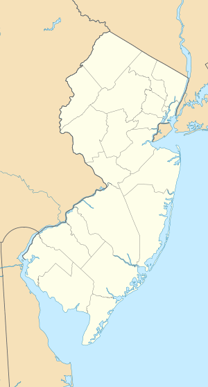 Monroeville, New Jersey  Monroeville, New Jersey | |
| Coordinates: 39°37′44″N 75°09′34″W / 39.62889°N 75.15944°WCoordinates: 39°37′44″N 75°09′34″W / 39.62889°N 75.15944°W | |
| Country |
|
| State |
|
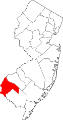
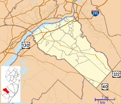
| Counties | Gloucester and Salem |
| Townships | Elk and Upper Pittsgrove |
| Named for | Rev. Samuel Y. Monroe |
| Elevation | 138 ft (42 m) |
| Population (2010 Census)[1] | |
| • Total | 5,030 |
| ZIP code | 08343[2] |
| GNIS feature ID | 0878442[3] |
Monroeville is an unincorporated community located within portions of Elk Township in Gloucester County and Upper Pittsgrove Township in Salem County, New Jersey, United States.[4] The area is served as United States Postal Service ZIP Code 08343. Monroeville is mostly filled with wooded areas and farms.[5]
Most of the residents attend Upper Pittsgrove School if they are in the Upper Pittsgrove Township portion, although some attend Olivet Elementary in Pittsgrove Township.
Monroeville was named after Rev. Samuel Y. Monroe, and had also been called Monroe Station for the train depot located in the area. It had contained a cigar factory, a blacksmith shop and a creamery.[6] During the 1880s and 1890s, it was one of several South Jersey destinations settled by Russian Jewish immigrants who were offered transportation by ship from Europe, and were provided with land and a cow in farming colonies.[7]
As of the 2010 United States Census, the population for ZIP Code Tabulation Area 08343 was 5,030.[1] As of the 2000 Census, the population was 4,596.[8]
References
- 1 2 DP-1 Profile of General Population and Housing Characteristics: 2010 - 2010 Census Summary File 1 for ZCTA 08343, United States Census Bureau. Accessed April 5, 2015.
- ↑ Look Up a ZIP Code for Monroeville, NJ, United States Postal Service. Accessed April 24, 2012.
- ↑ "Monroeville". Geographic Names Information System. United States Geological Survey. Retrieved September 22, 2012.
- ↑ Locality Search, State of New Jersey. Accessed March 28, 2015.
- ↑ "Monroeville, NJ". Google Maps. Retrieved April 9, 2015.
- ↑ Place Names of Salem County N.J., West Jersey History Project, Vol. 2 No. 4, 1964. Accessed April 14, 2015. "MONROEVILLE - Upper Pittsgrove Township. This village, in the eastern section of the County, was named for the Rev. Samuel Y. Monroe, and is sometimes known by the railroad name of Monroe Station. In former times it contained a creamery, a blacksmith shop and a cigar factory on Scott's Corner."
- ↑ Vernon, Leonard F.; and Meyers, Allan. Jewish South Jersey, p. 7. Arcadia Publishing, 2007. ISBN 9780738550022. Accessed April 9, 2015.
- ↑ DP-1 Profile of General Demographic Characteristics: 2000 - 2000 Summary File 1 (SF 1) 100-Percent Data for ZCTA 08343, United States Census Bureau. Accessed April 5, 2015.