Ezel, Kentucky
| Ezel | |
|---|---|
| CDP | |
 Ezel Location within the state of Kentucky | |
| Coordinates: 37°53′28″N 83°26′40″W / 37.89111°N 83.44444°WCoordinates: 37°53′28″N 83°26′40″W / 37.89111°N 83.44444°W | |
| Country | United States |
| State | Kentucky |
| County | Morgan |
| Elevation | 945 ft (288 m) |
| Population (2010) | |
| • Total | 235 |
| Time zone | Eastern (EST) (UTC-5) |
| • Summer (DST) | EDT (UTC-4) |
| GNIS feature ID | 512105 |
Ezel (also Ecell and Ezell) is a census-designated place (CDP) in Morgan County, Kentucky, United States. It lies along U.S. Route 460, west of the city of West Liberty, the county seat of Morgan County.[1] Its elevation is 945 feet (288 m).[2] Although it is unincorporated, it has a small post office, with the ZIP code 41425.[3]
History
First incorporated in 1882, the town was given the name Ezel, for a rock in the Bible, by its first postmaster, Eli Pieratt, when the post office opened in 1875.[4][5] It is now home to Ezel Elementary School and the Blackwater Volunteer Fire Department.
References
- ↑ Rand McNally. The Road Atlas '06. Chicago: Rand McNally, 2006, p. 43.
- ↑ U.S. Geological Survey Geographic Names Information System: Ezel, Kentucky, Geographic Names Information System, 1979-09-20. Accessed 2008-01-03.
- ↑ Zip Code Lookup
- ↑ Ky Atlas & Gazetteer
- ↑ Rennick, Robert M. (1987). Kentucky Place Names. University Press of Kentucky. p. 97. Retrieved 2013-04-28.
Municipalities and communities of Morgan County, Kentucky, United States | ||
|---|---|---|
| City | 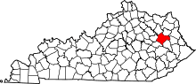 | |
| CDP | ||
| Other unincorporated communities | ||
This article is issued from Wikipedia - version of the 10/11/2016. The text is available under the Creative Commons Attribution/Share Alike but additional terms may apply for the media files.