Fingal, Tasmania
| Fingal Tasmania | |
|---|---|
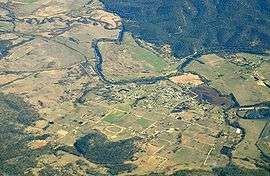 Aerial photo from south east. South Esk River visible. | |
| Population | 366 (2011 census)[1] |
| • Density | 79.6/km2 (206/sq mi) |
| Established | 1827 |
| Postcode(s) | 7214 |
| Elevation | 232 m (761 ft) |
| Area | 4.6 km2 (1.8 sq mi) |
| Location |
|
| LGA(s) | Break O'Day Council |
| State electorate(s) | Lyons |
| Federal Division(s) | Lyons |
Fingal /fɪŋˈɔːl/ is a small Australian town in Fingal Valley in the north-east of Tasmania, on the Esk Highway.
History
The Fingal area was surveyed in 1824 by Roderic O'Connor and John Helder Wedge, and is believed to have been named after Fingal's Cave in the Inner Hebrides of Scotland rather than Fingal in Ireland. The town of Fingal came into existence in 1827 as a convict station, and experienced a boom when Van Diemen's Land's first payable gold was discovered in nearby Mangana.[2]
Fingal Post Office opened on 1 June 1832.[3]
See also
- Electoral district of Fingal former Tasmanian House of Assembly district.
References
- ↑ Australian Bureau of Statistics (31 October 2012). "2011 Community Profiles: Fingal". 2011 Census of Population and Housing. Retrieved 2012-11-13.
- ↑ Fingal: Quiet and attractive rural town, The Sydney Morning Herald, February 8, 2004.
- ↑ Premier Postal History. "Post Office List". Premier Postal Auctions. Retrieved 16 June 2012.
External links
| Wikivoyage has a travel guide for Fingal (Tasmania). |
- Fingal Online Access Centre, Tasmanian Communities Online
Coordinates: 41°38′19″S 147°58′02″E / 41.6386°S 147.9672°E
East Coast region of Tasmania, Australia | |||||||
|---|---|---|---|---|---|---|---|
| Settlements | |||||||
| Governance former | |||||||
| Mountains | |||||||
| Protected areas, parks and reserves |
| ||||||
| Harbours, bays, inlets and estuaries | |||||||
| Landmarks |
| ||||||
| People of note | |||||||
| Islands |
| ||||||
| Books and newspapers | |||||||
| Flora, fauna, and fishlife | |||||||
| Bioregions | |||||||
| |||||||
This article is issued from Wikipedia - version of the 10/21/2016. The text is available under the Creative Commons Attribution/Share Alike but additional terms may apply for the media files.