Flemington, Missouri
| Flemington, Missouri | |
|---|---|
| Village | |
 Location of Flemington, Missouri | |
| Coordinates: 37°48′20″N 93°30′8″W / 37.80556°N 93.50222°WCoordinates: 37°48′20″N 93°30′8″W / 37.80556°N 93.50222°W | |
| Country | United States |
| State | Missouri |
| County | Polk |
| Area[1] | |
| • Total | 0.33 sq mi (0.85 km2) |
| • Land | 0.33 sq mi (0.85 km2) |
| • Water | 0 sq mi (0 km2) |
| Elevation | 1,129 ft (344 m) |
| Population (2010)[2] | |
| • Total | 148 |
| • Estimate (2012[3]) | 147 |
| • Density | 448.5/sq mi (173.2/km2) |
| Time zone | Central (CST) (UTC-6) |
| • Summer (DST) | CDT (UTC-5) |
| ZIP code | 65650 |
| Area code(s) | 417 |
| FIPS code | 29-24580[4] |
| GNIS feature ID | 0718013[5] |
Flemington is a village in Polk County, Missouri, United States. The population was 148 at the 2010 census. It is part of the Springfield, Missouri Metropolitan Statistical Area.
History
Flemington was named for Robert Fleming, an original owner of the town site.[6]
Geography
Flemington is located at 37°48′20″N 93°30′8″W / 37.80556°N 93.50222°W (37.805451, -93.502253).[7]
According to the United States Census Bureau, the village has a total area of 0.33 square miles (0.85 km2), all of it land.[1]
Demographics
| Historical population | |||
|---|---|---|---|
| Census | Pop. | %± | |
| 1950 | 181 | — | |
| 1960 | 142 | −21.5% | |
| 1970 | 126 | −11.3% | |
| 1980 | 140 | 11.1% | |
| 1990 | 141 | 0.7% | |
| 2000 | 124 | −12.1% | |
| 2010 | 148 | 19.4% | |
| Est. 2015 | 148 | [8] | 0.0% |
2010 census
As of the census[2] of 2010, there were 148 people, 59 households, and 35 families residing in the village. The population density was 448.5 inhabitants per square mile (173.2/km2). There were 73 housing units at an average density of 221.2 per square mile (85.4/km2). The racial makeup of the village was 97.3% White, 1.4% Native American, and 1.4% from two or more races. Hispanic or Latino of any race were 4.7% of the population.
There were 59 households of which 23.7% had children under the age of 18 living with them, 40.7% were married couples living together, 15.3% had a female householder with no husband present, 3.4% had a male householder with no wife present, and 40.7% were non-families. 33.9% of all households were made up of individuals and 18.7% had someone living alone who was 65 years of age or older. The average household size was 2.51 and the average family size was 3.31.
The median age in the village was 45.5 years. 23% of residents were under the age of 18; 4.1% were between the ages of 18 and 24; 20.9% were from 25 to 44; 35.9% were from 45 to 64; and 16.2% were 65 years of age or older. The gender makeup of the village was 45.9% male and 54.1% female.
2000 census
As of the census[4] of 2000, there were 124 people, 54 households, and 32 families residing in the village. The population density was 379.8 people per square mile (145.1/km²). There were 76 housing units at an average density of 232.8 per square mile (88.9/km²). The racial makeup of the village was 96.77% White, 1.61% Native American, and 1.61% from two or more races. Hispanic or Latino of any race were 0.81% of the population.
There were 54 households out of which 33.3% had children under the age of 18 living with them, 46.3% were married couples living together, 9.3% had a female householder with no husband present, and 38.9% were non-families. 33.3% of all households were made up of individuals and 13.0% had someone living alone who was 65 years of age or older. The average household size was 2.30 and the average family size was 2.94.
In the village the population was spread out with 24.2% under the age of 18, 9.7% from 18 to 24, 26.6% from 25 to 44, 27.4% from 45 to 64, and 12.1% who were 65 years of age or older. The median age was 40 years. For every 100 females there were 106.7 males. For every 100 females age 18 and over, there were 91.8 males.
The median income for a household in the village was $23,438, and the median income for a family was $22,500. Males had a median income of $18,438 versus $16,875 for females. The per capita income for the village was $11,499. There were 21.1% of families and 27.5% of the population living below the poverty line, including 54.8% of under eighteens and none of those over 64.
References
- 1 2 "US Gazetteer files 2010". United States Census Bureau. Retrieved 2012-07-08.
- 1 2 "American FactFinder". United States Census Bureau. Retrieved 2012-07-08.
- ↑ "Population Estimates". United States Census Bureau. Retrieved 2013-05-30.
- 1 2 "American FactFinder". United States Census Bureau. Retrieved 2008-01-31.
- ↑ "US Board on Geographic Names". United States Geological Survey. 2007-10-25. Retrieved 2008-01-31.
- ↑ Earngey, Bill (1995). Missouri Roadsides: The Traveler's Companion. University of Missouri Press. p. 19.
- ↑ "US Gazetteer files: 2010, 2000, and 1990". United States Census Bureau. 2011-02-12. Retrieved 2011-04-23.
- ↑ "Annual Estimates of the Resident Population for Incorporated Places: April 1, 2010 to July 1, 2015". Retrieved July 2, 2016.
- ↑ "Census of Population and Housing". Census.gov. Retrieved June 4, 2015.
External links
- Historic maps of Flemington in the Sanborn Maps of Missouri Collection at the University of Missouri
Municipalities and communities of Polk County, Missouri, United States | ||
|---|---|---|
| Cities | 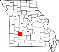 | |
| Villages | ||
| Townships |
| |
| Unincorporated communities | ||
| Ghost towns |
| |