Fortuna, North Dakota
| Fortuna, North Dakota | |
|---|---|
| City | |
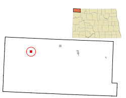 Location of Fortuna, North Dakota | |
 Fortuna, North Dakota Location in the United States | |
| Coordinates: 48°54′40″N 103°46′27″W / 48.91111°N 103.77417°WCoordinates: 48°54′40″N 103°46′27″W / 48.91111°N 103.77417°W | |
| Country |
|
| State |
|
| County | Divide |
| Area[1] | |
| • Total | 1.01 sq mi (2.62 km2) |
| • Land | 1.00 sq mi (2.59 km2) |
| • Water | 0.01 sq mi (0.03 km2) |
| Elevation | 2,211 ft (674 m) |
| Population (2010)[2] | |
| • Total | 22 |
| • Estimate (2014)[3] | 23 |
| • Density | 22.0/sq mi (8.5/km2) |
| Time zone | Central (CST) (UTC-6) |
| • Summer (DST) | CDT (UTC-5) |
| ZIP code | 58844 |
| Area code(s) | 701 |
| FIPS code | 38-27820 |
| GNIS feature ID | 1029028[4] |
Fortuna is a city in Divide County, North Dakota, United States. The population was 22 at the 2010 census.[5]
Fortuna was founded in 1913 along a Soo Line Railroad branch line running between Flaxton, North Dakota and Whitetail, Montana. The name comes from the Roman goddess of fortune and was chosen by railroad officials to note the settlers' expectations of prosperity with the arrival of the railroad.[6]
The city is located 6 miles from the Canada–US border and is the northernmost city on U.S. Route 85 before it crosses into Canada at Port of Oungre, Saskatchewan.
Fortuna, North Dakota has the latest sunset time several days after the summer solstice in the contiguous, lower 48 States. The sun set at 10:03:10 PM Central Daylight Time (CDT) on June 24, 2016.[7] This is due to Fortuna's location at the far western edge of the Central Time Zone. Although other communities in the lower 48 States are located farther north, none of them are located as far west in their respective time zones. Fortuna's westerly location in the time zone gives it the latest local time when the sun sets near the summer solstice.
Geography
Fortuna is located at 48°54′40″N 103°46′27″W / 48.911016°N 103.774263°W.[8]
According to the United States Census Bureau, the city has a total area of 1.01 square miles (2.62 km2), of which, 1.00 square mile (2.59 km2) is land and 0.01 square miles (0.03 km2) is water.[1]
Demographics
| Historical population | |||
|---|---|---|---|
| Census | Pop. | %± | |
| 1920 | 198 | — | |
| 1930 | 196 | −1.0% | |
| 1940 | 214 | 9.2% | |
| 1950 | 181 | −15.4% | |
| 1960 | 185 | 2.2% | |
| 1970 | 216 | 16.8% | |
| 1980 | 98 | −54.6% | |
| 1990 | 53 | −45.9% | |
| 2000 | 31 | −41.5% | |
| 2010 | 22 | −29.0% | |
| Est. 2015 | 23 | [9] | 4.5% |
| U.S. Decennial Census[10] 2014 Estimate[3] | |||
2010 census
As of the census[2] of 2010, there were 22 people, 14 households, and 3 families residing in the city. The population density was 22.0 inhabitants per square mile (8.5/km2). There were 26 housing units at an average density of 26.0 per square mile (10.0/km2). The racial makeup of the city was 95.5% White and 4.5% from two or more races. Hispanic or Latino of any race were 4.5% of the population.
There were 14 households of which 14.3% had children under the age of 18 living with them, 14.3% were married couples living together, 7.1% had a female householder with no husband present, and 78.6% were non-families. 64.3% of all households were made up of individuals and 14.3% had someone living alone who was 65 years of age or older. The average household size was 1.57 and the average family size was 3.00.
The median age in the city was 50.5 years. 18.2% of residents were under the age of 18; 9% were between the ages of 18 and 24; 18.1% were from 25 to 44; 36.3% were from 45 to 64; and 18.2% were 65 years of age or older. The gender makeup of the city was 54.5% male and 45.5% female.
2000 census
As of the census of 2000, there were 31 people, 17 households, and 8 families residing in the city. The population density was 31.0 people per square mile (12.0/km2). There were 39 housing units at an average density of 39.0 per square mile (15.1/km2). The racial makeup of the city was 100.00% White. Hispanic or Latino of any race were 3.23% of the population.
There were 17 households out of which 17.6% had children under the age of 18 living with them, 35.3% were married couples living together, 5.9% had a female householder with no husband present, and 52.9% were non-families. 52.9% of all households were made up of individuals and 23.5% had someone living alone who was 65 years of age or older. The average household size was 1.82 and the average family size was 2.75.
In the city the population was spread out with 19.4% under the age of 18, 29.0% from 25 to 44, 22.6% from 45 to 64, and 29.0% who were 65 years of age or older. The median age was 46 years. For every 100 females there were 121.4 males. For every 100 females age 18 and over, there were 150.0 males.
The median income for a household in the city was $13,542, and the median income for a family was $20,625. Males had a median income of $32,917 versus $13,750 for females. The per capita income for the city was $8,502. There were 45.5% of families and 54.0% of the population living below the poverty line, including 100.0% of under eighteens and 25.0% of those over 64.
Climate
Fortuna experiences a dry continental climate (Köppen Dfb/Dwb) with long, dry, very cold winters and very warm, wetter summers.
| Climate data for Fortuna, North Dakota | |||||||||||||
|---|---|---|---|---|---|---|---|---|---|---|---|---|---|
| Month | Jan | Feb | Mar | Apr | May | Jun | Jul | Aug | Sep | Oct | Nov | Dec | Year |
| Record high °F (°C) | 47 (8) |
64 (18) |
74 (23) |
90 (32) |
100 (38) |
103 (39) |
102 (39) |
105 (41) |
102 (39) |
91 (33) |
73 (23) |
53 (12) |
105 (41) |
| Average high °F (°C) | 15.5 (−9.2) |
23.4 (−4.8) |
35.1 (1.7) |
52.4 (11.3) |
65.9 (18.8) |
74.8 (23.8) |
80.5 (26.9) |
79.9 (26.6) |
67.0 (19.4) |
53.7 (12.1) |
32.9 (0.5) |
20.6 (−6.3) |
50.14 (10.07) |
| Daily mean °F (°C) | 5.6 (−14.7) |
13.6 (−10.2) |
25.0 (−3.9) |
40.2 (4.6) |
53.1 (11.7) |
62.2 (16.8) |
67.1 (19.5) |
65.8 (18.8) |
53.8 (12.1) |
41.3 (5.2) |
23.7 (−4.6) |
11.1 (−11.6) |
38.54 (3.64) |
| Average low °F (°C) | −4.3 (−20.2) |
3.7 (−15.7) |
14.8 (−9.6) |
28.0 (−2.2) |
40.2 (4.6) |
49.5 (9.7) |
53.6 (12) |
51.6 (10.9) |
40.5 (4.7) |
28.8 (−1.8) |
14.5 (−9.7) |
1.5 (−16.9) |
26.87 (−2.85) |
| Record low °F (°C) | −44 (−42) |
−39 (−39) |
−28 (−33) |
−11 (−24) |
14 (−10) |
28 (−2) |
38 (3) |
31 (−1) |
19 (−7) |
−5 (−21) |
−26 (−32) |
−45 (−43) |
−45 (−43) |
| Average precipitation inches (mm) | 0.34 (8.6) |
0.36 (9.1) |
0.76 (19.3) |
0.99 (25.1) |
1.98 (50.3) |
2.87 (72.9) |
2.71 (68.8) |
1.62 (41.1) |
1.33 (33.8) |
0.85 (21.6) |
0.33 (8.4) |
0.29 (7.4) |
14.43 (366.4) |
| Source #1: NOAA (normals, 1971–2000) [11] | |||||||||||||
| Source #2: The Weather Channel (Records) [12] | |||||||||||||
People
Clarence Aaberg, an air force captain during World War Two, was born and raised on a farm near Fortuna. During a mission over France in 1943, when his plane was shot down, he let all of his crew out first, but when he jumped it is believed that his altitude was too low to allow for his parachute to open, resulting in his death. Clarence Aaberg's body was found and buried at Cambridge-American Cemetery near Cambridge, England (Plot D, Row 1, Grave 49). There is a memorial in Fortuna dedicated to Lt. Aaberg.
References
- 1 2 "US Gazetteer files 2010". United States Census Bureau. Retrieved 2012-06-14.
- 1 2 "American FactFinder". United States Census Bureau. Retrieved 2012-06-14.
- 1 2 "Population Estimates". United States Census Bureau. Retrieved June 10, 2015.
- ↑ "US Board on Geographic Names". United States Geological Survey. 2007-10-25. Retrieved 2008-01-31.
- ↑ "2010 Census Redistricting Data (Public Law 94-171) Summary File". American FactFinder. United States Census Bureau. Retrieved 2 May 2011.
- ↑ Wick, Douglas A. "Fortuna (Divide County)". North Dakota Place Names. Retrieved 9 May 2011.
- ↑ "Sunrise Sunset". Retrieved 21 November 2016.
- ↑ "US Gazetteer files: 2010, 2000, and 1990". United States Census Bureau. 2011-02-12. Retrieved 2011-04-23.
- ↑ "Annual Estimates of the Resident Population for Incorporated Places: April 1, 2010 to July 1, 2015". Retrieved July 2, 2016.
- ↑ United States Census Bureau. "Census of Population and Housing". Retrieved September 7, 2013.
- ↑ "Climatography of the United States NO.81" (PDF). National Oceanic and Atmospheric Administration. Retrieved January 16, 2011.
- ↑ "Monthly Averages for Fortuna, ND". The Weather Channel. Retrieved January 16, 2011.
Municipalities and communities of Divide County, North Dakota, United States | ||
|---|---|---|
| Cities | 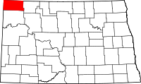 | |
| Townships |
| |
| Unincorporated communities | ||