Frankfort (village), New York
| Frankfort, New York | |
|---|---|
| Village | |
 Frankfort, New York Location within the state of New York | |
| Coordinates: 43°2′14″N 75°4′19″W / 43.03722°N 75.07194°WCoordinates: 43°2′14″N 75°4′19″W / 43.03722°N 75.07194°W | |
| Country | United States |
| State | New York |
| County | Herkimer |
| Area | |
| • Total | 1.0 sq mi (2.6 km2) |
| • Land | 1.0 sq mi (2.6 km2) |
| • Water | 0.0 sq mi (0.0 km2) |
| Elevation | 407 ft (124 m) |
| Population (2010) | |
| • Total | 2,598 |
| • Density | 2,600/sq mi (1,000/km2) |
| Time zone | Eastern (EST) (UTC-5) |
| • Summer (DST) | EDT (UTC-4) |
| ZIP code | 13340 |
| Area code(s) | 315 |
| FIPS code | 36-27188 |
| GNIS feature ID | 0950600 |
Frankfort is a village in Herkimer County, New York, United States. The population was 2,598 at the 2010 census. Like the town, the village is named after early settler, Lawrence (Lewis) Frank.
The Village of Frankfort is in the northeast corner of the Town of Frankfort. Frankfort is on the south side of the Erie Canal and east of Utica, New York.
History
The village was settled prior to 1807.
The village was incorporated in 1863.
The Frankfort Town Hall and United States Post Office are listed on the National Register of Historic Places.[1]
Geography
Frankfort is located at 43°2′14″N 75°4′18″W / 43.03722°N 75.07167°W (43.037267, -75.071879).[2]
According to the United States Census Bureau, the village has a total area of 1.0 square miles (2.6 km²), of which, 1.0 square miles (2.6 km²) of it is land and 0.04 square miles (0.1 km²) of it (1.96%) is water.
The village is south of the Mohawk River. Moyer Creek flows through the village to the Mohawk River.
Frankfort is at the northern terminus of New York State Route 171 with the old New York State Route 5S. The new New York State Route 5S does not intersect New York State Route 171; making Route 171 the only state route not to intersect another state route.
Lying between Frankfort and the Mohawk River is the community of North Frankfort. East Frankfort borders Frankfort on the southeast, and Corrado Corners on the southwest.
Demographics
| Historical population | |||
|---|---|---|---|
| Census | Pop. | %± | |
| 1870 | 1,083 | — | |
| 1880 | 1,085 | 0.2% | |
| 1890 | 2,291 | 111.2% | |
| 1900 | 2,664 | 16.3% | |
| 1910 | 3,303 | 24.0% | |
| 1920 | 4,198 | 27.1% | |
| 1930 | 4,203 | 0.1% | |
| 1940 | 3,859 | −8.2% | |
| 1950 | 3,844 | −0.4% | |
| 1960 | 3,872 | 0.7% | |
| 1970 | 3,305 | −14.6% | |
| 1980 | 2,995 | −9.4% | |
| 1990 | 2,693 | −10.1% | |
| 2000 | 2,537 | −5.8% | |
| 2010 | 2,598 | 2.4% | |
| Est. 2015 | 2,507 | [3] | −3.5% |
As of the census[5] of 2000, there were 2,537 people, 1,088 households, and 698 families residing in the village. The population density was 2,528.4 people per square mile (979.5/km²). There were 1,157 housing units at an average density of 1,153.1 per square mile (446.7/km²). The racial makeup of the village was 97.71% White, 0.04% Black or African American, 0.28% Native American, 0.16% Asian, 0.20% from other races, and 1.62% from two or more races. Hispanic or Latino of any race were 0.99% of the population.
There were 1,088 households out of which 29.3% had children under the age of 18 living with them, 45.3% were married couples living together, 14.0% had a female householder with no husband present, and 35.8% were non-families. 30.8% of all households were made up of individuals and 17.2% had someone living alone who was 65 years of age or older. The average household size was 2.33 and the average family size was 2.92.
In the village the population was spread out with 23.3% under the age of 18, 7.8% from 18 to 24, 26.0% from 25 to 44, 22.8% from 45 to 64, and 20.1% who were 65 years of age or older. The median age was 39 years. For every 100 females there were 83.7 males. For every 100 females age 18 and over, there were 79.8 males.
The median income for a household in the village was $25,925, and the median income for a family was $35,938. Males had a median income of $28,869 versus $22,238 for females. The per capita income for the village was $14,381. About 13.6% of families and 15.5% of the population were below the poverty line, including 22.9% of those under age 18 and 7.8% of those age 65 or over.
44.7% of Frankfort residents reported having Italian ancestry, one of the highest in the United States.[6]
References
- ↑ National Park Service (2010-07-09). "National Register Information System". National Register of Historic Places. National Park Service.
- ↑ "US Gazetteer files: 2010, 2000, and 1990". United States Census Bureau. 2011-02-12. Retrieved 2011-04-23.
- ↑ "Annual Estimates of the Resident Population for Incorporated Places: April 1, 2010 to July 1, 2015". Retrieved July 2, 2016.
- ↑ "Census of Population and Housing". Census.gov. Retrieved June 4, 2015.
- ↑ "American FactFinder". United States Census Bureau. Retrieved 2008-01-31.
- ↑ Italian ancestry by city - ePodunk
External links
Municipalities and communities of Herkimer County, New York, United States | ||
|---|---|---|
| City | 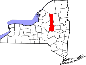 | |
| Towns | ||
| Villages | ||
| CDP | ||
| Hamlets | ||
| Footnotes | ‡This populated place also has portions in an adjacent county or counties | |