Ohio, New York
| Ohio | |
|---|---|
| Town | |
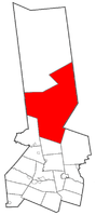 Location within Herkimer County | |
 Ohio Location within the state of New York | |
| Coordinates: 43°25′31″N 74°56′39″W / 43.42528°N 74.94417°WCoordinates: 43°25′31″N 74°56′39″W / 43.42528°N 74.94417°W | |
| Country | United States |
| State | New York |
| County | Herkimer |
| Government | |
| • Type | Town Council |
| • Town Supervisor | Scott Bagetis (R) |
| • Town Council |
Members' List
|
| Area | |
| • Total | 309.0 sq mi (800.2 km2) |
| • Land | 302.6 sq mi (783.7 km2) |
| • Water | 6.4 sq mi (16.6 km2) |
| Elevation | 2,119 ft (646 m) |
| Population (2010) | |
| • Total | 1,002 |
| • Density | 3.2/sq mi (1.3/km2) |
| Time zone | Eastern (EST) (UTC-5) |
| • Summer (DST) | EDT (UTC-4) |
| ZIP code | 13324 |
| Area code(s) | 315 |
| FIPS code | 36-54507 |
| GNIS feature ID | 0979302 |
| Website | http://ohiony.us |
Ohio is a town in Herkimer County, New York, United States. The population was 1,002 at the 2010 census.[1] The town is named after the state of Ohio.[2] The town is in the northwest part of the county and northeast of Utica. Part of Ohio is within the Adirondack Park.
History
The town of Ohio was established as the town of West Brunswick in 1823 from part of the town of Norway. The name changed to Ohio in 1836. Ohio was increased by some of the now-defunct town of Wilmurt, which itself had been partly formed with territory from Ohio and the town of Russia in 1836. Willmurt was once the largest town in New York.
Geography
According to the United States Census Bureau, the town has a total area of 309.0 square miles (800 km2), of which, 302.6 square miles (784 km2) of it is land and 6.4 square miles (17 km2) of it (2.07%) is water.
The eastern town line is the border of Hamilton County, and the western town line is the border of Oneida County.
Hinckley Reservoir, formed by a dam on the West Canada Creek, is mostly in the town.
New York State Route 8 is a north-south highway in Ohio. New York State Route 365, passes along the north side of the Hinckley Lake before intersecting NY-8.
Demographics
| Historical population | |||
|---|---|---|---|
| Census | Pop. | %± | |
| 1830 | 713 | — | |
| 1840 | 692 | −2.9% | |
| 1850 | 1,051 | 51.9% | |
| 1860 | 1,135 | 8.0% | |
| 1870 | 1,009 | −11.1% | |
| 1880 | 961 | −4.8% | |
| 1890 | 832 | −13.4% | |
| 1900 | 660 | −20.7% | |
| 1910 | 527 | −20.2% | |
| 1920 | 583 | 10.6% | |
| 1930 | 457 | −21.6% | |
| 1940 | 460 | 0.7% | |
| 1950 | 547 | 18.9% | |
| 1960 | 480 | −12.2% | |
| 1970 | 468 | −2.5% | |
| 1980 | 788 | 68.4% | |
| 1990 | 880 | 11.7% | |
| 2000 | 922 | 4.8% | |
| 2010 | 1,002 | 8.7% | |
| Est. 2014 | 1,006 | [3] | 0.4% |
As of the census[1] of 2000, there were 922 people, 349 households, and 255 families residing in the town. The population density was 3.0 people per square mile (1.2/km²). There were 974 housing units at an average density of 3.2 per square mile (1.2/km²). The racial makeup of the town was 96.96% White, 0.54% African American, 1.41% Native American, 0.11% Asian, 0.54% from other races, and 0.43% from two or more races. Hispanic or Latino of any race were 0.54% of the population.
There were 349 households out of which 35.2% had children under the age of 18 living with them, 60.7% were married couples living together, 8.0% had a female householder with no husband present, and 26.9% were non-families. 20.9% of all households were made up of individuals and 6.6% had someone living alone who was 65 years of age or older. The average household size was 2.64 and the average family size was 3.06.
In the town the population was spread out with 26.7% under the age of 18, 6.8% from 18 to 24, 29.0% from 25 to 44, 27.3% from 45 to 64, and 10.2% who were 65 years of age or older. The median age was 38 years. For every 100 females there were 104.9 males. For every 100 females age 18 and over, there were 107.4 males.
The median income for a household in the town was $29,813, and the median income for a family was $36,667. Males had a median income of $25,625 versus $22,153 for females. The per capita income for the town was $13,641. About 18.7% of families and 20.9% of the population were below the poverty line, including 26.2% of those under age 18 and 30.7% of those age 65 or over.
Communities and locations in Ohio
Communities and inhabited locations
- Atwell – A hamlet in the center of the town, located at the south end of North Lake, named for local hermit Atwell Martin.
- Bull Hill – A hamlet in the southeast corner of the town on County Road 129.
- Gray – A hamlet on the south town line.
- Nobleboro – A hamlet on NY Route 8 near the Hamilton County border. The name is derived from its situation at the boundary of a royal grant to Sir William Johnson. The remains of a pulpwood boom and rossing mill on West Canada Creek, commemorated today with a scenic overlook and kiosk.
- North Wilmurt – A hamlet in the west-central part of the town.
- Ohio – A hamlet on NY-8 in the south-central part of the town. It was formerly called "Ohio City" and "Dutch Settlement."
- Wilmurt Corners – A hamlet in the eastern part of the town, south of Route 8, located on County Road 69.
Geographical and similar locations
- Forest Lodge – A location at the east end of Honnedaga Lake.
- Herkimer Landing – A location at the southeast end of Honnedaga Lake.
- Hinkley Reservoir – A reservoir on the south town line.
- Honnedaga – An historic location in the town.
- Honnedaga Lake – A lake in the northern part of Ohio.
- McIntosh Bridge – An historic location in the town.
- Limekiln Lake – A lake partly in Ohio in the northwest corner.
- North Lake – A lake near the north town line, northwest of South Lake.
- South Lake – A lake southwest of Honnedaga Lake.
- Woodin Corners – A location near the south town line.
References
- 1 2 "American FactFinder". United States Census Bureau. Archived from the original on September 11, 2013. Retrieved 2008-01-31.
- ↑ "Towns named after states". Reading Eagle. Jul 2, 1897. p. 3. Retrieved 14 October 2015.
- ↑ "Annual Estimates of the Resident Population for Incorporated Places: April 1, 2010 to July 1, 2014". Retrieved June 4, 2015.
- ↑ "Census of Population and Housing". Census.gov. Archived from the original on May 11, 2015. Retrieved June 4, 2015.
External links
Municipalities and communities of Herkimer County, New York, United States | ||
|---|---|---|
| City | 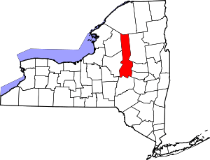 | |
| Towns | ||
| Villages | ||
| CDP | ||
| Hamlets | ||
| Footnotes | ‡This populated place also has portions in an adjacent county or counties | |