Mohawk, Herkimer County, New York
| Mohawk, New York | |
|---|---|
| Village | |
 Mohawk, New York Location within the state of New York | |
| Coordinates: 43°0′37″N 75°0′18″W / 43.01028°N 75.00500°WCoordinates: 43°0′37″N 75°0′18″W / 43.01028°N 75.00500°W | |
| Country | United States |
| State | New York |
| County | Herkimer |
| Area | |
| • Total | 0.9 sq mi (2.4 km2) |
| • Land | 0.9 sq mi (2.3 km2) |
| • Water | 0.0 sq mi (0.1 km2) |
| Elevation | 410 ft (125 m) |
| Population (2010) | |
| • Total | 2,731 |
| Time zone | Eastern (EST) (UTC-5) |
| • Summer (DST) | EDT (UTC-4) |
| ZIP code | 13407 |
| Area code(s) | 315 |
| FIPS code | 36-47823 |
| GNIS feature ID | 0957470 |
Mohawk is a village in Herkimer County, New York, United States. The population was 2,731 at the 2010 census. The village was named after the adjacent river.
The Village of Mohawk is at the north border of the Town of German Flatts and adjacent to the Erie Canal. Mohawk is south of Utica.
Mohawk students get their education from the Central Valley Central School District, a merger between the Ilion and Mohawk Central School Districts that took effect early in 2013. The sports teams of Central Valley call themselves the Thunder. Prior to this, Mohawk had called their teams the "Mohicans". The Mohawk Nation occupied the Mohawk Valley.
History
Mohawk was settled by Palatine Germans after 1722.
In 1725, the Queen of England and Governor Burnet granted Mohawk to the Palatine Germans in what was known as the Burnetsfield Patent.
George Washington was known to stop in Mohawk to have lunch at the Shoemaker Tavern on his way to and from Fort Stanwix in Rome, NY.
Mohawk became known as Bennetts Corners after a hotel stand that was located here in 1826.
In 1838, the village officially became known as Mohawk.
The village was incorporated on April 16, 1844. The first President of the Village, Frederick Bellinger came into office on May 4 of that same year.
The first Mayor of Mohawk was James V. Casey, he was elected in 1960.[1] The current mayor is Jim Baron.
Mohawk is one of only twelve villages in New York still incorporated under a charter, the other villages having incorporated or re-incorporated under the provisions of Village Law.[2]
Among famous Mohawk natives are Francis E. Spinner, who served as Treasurer of the United States during and after the Civil War and was celebrated for his distinctive signature as well as the first federal official to employ women, and Gregory Jarvis, who died in the Challenger space shuttle disaster. The local high school, which was repurposed into a middle school following the Mohawk school district's merger with the Ilion school district, is named after him. Other famous natives of Mohawk include Walter G. Bruska, distinguished Cornell University alumnus, nationally-recognized collegiate football player, and vice president of several prominent American universities and Robert E. Fistick, also a Cornell alumnus, noted national journalist and newspaper publisher with Gannett, Hearst, and Whitney publishing organizations and later a deputy director at The Library of Congress, Washington, D.C.
On March 13, 2013, two people were shot to death and two others were injured at a barbershop in Mohawk, by 64-year-old Kurt Myers, who committed a killing spree throughout Herkimer County that day. Prior to the shootings Myers engulfed the apartment he was residing at and nearly killed a couple with a newborn child. Myers then drove less than 200 yards to John's Barbershop where two clients were killed and two wounded by shotgun blasts. Myers then drove to Herkimer where he shot to death two people at a car wash in the village of Herkimer. He was eventually located and cornered at the closed Glory Days bar in Herkimer. Myers was shot and killed by police the next day in Herkimer.[3][4]
Geography
Mohawk is located at 43°0′37″N 75°0′18″W / 43.01028°N 75.00500°W (43.010194, -75.005022).[5]
According to the United States Census Bureau, the village has a total area of 0.9 square miles (2.4 km²), of which, 0.9 square miles (2.3 km²) of it is land and 0.04 square miles (0.1 km²) of it (3.30%) is water.
The village is on the South bank of the Mohawk River.
Mohawk is east of the Village of Ilion and on the opposite shore of the Mohawk River from the Village of Herkimer.
New York State Route 5S, an east-west highway, lies between the village and the Mohawk River. New York State Route 28 is a north-south highway. In addition, New York State Route 168 has its western terminus in the village.
Demographics
| Historical population | |||
|---|---|---|---|
| Census | Pop. | %± | |
| 1870 | 1,464 | — | |
| 1880 | 1,441 | −1.6% | |
| 1890 | 1,806 | 25.3% | |
| 1900 | 2,028 | 12.3% | |
| 1910 | 2,079 | 2.5% | |
| 1920 | 2,919 | 40.4% | |
| 1930 | 2,835 | −2.9% | |
| 1940 | 2,882 | 1.7% | |
| 1950 | 3,196 | 10.9% | |
| 1960 | 3,533 | 10.5% | |
| 1970 | 3,301 | −6.6% | |
| 1980 | 2,956 | −10.5% | |
| 1990 | 2,986 | 1.0% | |
| 2000 | 2,660 | −10.9% | |
| 2010 | 2,731 | 2.7% | |
| Est. 2015 | 2,628 | [6] | −3.8% |
As of the census[8] of 2000, there were 2,660 people, 1,146 households, and 708 families residing in the village. The population density was 3,009.8 people per square mile (1,167.1/km²). There were 1,233 housing units at an average density of 1,395.1 per square mile (541.0/km²). The racial makeup of the village was 98.42% White, 0.49% African American, 0.15% Native American, 0.15% Asian, 0.23% from other races, and 0.56% from two or more races. Hispanic or Latino of any race were 1.88% of the population.
There were 1,146 households out of which 27.0% had children under the age of 18 living with them, 47.0% were married couples living together, 10.4% had a female householder with no husband present, and 38.2% were non-families. 30.7% of all households were made up of individuals and 14.8% had someone living alone who was 65 years of age or older. The average household size was 2.29 and the average family size was 2.86.
In the village the population was spread out with 21.7% under the age of 18, 9.4% from 18 to 24, 25.9% from 25 to 44, 24.4% from 45 to 64, and 18.7% who were 65 years of age or older. The median age was 40 years. For every 100 females there were 92.9 males. For every 100 females age 18 and over, there were 85.9 males.
The median income for a household in the village was $32,439, and the median income for a family was $39,185. Males had a median income of $29,915 versus $20,918 for females. The per capita income for the village was $16,469. About 5.5% of families and 8.5% of the population were below the poverty line, including 5.0% of those under age 18 and 6.1% of those age 65 or over.
Notable people
- Mary Myers, was the first female to solo fly a lighter-than-air passenger balloon.
- Carl Edgar Myers, balloon inventor and aeronautical engineer scientist.
- Gregory Jarvis, American engineer who died during the destruction of the Space Shuttle Challenger on mission STS-51-L, where he was serving as Payload Specialist.
References
- ↑
- ↑ "Local Government Handbook - Village Government: Historical Development" (PDF) (5th ed.). New York State Department of State. 2008. pp. PDF page 72. Retrieved 2009-06-26.
- ↑ Carroll, Sean (March 14, 2013). "Suspect Killed In Shootout In Herkimer". WHAM-TV. Retrieved 2013-06-10.
- ↑ Carpenter, Jake (March 14, 2013). "Four killed in upstate New York shootings, police say". CNN. Retrieved 2013-06-10.
- ↑ "US Gazetteer files: 2010, 2000, and 1990". United States Census Bureau. 2011-02-12. Retrieved 2011-04-23.
- ↑ "Annual Estimates of the Resident Population for Incorporated Places: April 1, 2010 to July 1, 2015". Retrieved July 2, 2016.
- ↑ "Census of Population and Housing". Census.gov. Retrieved June 4, 2015.
- ↑ "American FactFinder". United States Census Bureau. Retrieved 2008-01-31.
External links
Municipalities and communities of Herkimer County, New York, United States | ||
|---|---|---|
| City | 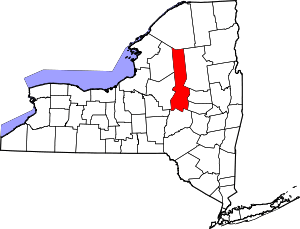 | |
| Towns | ||
| Villages | ||
| CDP | ||
| Hamlets | ||
| Footnotes | ‡This populated place also has portions in an adjacent county or counties | |