Fullerton, Nebraska
| Fullerton, Nebraska | |
|---|---|
| City | |
|
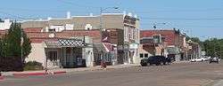
Downtown Fullerton | |
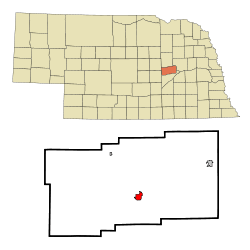 Location of Fullerton, Nebraska | |
| Coordinates: 41°21′47″N 97°58′15″W / 41.36306°N 97.97083°WCoordinates: 41°21′47″N 97°58′15″W / 41.36306°N 97.97083°W | |
| Country | United States |
| State | Nebraska |
| County | Nance |
| Area[1] | |
| • Total | 1.26 sq mi (3.26 km2) |
| • Land | 1.26 sq mi (3.26 km2) |
| • Water | 0 sq mi (0 km2) |
| Elevation | 1,647 ft (502 m) |
| Population (2010)[2] | |
| • Total | 1,307 |
| • Estimate (2012[3]) | 1,302 |
| • Density | 1,037.3/sq mi (400.5/km2) |
| Time zone | Central (CST) (UTC-6) |
| • Summer (DST) | CDT (UTC-5) |
| ZIP code | 68638 |
| Area code(s) | 308 |
| FIPS code | 31-17810[4] |
| GNIS feature ID | 0829430[5] |
| Website | www.fullerton-ne.com |
Fullerton is a city in, and the county seat of, Nance County, Nebraska, United States. The population was 1,307 as of the 2010 Census.[6]
History
A location by Fullerton called "Buffalo Leap" was thought to be used by aboriginals for driving buffalo to their deaths as a hunting method. It is also known as "Lover's Leap". Currently it is a part of the Broken Arrow Wilderness Camp located just north of Fullerton.[7]
In 1856, the Fullerton area became part of a Pawnee reservation and was excluded from settlement under the Homestead Act. Randall Fuller bought large tracts of land when the reservation was auctioned in 1871 and donated some for public use.[7] The town was platted in about 1878,[8] and named after Fuller.[9][10]
Geography
Fullerton is located at 41°21′47″N 97°58′15″W / 41.36306°N 97.97083°W (41.363009, -97.970858).[11]
According to the United States Census Bureau, the city has a total area of 1.26 square miles (3.26 km2), all of it land.[1]
The community is located at the junction of Routes 14 and 22.
Demographics
| Historical population | |||
|---|---|---|---|
| Census | Pop. | %± | |
| 1900 | 1,464 | — | |
| 1910 | 1,638 | 11.9% | |
| 1920 | 1,595 | −2.6% | |
| 1930 | 1,680 | 5.3% | |
| 1940 | 1,707 | 1.6% | |
| 1950 | 1,520 | −11.0% | |
| 1960 | 1,475 | −3.0% | |
| 1970 | 1,444 | −2.1% | |
| 1980 | 1,506 | 4.3% | |
| 1990 | 1,452 | −3.6% | |
| 2000 | 1,378 | −5.1% | |
| 2010 | 1,307 | −5.2% | |
| Est. 2015 | 1,266 | [12] | −3.1% |
2010 census
As of the census[2] of 2010, there were 1,307 people, 564 households, and 346 families residing in the city. The population density was 1,037.3 inhabitants per square mile (400.5/km2). There were 656 housing units at an average density of 520.6 per square mile (201.0/km2). The racial makeup of the city was 98.3% White, 0.5% African American, 0.5% Native American, 0.5% from other races, and 0.3% from two or more races. Hispanic or Latino of any race were 1.0% of the population.
There were 564 households of which 24.1% had children under the age of 18 living with them, 48.8% were married couples living together, 7.8% had a female householder with no husband present, 4.8% had a male householder with no wife present, and 38.7% were non-families. 36.0% of all households were made up of individuals and 19.3% had someone living alone who was 65 years of age or older. The average household size was 2.19 and the average family size was 2.81.
The median age in the city was 47.5 years. 21.3% of residents were under the age of 18; 5.9% were between the ages of 18 and 24; 19.8% were from 25 to 44; 28.9% were from 45 to 64; and 24.3% were 65 years of age or older. The gender makeup of the city was 48.2% male and 51.8% female.
2000 census
As of the census[4] of 2000, there were 1,378 people, 551 households, and 375 families residing in the city. The population density was 1,110.0 people per square mile (429.1/km²). There were 636 housing units at an average density of 512.3 per square mile (198.0/km²). The racial makeup of the city was 96.95% White, 0.80% Native American, 0.07% Asian, 1.09% from other races, and 1.09% from two or more races. Hispanic or Latino of any race were 2.47% of the population.
There were 551 households out of which 29.6% had children under the age of 18 living with them, 55.4% were married couples living together, 9.1% had a female householder with no husband present, and 31.9% were non-families. 30.3% of all households were made up of individuals and 16.9% had someone living alone who was 65 years of age or older. The average household size was 2.37 and the average family size was 2.94.
In the city the population was spread out with 25.9% under the age of 18, 6.7% from 18 to 24, 20.6% from 25 to 44, 22.2% from 45 to 64, and 24.5% who were 65 years of age or older. The median age was 42 years. For every 100 females there were 96.0 males. For every 100 females age 18 and over, there were 88.7 males.
As of 2000 the median income for a household in the city was $31,055, and the median income for a family was $39,087. Males had a median income of $26,528 versus $19,063 for females. The per capita income for the city was $17,593. About 8.5% of families and 12.0% of the population were below the poverty line, including 17.2% of those under age 18 and 10.3% of those age 65 or over.
Notable people
- Annette Dubas, Nebraska State Senator
References
- 1 2 "US Gazetteer files 2010". United States Census Bureau. Retrieved 2012-06-24.
- 1 2 "American FactFinder". United States Census Bureau. Retrieved 2012-06-24.
- ↑ "Population Estimates". United States Census Bureau. Retrieved 2013-05-29.
- 1 2 "American FactFinder". United States Census Bureau. Retrieved 2008-01-31.
- ↑ "US Board on Geographic Names". United States Geological Survey. 2007-10-25. Retrieved 2008-01-31.
- ↑ "Find a County". National Association of Counties. Retrieved 2011-06-07.
- 1 2 "Our Community: History". City of Fullerton, NE. Retrieved 20 August 2014.
- ↑ "Fullerton, Nance County". Center for Advanced Land Management Information Technologies. University of Nebraska. Retrieved 20 August 2014.
- ↑ "Profile for Fullerton, NE". ePodunk. Retrieved 20 August 2014.
- ↑ Fitzpatrick, Lillian L. (1960). Nebraska Place-Names. University of Nebraska Press. p. 105. ISBN 0-8032-5060-6. A 1925 edition is available for download at University of Nebraska—Lincoln Digital Commons.
- ↑ "US Gazetteer files: 2010, 2000, and 1990". United States Census Bureau. 2011-02-12. Retrieved 2011-04-23.
- ↑ "Annual Estimates of the Resident Population for Incorporated Places: April 1, 2010 to July 1, 2015". Retrieved July 2, 2016.
- ↑ "Census of Population and Housing". Census.gov. Retrieved June 4, 2015.
External links
Municipalities and communities of Nance County, Nebraska, United States | ||
|---|---|---|
| Cities | ||
| Village | ||
| Townships | ||
| Unincorporated communities | ||