Gairo, Sardinia
| Gairo Gàiru | |
|---|---|
| Comune | |
| Comune di Gairo | |
 | |
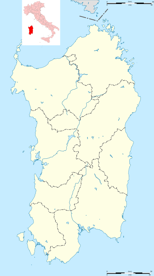 Gairo Location of Gairo in Sardinia | |
| Coordinates: 39°51′N 9°30′E / 39.850°N 9.500°ECoordinates: 39°51′N 9°30′E / 39.850°N 9.500°E | |
| Country | Italy |
| Region | Sardinia |
| Province / Metropolitan city | Nuoro (NU) |
| Area | |
| • Total | 78.4 km2 (30.3 sq mi) |
| Elevation | 690 m (2,260 ft) |
| Population (Dec. 2004) | |
| • Total | 1,643 |
| • Density | 21/km2 (54/sq mi) |
| Time zone | CET (UTC+1) |
| • Summer (DST) | CEST (UTC+2) |
| Postal code | 08040 |
| Dialing code | 0782 |
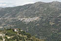
Gairo, Gàiru in sardinian language, is a comune (municipality) in the Province of Nuoro in the Italian region Sardinia, located about 80 kilometres (50 mi) northeast of Cagliari and about 30 kilometres (19 mi) southwest of Tortolì. As of 31 December 2004, it had a population of 1,643 and an area of 78.4 square kilometres (30.3 sq mi).[1]
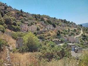
Gairo was originally constructed on unstable ground. Starting in 1951, buildings began to collapse. This led to the abandonment of the original location and re-building at an uphill location. The original village, known as "Gairo Vecchio", or "Old Gairo", is open to visitors.
Gairo borders the following municipalities: Arzana, Cardedu, Jerzu, Lanusei, Osini, Seui, Tertenia, Ulassai, Ussassai.
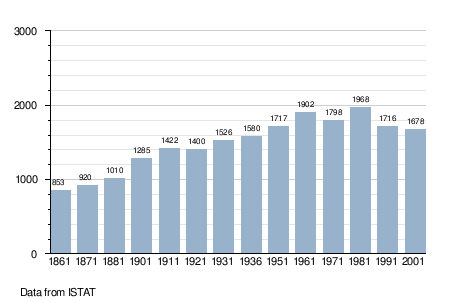
Demographic evolution

References
| Wikimedia Commons has media related to Gairo. |