Lei, Sardinia
| Lei | |
|---|---|
| Comune | |
| Comune di Lei | |
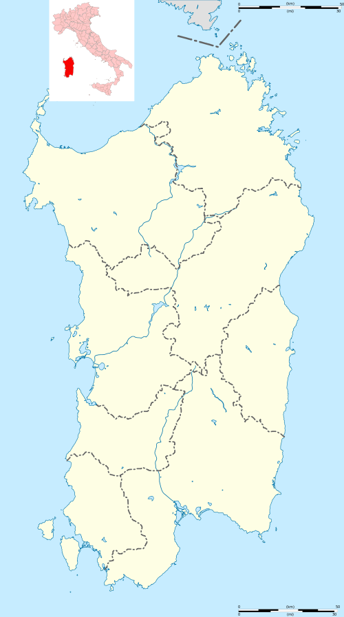 Lei Location of Lei in Sardinia | |
| Coordinates: 40°18′N 8°55′E / 40.300°N 8.917°ECoordinates: 40°18′N 8°55′E / 40.300°N 8.917°E | |
| Country | Italy |
| Region | Sardinia |
| Province / Metropolitan city | Province of Nuoro (NU) |
| Area | |
| • Total | 19.0 km2 (7.3 sq mi) |
| Elevation | 450 m (1,480 ft) |
| Population (Dec. 2004) | |
| • Total | 617 |
| • Density | 32/km2 (84/sq mi) |
| Demonym(s) | Leiesi |
| Time zone | CET (UTC+1) |
| • Summer (DST) | CEST (UTC+2) |
| Postal code | 08010 |
| Dialing code | 0785 |
Lei is a comune (municipality) in the Province of Nuoro in the Italian region Sardinia, located about 120 kilometres (75 mi) north of Cagliari and about 35 kilometres (22 mi) west of Nuoro. As of 31 December 2004, it had a population of 617 and an area of 19.0 square kilometres (7.3 sq mi).[1]
Lei borders the following municipalities: Bolotana, Silanus.
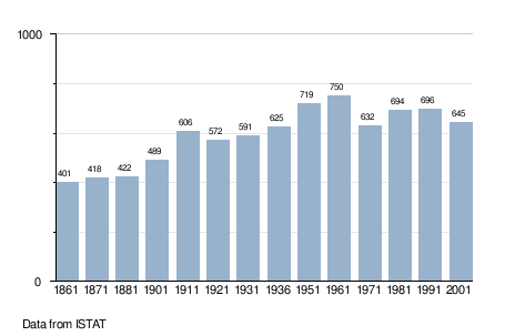
Demographic evolution
References
External links
| Wikimedia Commons has media related to Lei (Italy). |
This article is issued from Wikipedia - version of the 5/3/2015. The text is available under the Creative Commons Attribution/Share Alike but additional terms may apply for the media files.