Gawler Ranges Conservation Park
| Gawler Ranges Conservation Park South Australia | |
|---|---|
|
IUCN category VI (protected area with sustainable use of natural resources) | |
 Gawler Ranges Conservation Park | |
| Nearest town or city | Poochera. |
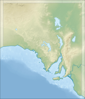
| Coordinates | 32°35′S 135°04′E / 32.58°S 135.06°ECoordinates: 32°35′S 135°04′E / 32.58°S 135.06°E |
| Established | 11 November 1993[1] |
| Area | 154.80 km2 (59.8 sq mi)[1] |
| Managing authorities | Department of Environment, Water and Natural Resources |
| Footnotes |
Coordinates[2] Nearest town[3] |
| See also | Protected areas of South Australia |
Gawler Ranges Conservation Park (formerly the Gawler Ranges Conservation Reserve) is a protected area in the Australian state of South Australia on the Eyre Peninsula located about 28 kilometres (17 mi) north-west of the town centre in Poochera.[3]
The conservation park is located to the south-west of the Gawler Ranges with the majority of its area being located within the gazetted locality of Bockelberg and with a smaller portion being located in the locality of Minnipa to the south.[3][4][5]
The conservation park’s name was originally approved by the Geographical Names Board as the Bockelberg Conservation Park but "due to legal processes", it was not constituted under the National Parks and Wildlife Act 1972 and was subsequently declared as the Gawler Ranges Conservation Reserve. Its name is derived from its “proximity” to the Gawler Ranges.[3] As of 2006, it was intended that the conservation reserve would be incorporated in the Gawler Ranges National Park.[5] The conservation reserve was eventually ‘redesignated’ as the Gawler Ranges Conservation Park on 6 September 2012.[6]
Flora found within the conservation park was described in 2001 as consisting of “Tree mallee dominated by Eucalyptus oleosa Red Mallee and Eucalyptus brachycalyx Gilja with scattered patches of Eucalyptus gracilis Yorrell.”[7]
The conservation park is classified as an IUCN Category VI protected area.[2]
See also
References
- 1 2 "Protected Areas Information System - reserve list (as of 11 July 2016)" (PDF). Department of Environment Water and Natural Resources. 11 July 2016. Retrieved 14 July 2016.
- 1 2 "Terrestrial Protected Areas of South Australia (see 'DETAIL' tab)". CAPAD 2014. Australian Government, Department of the Environment (DoE). 2014. Retrieved 20 June 2016.
- 1 2 3 4 "Search result for "Gawler Ranges Conservation Park" (Record no SA0049955) with the following layers selected - "Suburbs and Localities" and "Place names (gazetteer)"". Property Location Browser. Government of South Australia. Retrieved 26 July 2016.
- ↑ "Search result for " Bockelberg (Locality Bounded)" with the following datasets being selected - "Suburbs and Localities"". LocationSA Map Viewer. Government of South Australia. Retrieved 26 July 2016.
- 1 2 "Gawler Ranges National Park Management Plan" (PDF). Department for Environment and Heritage (DEH). 2006. pp. 3, 9 and 34. Retrieved 25 April 2016.
- ↑ "National Parks and Wildlife (Gawler Ranges Conservation Park) Proclamation 2012". The South Australian Government Gazette. Government of South Australia: 4347. 6 September 2012. Retrieved 25 July 2016.
- ↑ Hudspith, T. J.; A.C., Robinson; P. J., Lang (2001). A Vegetation Map of the Western Gawler Ranges, South Australia (PDF). Adelaide, South Australia: Department for Environment and Heritage. p. 28. ISBN 0-7590-1029-3.