Nullarbor Wilderness Protection Area
| Nullarbor Wilderness Protection Area South Australia | |
|---|---|
|
IUCN category Ib (wilderness area) | |
 Nullarbor Wilderness Protection Area | |
| Nearest town or city | Ceduna |
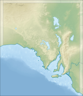
| Coordinates | 31°22′30.2″S 130°09′59.8″E / 31.375056°S 130.166611°ECoordinates: 31°22′30.2″S 130°09′59.8″E / 31.375056°S 130.166611°E |
| Established | 6 June 2013[1] |
| Area | 8,942.91 km2 (3,452.9 sq mi)[2] |
| Managing authorities | Department of Environment, Water and Natural Resources |
| Footnotes | Coordinates[3] |
| See also | Protected areas of South Australia |
Nullarbor Wilderness Protection Area is a protected area in the Australian state of South Australia located about 270 kilometres (170 mi) west of Ceduna. The wilderness protection area was proclaimed under the Wilderness Protection Act 1992 on 6 June 2013 on land previously proclaimed under the National Parks and Wildlife Act 1972 as the Nullarbor National Park and the Nullarbor Regional Reserve. It is bounded in the west by the Western Australia - South Australian state border, in the south by the coastline adjoining the Great Australian Bight, to the east by the Yalata Indigenous Protected Area and the Nullarbor Regional Reserve, and to the north by the Nullarbor National Park and the Nullarbor Regional Reserve. It is classified as an IUCN Category Ib protected area.[1][3][4][5][6]
Two heritage-listed sites within the area, Koonalda Cave and the Koonalda Homestead Complex, are listed on the South Australian Heritage Register; the former is also listed on the Australian National Heritage List.[7][8][9]
See also
References
- 1 2 "Wilderness Advisory Committee Annual Report 2012-13" (PDF). September 2013: 17–18. ISSN 1832-9357. Retrieved 17 March 2014.
- ↑ "Protected Areas Information System - reserve list (as of 25 November 2014)" (PDF). Department of Environment Water and Natural Resources. Retrieved 8 January 2015.
- 1 2 "Terrestrial Protected Areas in South Australia (2014) (see 'DETAIL' tab)". CAPAD 2014. Australian Government - Department of the Environment. 2014. Retrieved 4 March 2015.
- ↑ "Search for feature SA0002838 (Nullarbor Wilderness Protection Area)". Geoscience Australia. Retrieved 16 March 2015.
- ↑ "Highest protection for Nullarbor". Department of Environment, Water and Natural Resources. Retrieved 16 March 2015.
- ↑ A Review of Nullarbor Regional Reserve 1999 - 2009 (PDF). Department for Environment and Heritage. July 2009. p. 8. ISBN 978-1-921466-43-4. Retrieved 16 March 2015.
- ↑ "Koonalda Cave". Australian National Heritage List. Department of the Environment (Cth). Retrieved 12 February 2016.
- ↑ "Koonalda Cave, Nullarbor National Park [also on the National Heritage List ID 106022]". South Australian Heritage Register. Department of Environment, Water and Natural Resources. Retrieved 12 February 2016.
- ↑ "Koonalda Homestead Complex (including homestead, petrol outlet and generator room, outbuilding, shearers' hut, shearing shed, yards and sheep dip), Nullarbor National Park". South Australian Heritage Register. Department of Environment, Water and Natural Resources. Retrieved 12 February 2016.