Point Labatt Aquatic Reserve
| Point Labatt Aquatic Reserve South Australia | |
|---|---|
|
IUCN category Ia (strict nature reserve) | |
|
Looking east from visitors’ observation area at Point Labatt. | |
 Point Labatt Aquatic Reserve | |
| Nearest town or city | Streaky Bay. |
| Coordinates | 33°09′03″S 134°15′12″E / 33.1508°S 134.2532°ECoordinates: 33°09′03″S 134°15′12″E / 33.1508°S 134.2532°E |
| Established | 1988[1] |
| Area | 2.38 km2 (0.9 sq mi)[2] |
| Managing authorities | Primary Industries and Resources South Australia (PIRSA) |
| Footnotes |
Coordinates[2] Nearest town[3] |
| See also | Protected areas of South Australia |
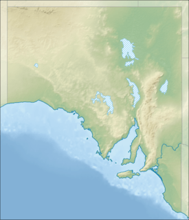
Point Labatt Aquatic Reserve is a marine protected area in the Australian state of South Australia located in the waters of the Great Australian Bight adjoining the west coast of Eyre Peninsula at the headland of Point Labatt.[1][3]
It was proclaimed under the Fisheries Act 1982 in 1988 and was re-proclaimed in 2007 following the enactment of the Fisheries Management Act 2007. The creation of the aquatic reserve was for the purpose of protection of a breeding colony of Australian sea lion, a species protected under the Fisheries Management Act 2007 and scheduled as ‘rare’ under the National Parks and Wildlife Act 1972. This purpose is achieved via the prohibition of public access as well as any activity involving fishing or the collection and removal of marine organisms. The aquatic reserve extends a distance of 1 nautical mile (1.9 km; 1.2 mi) seaward from the coastline and covers an area of 2.38 square kilometres (0.92 sq mi).[1][3][2]
Since 2012, it has been located within the boundaries of a ‘restricted access zone’ within the West Coast Bays Marine Park.[4]
The aquatic reserve is classified as an IUCN Category Ia protected area.[2]
See also
References
- 1 2 3 South Australia. Department of Environment and Natural Resources (DENR). Far West District; South Australia. National Parks and Wildlife Service (1995), Point Labatt Conservation Park management plan, Eyre Peninsula, South Australia (PDF), Dept. of Environment and Natural Resources, p. 5
- 1 2 3 4 "Collaborative Australian Protected Area Database (CAPAD) - Marine Protected Areas in coastal waters of South Australia (refer "DETAIL' tab)". Australian Government, Department of the Environment (DoE). Retrieved 11 April 2016.
- 1 2 3 Primary Industries and Regions South Australia (PIRSA) (2007), Aquatic Reserve: Point Labatt (PDF), Primary Industries and Regions South Australia
- ↑ "West Coast Bays Marine Park Management Plan 2012" (PDF). Department of Environment, Water and Natural Resources (DEWNR). pp. 10, 11, 22 and 24. Retrieved 9 October 2016.