Gawler Ranges National Park
| Gawler Ranges National Park South Australia | |
|---|---|
|
IUCN category VI (protected area with sustainable use of natural resources) | |
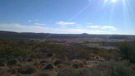 The Conical Hill Track | |
 Gawler Ranges National Park | |
| Nearest town or city | Wudinna |
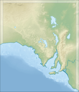
| Coordinates | 32°33′14″S 135°27′50″E / 32.55389°S 135.46389°ECoordinates: 32°33′14″S 135°27′50″E / 32.55389°S 135.46389°E |
| Established | 15 January 2002[1] |
| Area | 1,628.75 km2 (628.9 sq mi)[1] |
| Managing authorities | Department of Environment, Water and Natural Resources |
| Website | Gawler Ranges National Park |
| See also | Protected areas of South Australia |
Gawler Ranges National Park is a 1,633 km2 (631 sq mi) protected area lying 350 km (217 mi) north-west of Adelaide in the northern Eyre Peninsula of South Australia. It is known for its spectacular rock formations.[2]
History
The national park originated as the 1,200 km2 (463 sq mi) Paney Station pastoral lease, which was acquired in 2000 by the South Australian Government with assistance from the Australian Government. In 2001 some 420 km2 (162 sq mi) of the adjacent Scrubby Peak Station was acquired and added to the national park.[3]
Access
The national park is 40 km (25 mi) north of Wudinna, 40 km (25 mi) north-east of Minnipa and is accessible using high ground clearance two wheel drive vehicles via the gravel roads from Kimba, Wudinna or Minnipa.[4][5][6]
Camping is permissible and encouraged at several campgrounds. Although some have toilets, there are minimal other facilities and visitors are encouraged to take adequate food, water, fuel and firewood with them.[4]
Features
Historic sites in the national park include the Old Paney Homestead, the Policemans Point precinct, Stone Dam, and Pondanna Outstation, where agriculture was attempted in the early 20th century. Notable landmarks are Paney Bluff, Mount Allalone, Mount Sturt, Conical Hill and Scrubby Peak. Other scenic sites are Kolay Mirica Falls, the Organ Pipes and Yandinga Gorge.
Environment
Some 21 rare and endangered animal and plant species including the yellow-footed rock-wallaby can be found in the national park.[7] Another larger mammal is the southern hairy-nosed wombat.[8] Some 140 species of birds have been recorded in the national park. The area covered by the national park has been identified by BirdLife International as an Important Bird Area (IBA) because it supports populations of the vulnerable malleefowl, the Gawler Ranges subspecies of the short-tailed grasswren, rufous treecreeper, blue-breasted fairy-wren, purple-gaped honeyeater and western yellow robin.[7]
See also
References
- 1 2 "CAPAD 2012 South Australia Summary (see 'DETAIL' tab)". CAPAD 2012. Australian Government - Department of the Environment. 6 February 2014. Retrieved 6 February 2014.
- ↑ "Gawler Ranges National Park". National Parks South Australia. Government of South Australia. Retrieved 17 January 2016.
- ↑ "Gawler ranges: Eco-tourism". National Reserve System. Department of Sustainability, Environment, Water, Population and Communities, Australia. 2011-05-09. Retrieved 2011-06-24.
- 1 2 Wudinna District Council - Gawler Ranges Tourism
- ↑ "Gawler Ranges National Park" (PDF). Department of Environment and Natural Resources. Retrieved 17 April 2012.
- ↑ South Australia - Gawler Ranges
- 1 2 "IBA: Gawler Ranges". Birdata. Birds Australia. Retrieved 2011-06-24.
- ↑ Gawler Ranges National Park (official website)
External links
- Gawler Ranges National Park official webpage Accessed 17 April 2012.
- Friends of the Gawler Ranges National Park
- Gawler Ranges National Park webpage on protected planet