Kaiserstuhl Conservation Park
| Kaiserstuhl Conservation Park South Australia | |
|---|---|
|
IUCN category III (natural monument or feature) | |
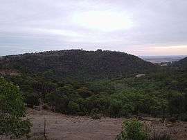 The Kaiserstuhl | |
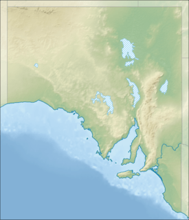 Kaiserstuhl Conservation Park | |
| Nearest town or city | Tanunda |
| Coordinates | 34°35′05″S 139°00′48″E / 34.58472°S 139.01333°ECoordinates: 34°35′05″S 139°00′48″E / 34.58472°S 139.01333°E |
| Established | 3 December 1987 |
| Area | 4.03 km2 (1.6 sq mi) |
| Managing authorities | Department for Environment and Heritage |
| Website | Kaiserstuhl Conservation Park |
| See also | Protected areas of South Australia |
The Kaiserstuhl Conservation Park is a small 403 ha park about 12 km southeast of Tanunda in South Australia. It lies in the range overlooking the Barossa Valley, and is named after the 600 metre high Kaiserstuhl (literally "emperor's chair") or Patpoori in an immediately adjacent section of the Mount Crawford Forest.
The mountain itself was named by geologist Joseph Menge after the Kaiserstuhl mountain range near Freiburg in southwestern Germany, a famous winegrowing region. It is dual-named with the Aboriginal name Patpoori. The German name was changed to Mount Kitchener in 1918 but has been changed back.[1]
References
- ↑ "Placename Details: Kaiserstuhl". Property Location Browser. Department of Planning, Transport and Infrastructure. SA0033466. Retrieved 27 November 2014.
External links
- Kaiserstuhl Conservation Park official webpage
- Kaiserstuhl Conservation Park webpage on protected planet
This article is issued from Wikipedia - version of the 4/4/2016. The text is available under the Creative Commons Attribution/Share Alike but additional terms may apply for the media files.