Grade II* listed buildings in South Derbyshire

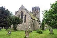
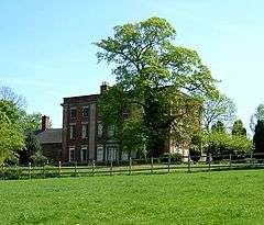
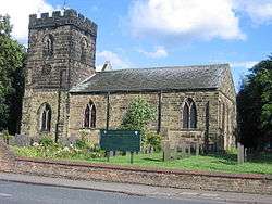
There are over 20,000 Grade II* listed buildings in England. This page is a list of these buildings in the district of South Derbyshire in Derbyshire.

List of buildings

Name Location Type Completed [note 1]Date designated Grid ref.[note 2]
Geo-coordinates
Entry number [note 3]Image
Aston Hall Aston-on-Trent Country House Early 18th century 10 November 1967 SK4149829170
52°51′30″N 1°23′06″W / 52.858428°N 1.385118°W / 52.858428; -1.385118 (Aston Hall)
1096430
Barton Hall Barton Blount Country House 15th century 2 September 1952 SK2081934658
52°54′32″N 1°41′31″W / 52.908953°N 1.691885°W / 52.908953; -1.691885 (Barton Hall)
1096544
Bretby Hall Bretby Park, Bretby Country House Early 17th century 31 October 1985 SK3001122547
52°47′59″N 1°33′23″W / 52.799653°N 1.556322°W / 52.799653; -1.556322 (Bretby Hall)
1334588
Brizlincote Hall Farmhouse Bretby Farmhouse 1707 19 January 1967 SK2727022027
52°47′42″N 1°35′49″W / 52.795124°N 1.597018°W / 52.795124; -1.597018 (Brizlincote Hall Farmhouse)
1096480
Deercote west of the Church of St Giles Calke Park, Calke Wall Late 18th century 6 January 1987 SK3670922280
52°47′49″N 1°27′25″W / 52.79684°N 1.457013°W / 52.79684; -1.457013 (Deercote west of the Church of St Giles)
1031806
Stables and Riding School Calke Park, Calke Courtyard Mid–late 18th century 19 January 1967 SK3668322666
52°48′01″N 1°27′26″W / 52.800312°N 1.457355°W / 52.800312; -1.457355 (Stables and Riding School)
1096488
Catton Hall Catton Country House 1741 2 September 1952 SK2061315359
52°44′08″N 1°41′46″W / 52.735476°N 1.696159°W / 52.735476; -1.696159 (Catton Hall)
1334609
Cauldwell Hall Cauldwell Country House Early 18th century 2 September 1952 SK2551417173
52°45′06″N 1°37′24″W / 52.751575°N 1.623436°W / 52.751575; -1.623436 (Cauldwell Hall)
1334612
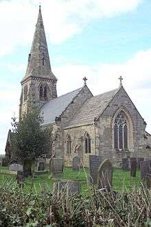
Church of All Saints Dalbury Lees Parish Church 13th century 19 January 1967 SK2635434282
52°54′19″N 1°36′35″W / 52.905331°N 1.609616°W / 52.905331; -1.609616 (Church of All Saints)
1334550
Footbridge on former Eggington Estate at SK264277 Egginton Footbridge 1812 19 April 1990 SK2640027700
52°50′46″N 1°36′34″W / 52.846163°N 1.609464°W / 52.846163; -1.609464 (Footbridge on former Eggington Estate at SK264277)
1140125
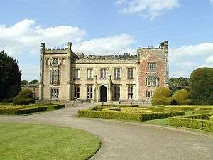
Elvaston Castle Elvaston Country House 1633 2 September 1952 SK4078533004
52°53′35″N 1°23′43″W / 52.892945°N 1.395228°W / 52.892945; -1.395228 (Elvaston Castle)
1334604
Gates, gatepiers, and railings to south of the Etwall Almshouses Etwall Gate Early 18th century 22 August 1985 SK2688232038
52°53′06″N 1°36′07″W / 52.885134°N 1.601951°W / 52.885134; -1.601951 (Gates, gatepiers, and railings to south of the Etwall Almshouses)
1334552
Sir John Port Almshouses Etwall Almshouse circa 1690 2 September 1952 SK2687832064
52°53′07″N 1°36′07″W / 52.885368°N 1.602008°W / 52.885368; -1.602008 (Sir John Port Almshouses)
1096567
Two sets of gatepiers and walls enclosing churchyard of St Saviours Church Foremark Gate Early 18th century 19 January 1967 SK3297426488
52°50′06″N 1°30′43″W / 52.834907°N 1.51198°W / 52.834907; -1.51198 (Two sets of gatepiers and walls enclosing churchyard of St Saviours Church)
1334572
The Manor House Hartshorne House 20th century 2 September 1952 SK3269020767
52°47′01″N 1°31′00″W / 52.783497°N 1.516766°W / 52.783497; -1.516766 (The Manor House)
1281804
Ingleby Toft Ingleby House Early 18th century 19 January 1967 SK3550526504
52°50′06″N 1°28′28″W / 52.83489°N 1.474411°W / 52.83489; -1.474411 (Ingleby Toft)
1370039
Church of All Saints Lullington Parish Church Late 14th century 19 January 1967 SK2498712944
52°42′49″N 1°37′54″W / 52.713583°N 1.631564°W / 52.713583; -1.631564 (Church of All Saints)
1159003
Grotto to south-east of the Old Mill in Melbourne Hall gardens Melbourne Shell Grotto Early 19th century 10 November 1967 SK3910424843
52°49′11″N 1°25′16″W / 52.819711°N 1.421189°W / 52.819711; -1.421189 (Grotto to south-east of the Old Mill in Melbourne Hall gardens)
1334617
Hall Cottages and Stables at Melbourne Hall Melbourne House 16th century 10 November 1967 SK3894525025
52°49′17″N 1°25′25″W / 52.821359°N 1.423526°W / 52.821359; -1.423526 (Hall Cottages and Stables at Melbourne Hall)
1096408
Melbourne Hall Melbourne Country House circa 1630 2 September 1952 SK3897625010
52°49′16″N 1°25′23″W / 52.821222°N 1.423068°W / 52.821222; -1.423068 (Melbourne Hall)
1204079
Pair of curved benches to either side of Grand Basin in Melbourne Hall gardens Melbourne Garden Seat Early 18th century 11 March 1987 SK3916424944
52°49′14″N 1°25′13″W / 52.820615°N 1.420286°W / 52.820615; -1.420286 (Pair of curved benches to either side of Grand Basin in Melbourne Hall gardens)
1096373
Pair of garden walls flanking top terrace of Melbourne Hall gardens Melbourne Garden Wall circa 1704 11 March 1987 SK3903724949
52°49′14″N 1°25′20″W / 52.820669°N 1.42217°W / 52.820669; -1.42217 (Pair of garden walls flanking top terrace of Melbourne Hall gardens)
1096410
Tithe Barn Melbourne Malt Kiln 17th century 2 September 1952 SK3887324981
52°49′15″N 1°25′29″W / 52.820969°N 1.4246°W / 52.820969; -1.4246 (Tithe Barn)
1204539
Water channel and three bridges in Melbourne Hall gardens Melbourne Bridge Early 18th century 11 March 1987 SK3912624926
52°49′14″N 1°25′15″W / 52.820456°N 1.420852°W / 52.820456; -1.420852 (Water channel and three bridges in Melbourne Hall gardens)
1204519
Church of St Peter Netherseal Parish Church 13th century 10 January 1967 SK2887712890
52°42′46″N 1°34′26″W / 52.712905°N 1.573988°W / 52.712905; -1.573988 (Church of St Peter)
1334597
Netherseal Old Hall and attached outbuildings and garden walls Netherseal House 1642 2 September 1952 SK2899712892
52°42′47″N 1°34′20″W / 52.712917°N 1.572212°W / 52.712917; -1.572212 (Netherseal Old Hall and attached outbuildings and garden walls)
1096414
Pigeoncote at Old Hall Cottages Netherseal Dovecote 1689 19 January 1967 SK2898512819
52°42′44″N 1°34′21″W / 52.712261°N 1.572396°W / 52.712261; -1.572396 (Pigeoncote at Old Hall Cottages)
1096418
Bladon Castle Newton Solney Motte 1801-2 19 January 1967 SK2698925079
52°49′21″N 1°36′03″W / 52.822573°N 1.600934°W / 52.822573; -1.600934 (Bladon Castle)
1096466
Church of St Mary the Virgin Newton Solney Parish Church circa 1300 19 January 1967 SK2792425770
52°49′43″N 1°35′13″W / 52.828737°N 1.587001°W / 52.828737; -1.587001 (Church of St Mary the Virgin)
1334576
Overseal House Overseal House Late 18th century 19 January 1967 SK2963714953
52°43′53″N 1°33′45″W / 52.731409°N 1.562553°W / 52.731409; -1.562553 (Overseal House)
1311162
The Grange Repton House 1703 2 September 1952 SK3069326437
52°50′04″N 1°32′45″W / 52.834583°N 1.545843°W / 52.834583; -1.545843 (The Grange)
1096501
Church of St Mary Rosliston Parish Church 14th century 19 January 1967 SK2433716815
52°44′54″N 1°38′27″W / 52.748411°N 1.6409°W / 52.748411; -1.6409 (Church of St Mary)
1159242
Shardlow Hall with attached garden seat to north-east corner, steps c.14m from north-west front and steps c.7m west of south-west corner Shardlow Country House 1684 11 March 1987 SK4384830478
52°52′12″N 1°21′00″W / 52.869999°N 1.350043°W / 52.869999; -1.350043 (Shardlow Hall with attached garden seat to north-east corner, steps c.14m from north-west front and steps c.7m west of south-west corner)
1088368
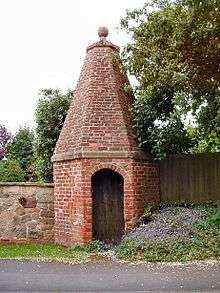
The Lock Up (Round House) Smisby Lock Up Late 18th century 19 January 1967 SK3486919083
52°46′06″N 1°29′05″W / 52.768224°N 1.48464°W / 52.768224; -1.48464 (The Lock Up (Round House))
1281737
Church of St Michael Sutton on the Hill Statue 20th century 19 January 1967 SK2374434239
52°54′18″N 1°38′54″W / 52.905066°N 1.648424°W / 52.905066; -1.648424 (Church of St Michael)
1096581
Sutton Hall and attached outbuildings Sutton on the Hill House 1952 2 September 1952 SK2363333815
52°54′05″N 1°39′00″W / 52.901259°N 1.650105°W / 52.901259; -1.650105 (Sutton Hall and attached outbuildings)
1334519
Church of St James Swarkestone Parish Church 12th century 10 November 1967 SK3719628595
52°51′13″N 1°26′57″W / 52.853573°N 1.449073°W / 52.853573; -1.449073 (Church of St James)
1088344
Swarkestone Hall Farmhouse Swarkestone Farmhouse Early 17th century 2 September 1952 SK3745528406
52°51′07″N 1°26′43″W / 52.851856°N 1.445249°W / 52.851856; -1.445249 (Swarkestone Hall Farmhouse)
1088346
Swarkestone Old Hall and attached walls Swarkestone House 18th century 10 November 1967 SK3734328500
52°51′10″N 1°26′49″W / 52.852709°N 1.446901°W / 52.852709; -1.446901 (Swarkestone Old Hall and attached walls)
1280604
The Lock-up Ticknall Lock Up Late 18th century 19 January 1967 SK3515323908
52°48′42″N 1°28′48″W / 52.811578°N 1.479914°W / 52.811578; -1.479914 (The Lock-up)
1096445
The Middle Lodge Calke Park, Ticknall Gate Lodge circa 1805 19 January 1967 SK3573223168
52°48′18″N 1°28′17″W / 52.804888°N 1.471405°W / 52.804888; -1.471405 (The Middle Lodge)
1203338
All Saints Church Trusley Parish Church 1713 19 January 1967 SK2535735533
52°55′00″N 1°37′28″W / 52.916625°N 1.624342°W / 52.916625; -1.624342 (All Saints Church)
1281370
Old Hall Cottage Twyford House 16th century 19 January 1967 SK3291128928
52°51′25″N 1°30′46″W / 52.856844°N 1.51267°W / 52.856844; -1.51267 (Old Hall Cottage)
1096517
Church of St Laurence Walton-on-Trent Statue 20th century 19 January 1967 SK2158918230
52°45′40″N 1°40′53″W / 52.761247°N 1.681517°W / 52.761247; -1.681517 (Church of St Laurence)
1159347
Walton Hall and attached stable range and garden wall Walton-on-Trent Country House Early 18th century 2 September 1952 SK2145917882
52°45′29″N 1°41′00″W / 52.758124°N 1.683466°W / 52.758124; -1.683466 (Walton Hall and attached stable range and garden wall)
1159300
Weston Hall Weston-on-Trent Country House Early 17th century 2 September 1952 SK4032628350
52°51′04″N 1°24′09″W / 52.851146°N 1.402625°W / 52.851146; -1.402625 (Weston Hall)
1088352
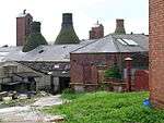
Four bottle kilns at Greens Pottery Church Gresley Bottle kiln 18th century 29 October 1974 SK3055818744
52°45′56″N 1°32′55″W / 52.765437°N 1.548563°W / 52.765437; -1.548563 (Four bottle kilns at Greens Pottery)
1280950
Parish Church of St Mary and Saint George Church Gresley Church 15th century 14 October 1981 SK2932718108
52°45′35″N 1°34′01″W / 52.759787°N 1.566863°W / 52.759787; -1.566863 (Parish Church of St Mary and Saint George)
1204963

See also

Notes

  1. The date given is the date used by Historic England as significant for the initial building or that of an important part in the structure's description.
  2. Sometimes known as OSGB36, the grid reference is based on the British national grid reference system used by the Ordnance Survey.
  3. The "List Entry Number" is a unique number assigned to each listed building and scheduled monument by Historic England.

Media related to Grade II* listed buildings in Derbyshire at Wikimedia Commons

This article is issued from Wikipedia - version of the 12/2/2016. The text is available under the Creative Commons Attribution/Share Alike but additional terms may apply for the media files.