Greenleaf, Kansas
| Greenleaf, Kansas | |
|---|---|
| City | |
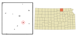 Location within Washington County and Kansas | |
 KDOT map of Washington County (legend) | |
| Coordinates: 39°43′42″N 96°58′44″W / 39.72833°N 96.97889°WCoordinates: 39°43′42″N 96°58′44″W / 39.72833°N 96.97889°W | |
| Country | United States |
| State | Kansas |
| County | Washington |
| Area[1] | |
| • Total | 0.46 sq mi (1.19 km2) |
| • Land | 0.46 sq mi (1.19 km2) |
| • Water | 0 sq mi (0 km2) |
| Elevation | 1,421 ft (433 m) |
| Population (2010)[2] | |
| • Total | 331 |
| • Estimate (2012[3]) | 326 |
| • Density | 720/sq mi (280/km2) |
| Time zone | Central (CST) (UTC-6) |
| • Summer (DST) | CDT (UTC-5) |
| ZIP code | 66943 |
| Area code | 785 |
| FIPS code | 20-28625 [4] |
| GNIS feature ID | 0473149 [5] |
Greenleaf is a city in Washington County, Kansas, United States. As of the 2010 census, the city population was 331.[6]
History
Greenleaf was founded in 1876.[7] It was incorporated in 1880.[8] Greenleaf was named for A. W. Greenleaf, the treasurer of the Central Branch Union Pacific Railroad.[9] The post office at Round Grove, Kansas; which had been known at various times as Prospect Hill and Hopper, was moved to Greenleaf when the railroad missed the settlement.[10]
Geography
Greenleaf is located at 39°43′42″N 96°58′44″W / 39.72833°N 96.97889°W (39.728350, -96.978797).[11] According to the United States Census Bureau, the city has a total area of 0.46 square miles (1.19 km2), all of it land.[1]
Demographics
| Historical population | |||
|---|---|---|---|
| Census | Pop. | %± | |
| 1880 | 316 | — | |
| 1890 | 916 | 189.9% | |
| 1900 | 854 | −6.8% | |
| 1910 | 781 | −8.5% | |
| 1920 | 778 | −0.4% | |
| 1930 | 660 | −15.2% | |
| 1940 | 739 | 12.0% | |
| 1950 | 614 | −16.9% | |
| 1960 | 562 | −8.5% | |
| 1970 | 448 | −20.3% | |
| 1980 | 462 | 3.1% | |
| 1990 | 353 | −23.6% | |
| 2000 | 357 | 1.1% | |
| 2010 | 331 | −7.3% | |
| Est. 2015 | 312 | [12] | −5.7% |
| U.S. Decennial Census | |||
2010 census
As of the census[2] of 2010, there were 331 people, 171 households, and 82 families residing in the city. The population density was 719.6 inhabitants per square mile (277.8/km2). There were 199 housing units at an average density of 432.6 per square mile (167.0/km2). The racial makeup of the city was 97.9% White, 0.9% Native American, 0.9% from other races, and 0.3% from two or more races. Hispanic or Latino of any race were 3.6% of the population.
There were 171 households of which 18.7% had children under the age of 18 living with them, 40.4% were married couples living together, 5.3% had a female householder with no husband present, 2.3% had a male householder with no wife present, and 52.0% were non-families. 48.5% of all households were made up of individuals and 18.1% had someone living alone who was 65 years of age or older. The average household size was 1.92 and the average family size was 2.77.
The median age in the city was 46.5 years. 18.7% of residents were under the age of 18; 5.6% were between the ages of 18 and 24; 23.4% were from 25 to 44; 27.8% were from 45 to 64; and 24.2% were 65 years of age or older. The gender makeup of the city was 52.0% male and 48.0% female.
2000 census
As of the census[4] of 2000, there were 357 people, 171 households, and 81 families residing in the city. The population density was 770.1 people per square mile (299.6/km²). There were 202 housing units at an average density of 435.7 per square mile (169.5/km²). The racial makeup of the city was 99.44% White, 0.28% from other races, and 0.28% from two or more races. Hispanic or Latino of any race were 0.84% of the population.
There were 171 households out of which 18.7% had children under the age of 18 living with them, 39.2% were married couples living together, 5.3% had a female householder with no husband present, and 52.6% were non-families. 50.3% of all households were made up of individuals and 29.8% had someone living alone who was 65 years of age or older. The average household size was 1.95 and the average family size was 2.88.
In the city the population was spread out with 18.5% under the age of 18, 5.0% from 18 to 24, 26.1% from 25 to 44, 23.2% from 45 to 64, and 27.2% who were 65 years of age or older. The median age was 45 years. For every 100 females there were 97.2 males. For every 100 females age 18 and over, there were 91.4 males.
The median income for a household in the city was $25,750, and the median income for a family was $38,125. Males had a median income of $26,250 versus $16,635 for females. The per capita income for the city was $15,084. About 8.3% of families and 19.5% of the population were below the poverty line, including 21.9% of those under age 18 and 13.1% of those age 65 or over.
See also
References
- 1 2 "US Gazetteer files 2010". United States Census Bureau. Retrieved 2012-07-06.
- 1 2 "American FactFinder". United States Census Bureau. Retrieved 2012-07-06.
- ↑ "Population Estimates". United States Census Bureau. Retrieved 2013-05-29.
- 1 2 "American FactFinder". United States Census Bureau. Retrieved 2008-01-31.
- ↑ "US Board on Geographic Names". United States Geological Survey. 2007-10-25. Retrieved 2008-01-31.
- ↑ "2010 City Population and Housing Occupancy Status". U.S. Census Bureau. Retrieved November 3, 2011.
- ↑ Kansas State Historical Society (1916). Biennial Report of the Board of Directors of the Kansas State Historical Society. Kansas State Printing Plant. p. 312.
- ↑ Blackmar, Frank Wilson (1912). Kansas: A Cyclopedia of State History, Embracing Events, Institutions, Industries, Counties, Cities, Towns, Prominent Persons, Etc. Standard Publishing Company. p. 792.
- ↑ Gannett, Henry (1905). The Origin of Certain Place Names in the United States. Govt. Print. Off. p. 144.
- ↑ Rydjord, John (1972). Kansas Place-Names. University of Oklahoma Press, Norman. p. 456. ISBN 0-8061-0994-7.
- ↑ "US Gazetteer files: 2010, 2000, and 1990". United States Census Bureau. 2011-02-12. Retrieved 2011-04-23.
- ↑ "Annual Estimates of the Resident Population for Incorporated Places: April 1, 2010 to July 1, 2015". Retrieved July 2, 2016.
External links
| Wikimedia Commons has media related to Greenleaf, Kansas. |
- City
- Schools
- USD 108, local school district
- Maps
- Greenleaf City Map, KDOT
Municipalities and communities of Washington County, Kansas, United States | ||
|---|---|---|
| Cities | 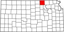 | |
| Unincorporated communities | ||
| Footnotes | ‡This populated place also has portions in an adjacent county or counties | |