Hanover, Kansas
| Hanover, Kansas | |
|---|---|
| City | |
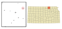 Location within Washington County and Kansas | |
 KDOT map of Washington County (legend) | |
| Coordinates: 39°53′27″N 96°52′31″W / 39.89083°N 96.87528°WCoordinates: 39°53′27″N 96°52′31″W / 39.89083°N 96.87528°W | |
| Country | United States |
| State | Kansas |
| County | Washington |
| Incorporated | 1872 |
| Government | |
| • Mayor | Jim Scheetz [1] |
| • City Clerk | Dora Ann Sand [1] |
| Area[2] | |
| • Total | 0.54 sq mi (1.40 km2) |
| • Land | 0.54 sq mi (1.40 km2) |
| • Water | 0 sq mi (0 km2) |
| Elevation | 1,230 ft (375 m) |
| Population (2010)[3] | |
| • Total | 682 |
| • Estimate (2014)[4] | 665 |
| • Density | 1,300/sq mi (490/km2) |
| Time zone | CST (UTC-6) |
| • Summer (DST) | CDT (UTC-5) |
| ZIP code | 66945 |
| Area code | 785 |
| FIPS code | 20-29875 [5] |
| GNIS feature ID | 0472646 [6] |
Hanover is a city in Washington County, Kansas, United States. As of the 2010 census, the city population was 682;[7] as of 2014, it was estimated to have decreased to 665.[4] It is the second most populous town within Washington County.
The city is primarily agricultural, and the surrounding countryside is filled with small family farms. The Hanover area is also a popular destination for deer hunting. Named after Hanover, Germany, the town is a traditional German community with strong German cultural influences. The local area is home to numerous other German communities such as Hollenberg, Hermansburg, Frankfort, and Bremen.
History
The "Hollenberg Station" became an important hub along the way for Pony Express travelers and Geret Hollenberg eventually established a grocery and stage depot on his farm in 1858.[8] The Hollenberg farm housed nine boarding rooms, and the success of "Hollenberg Station" as a business attracted more people to the area and many settled alongside the Hollengbergs in the decade leading up to the establishment of Hanover.[9]
Prior to the establishment of the town, in 1868 a school district was established in the area to satisfy the need to educate children of settlers who continued to arrive near the "Hollenberg Station."[10]
Hanover was laid out in 1869, and incorporated as a city in 1872.[11] It is a German community named after Hanover, Germany. The founders Geret Hollenberg and Sophia Brockmeyer settled their farm originally called "The Cottonwood Ranch" and later the "Hollenberg Station" alongside the Little Blue River, which became a popular stop along the Pony Express. The popularity led to the establishment of Hanover. The Hollenberg Pony Express Station is the only remaining building along the two thousand mile route, and it continues to stand one mile northeast of Hanover. In the 1940s it was registered as a National Historic Landmark.[8][9]
Hollenberg, who laid out the original plans for the town in 1869, decided to name it Hanover after his hometown in Germany.[9][12] A contemporary of Hollenberg wrote at the time that Hanover represented "just a little bit of Germany" in Kansas Territory.[8] Located at the junction of two railroads, it was an important shipping point.[11] Access to the railroad was greatly contributed to the economic growth of Hanover, enabling the expansion of the local grain elevator. The success of the grain elevator, because of its close connection with the railroad contributed to the growth and initial success of the town.[13] As the town continued to develop, a German Evangelical Society church, as well as a Catholic church to serve the town's Czech residents were established in 1870.[14] Additionally, following the movement of some Native groups to Oklahoma from the nearby Ottoe reservation, some land was annexed by the Hanover township, which allowed for further expansion as more white settlers moved into the area.[8][14]
The local area had a significant Native American population. The Pawnee Indians resided west of Hanover, the Kansa and Kaw tribes lived to the south, and the Otoe Indians were located north.[13] The Otoe Reservation resided north of Hanover on the Kansas-Nebraska border from 1854 to 1883.[15] Their reservation was 160,000 acres large (250 mi²).[16] When the Otoe tribal lands were sold in 1883, the land sold for a record-high average of $12.22 per acre. By comparison, most other Native American tribes in the central and northern Great Plains were only paid ten cents per acre.[15] Some of the Otoe Indians were relocated to Red Rock, Oklahoma, while many of the mixed-race Otoe Indians were integrated with the local German settlers.[17] Many people in Hanover today have a fraction of Native American ancestry.
The region was especially attractive to German speakers and settlers, and when the town was established Hollenberg continued to draw to settlers of German, as well as Czech origin. Until World War I many residents of Hanover and the surrounding continued to speak their native languages, and to this day many German traditions remain an important aspect of town identity.[18] German settlers often encountered Native people groups such as the Pawnee, Kansa, and the Kaw. Contact between the German settlers and natives were mainly non-violent and few conflicts were reported between the various groups. In fact, a substantial amount of trade took place between the settlers and the native groups.[19]
Geography
Hanover is located at 39°53′27″N 96°52′31″W / 39.89083°N 96.87528°W (39.890836, -96.875348).[20] According to the United States Census Bureau, the city has a total area of 0.54 square miles (1.40 km2), all of it land.[2]
Demographics
| Historical population | |||
|---|---|---|---|
| Census | Pop. | %± | |
| 1880 | 578 | — | |
| 1890 | 903 | 56.2% | |
| 1900 | 987 | 9.3% | |
| 1910 | 1,039 | 5.3% | |
| 1920 | 947 | −8.9% | |
| 1930 | 880 | −7.1% | |
| 1940 | 896 | 1.8% | |
| 1950 | 854 | −4.7% | |
| 1960 | 773 | −9.5% | |
| 1970 | 793 | 2.6% | |
| 1980 | 802 | 1.1% | |
| 1990 | 696 | −13.2% | |
| 2000 | 653 | −6.2% | |
| 2010 | 682 | 4.4% | |
| Est. 2015 | 668 | [21] | −2.1% |
| U.S. Decennial Census | |||
2010 census
As of the census[3] of 2010, there were 682 people, 285 households, and 180 families residing in the city. The population density was 1,263.0 inhabitants per square mile (487.6/km2). There were 314 housing units at an average density of 581.5 per square mile (224.5/km2). The racial makeup of the city was 98.2% White, 0.9% African American, 0.1% Native American, 0.1% Asian, 0.3% from other races, and 0.3% from two or more races. Hispanic or Latino of any race were 0.6% of the population.
There were 285 households of which 27.4% had children under the age of 18 living with them, 54.7% were married couples living together, 4.2% had a female householder with no husband present, 4.2% had a male householder with no wife present, and 36.8% were non-families. 34.0% of all households were made up of individuals and 18.3% had someone living alone who was 65 years of age or older. The average household size was 2.35 and the average family size was 3.06.
The median age in the city was 41.8 years. 24.8% of residents were under the age of 18; 7.6% were between the ages of 18 and 24; 21.7% were from 25 to 44; 26.7% were from 45 to 64; and 19.2% were 65 years of age or older. The gender makeup of the city was 50.0% male and 50.0% female.
Hanover is a rural community, so its income is slightly lower than the state average. The median income for a household in the city was $43,250 compared to Kansas's average of $51,332.[3][22] The per capita income for the city was $15,596, compared to Kansas's per capita income of $26,929. About 9.6% of families and 12.8% of the population were below the poverty line, including 25.0% of those under age 18 and 8.1% of those age 65 or over.
2000 census
As of the census[5] of 2000, there were 653 people, 283 households, and 170 families residing in the city. The population density was 1,298.7 people per square mile (504.2/km²). There were 332 housing units at an average density of 660.3 per square mile (256.4/km²). The racial makeup of the city was 98.32% White, 0.61% African American, 0.46% Native American, and 0.61% from two or more races. Hispanic or Latino of any race were 0.46% of the population.
There were 283 households out of which 24.0% had children under the age of 18 living with them, 53.4% were married couples living together, 4.2% had a female householder with no husband present, and 39.9% were non-families. 36.7% of all households were made up of individuals and 23.7% had someone living alone who was 65 years of age or older. The average household size was 2.20 and the average family size was 2.94.
In the city the population was spread out with 21.4% under the age of 18, 7.5% from 18 to 24, 22.2% from 25 to 44, 19.9% from 45 to 64, and 28.9% who were 65 years of age or older. The median age was 44 years. For every 100 females there were 98.5 males. For every 100 females age 18 and over, there were 97.3 males.
The median income for a household in the city was $31,375, and the median income for a family was $38,667. Males had a median income of $25,104 versus $18,235 for females. The per capita income for the city was $15,596. About 5.7% of families and 7.5% of the population were below the poverty line, including 7.7% of those under age 18 and 12.0% of those age 65 or over.
Government
The Hanover government consists of a mayor and five council members. The council meets the 2nd Monday of each month at 7 pm.[1]
Education
Primary and Secondary Education
Hanover is served by USD 223, which is a rural school district that also serves Linn.[23]
Hanover has Weecat Preschool, Hanover Public School (K-12), and St. John's Catholic School (1-8). Almost all Hanover children start their education in the Hanover Weecat Preschool located in the basement of St. John’s Catholic School.[24] This preschool was certified as a nuclear fallout shelter during the Cold War. The children attend kindergarten in Hanover Public School. In first grade the Hanover children are separated into different schools. The predominantly Lutheran population remains in Hanover Public School, while the predominantly Catholic population attends St. John’s Catholic School from first through eighth grade.
After eighth grade, children attend Hanover High School, a small 1A high school with 79 students.[25] Several Hanover High School students compete at the national level for the Future Business Leaders of America (FBLA) organization as well as at the state level for FBLA and possibly for other activities such as scholar bowl. The high school also competes well in sports like basketball, football, and track. Many Hanover students complete dual credit courses during high school at Cloud County Community College.
Libraries
Hanover has a small public library located in the city hall's basement. It is open for a few hours on Tuesday, Wednesday, Thursday, and Saturday.[26] The Hanover public library is supported by an annual budget of nearly $17,000.[27]
Media
The Hanover News is the local newspaper that reports current events in the Hanover area.[28] It has been published weekly since 1877.[29] Each issue of The Hanover News costs 50 cents and is sent out every Thursday.
See also
References
- 1 2 3 Hanover - Directory of Public Officials
- 1 2 "US Gazetteer files 2010". United States Census Bureau. Retrieved 2012-07-06.
- 1 2 3 "American FactFinder". United States Census Bureau. Retrieved 2012-07-06.
- 1 2 "Population Estimates". United States Census Bureau. Retrieved June 15, 2015.
- 1 2 "American FactFinder". United States Census Bureau. Retrieved 2008-01-31.
- ↑ "US Board on Geographic Names". United States Geological Survey. 2007-10-25. Retrieved 2008-01-31.
- ↑ "2010 City Population and Housing Occupancy Status". U.S. Census Bureau. Retrieved November 3, 2011.
- 1 2 3 4 Wilson, Julie (Summer 1996). ""Kansas Über Alles!": The Geography and Ideology of Conquest, 1870-1900". The Western Historical Quarterly. 27 (2): 170–187. JSTOR 970616.
- 1 2 3 Carnes, Rebekah (Spring 2012). "Hanover, Washington County, Kansas". Lost Kansas Communities: 2. Retrieved 23 April 2015.
- ↑ Carnes, Rebekah (Spring 2012). "Hanover, Washington County, Kansas". Lost Kansas Communities: 8. Retrieved 23 April 2015.
- 1 2 Blackmar, Frank Wilson (1912). Kansas: A Cyclopedia of State History, Embracing Events, Institutions, Industries, Counties, Cities, Towns, Prominent Persons, Etc. Standard Publishing Company. p. 806.
- ↑ Kansas State Historical Society (1916). Biennial Report of the Board of Directors of the Kansas State Historical Society. Kansas State Printing Plant. p. 312.
- 1 2 Carnes, Rebekah (Spring 2012). "Hanover, Washington County, Kansas". Lost Kansas Communities: 8–9. Retrieved 23 April 2015.
- 1 2 Rebekah Carnes, "Hanover, Washington County," Lost Kansas Communities, accessed April 26, 2015, http://lostkscommunities.omeka.net/items/show/92
- 1 2 Overton, Daniel W., "Withholding Payment on Otoe-Missouria Reservation Lands" (1992). Great Plains Research: A Journal of Natural and Social Sciences. Paper 75. Retrieved 5/30/15.
- ↑ "Otoe Reservation", Old West Trails Center. Retrieved 5/30/15.
- ↑ "Odell - Gage County", University of Nebraska. Retrieved 11/29/08.
- ↑ Carnes, Rebekah (Spring 2012). "Hanover, Washington County, Kansas". Lost Kansas Communities: 7–8. Retrieved 23 April 2015.
- ↑ Carnes, Rebekah (Spring 2012). "Hanover, Washington County, Kansas". Lost Kansas Communities: 4–5. Retrieved 23 April 2015.
- ↑ "US Gazetteer files: 2010, 2000, and 1990". United States Census Bureau. 2011-02-12. Retrieved 2011-04-23.
- ↑ "Annual Estimates of the Resident Population for Incorporated Places: April 1, 2010 to July 1, 2015". Retrieved July 2, 2016.
- ↑ "Kansas Income in the Past 12 Months". American FactFinder. Retrieved 5/31/15.
- ↑ "USD 223 Report Card" Kansas Department of Education. Retrieved 5/31/15.
- ↑ "Hanover Weecat Preschool" Retrieved 5/31/15.
- ↑ "Hanover High School Report Card". Kansas Department of Education. Retrieved 5/31/15.
- ↑ "Libraries within Washington County, Kansas". Washington County. Retrieved 5/31/15
- ↑ "Hanover Public Library". Library Technology Guides. Retrieved 5/31/15.
- ↑ "Washington County, Kansas Newspapers". Retrieved 6/1/15.
- ↑ (May 29, 2015). The Hanover News (Hanover). Retrieved 6/1/15.
External links
| Wikimedia Commons has media related to Hanover, Kansas. |
- City
- Schools
- USD 223, local school district
- St. John's Catholic School, parochial grade school
- Maps
- Hanover City Map, KDOT
Municipalities and communities of Washington County, Kansas, United States | ||
|---|---|---|
| Cities | 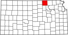 | |
| Unincorporated communities | ||
| Footnotes | ‡This populated place also has portions in an adjacent county or counties | |