Gully, Minnesota
| Gully, Minnesota | |
|---|---|
| City | |
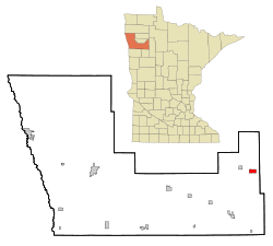 Location of Gully, Minnesota | |
| Coordinates: 47°46′2″N 95°37′31″W / 47.76722°N 95.62528°W | |
| Country | United States |
| State | Minnesota |
| County | Polk |
| Area[1] | |
| • Total | 0.26 sq mi (0.67 km2) |
| • Land | 0.26 sq mi (0.67 km2) |
| • Water | 0 sq mi (0 km2) |
| Elevation | 1,276 ft (389 m) |
| Population (2010)[2] | |
| • Total | 66 |
| • Estimate (2015)[3] | 66 |
| • Density | 253.8/sq mi (98.0/km2) |
| Time zone | Central (CST) (UTC-6) |
| • Summer (DST) | CDT (UTC-5) |
| ZIP code | 56646 |
| Area code(s) | 218 |
| FIPS code | 27-26270 |
| GNIS feature ID | 0644533[4] |
Gully is a city in Polk County, Minnesota, United States. It is part of the Grand Forks-ND-MN Metropolitan Statistical Area. The population was 66 at the 2010 census.[5]
History
A post office called Gully has been in operation since 1896.[6] The city was named for a gully near the town site.[7]
Geography
According to the United States Census Bureau, the city has a total area of 0.26 square miles (0.67 km2), all of it land.[1]
Demographics
| Historical population | |||
|---|---|---|---|
| Census | Pop. | %± | |
| 1930 | 138 | — | |
| 1940 | 164 | 18.8% | |
| 1950 | 183 | 11.6% | |
| 1960 | 168 | −8.2% | |
| 1970 | 96 | −42.9% | |
| 1980 | 116 | 20.8% | |
| 1990 | 117 | 0.9% | |
| 2000 | 106 | −9.4% | |
| 2010 | 66 | −37.7% | |
| Est. 2015 | 66 | [8] | 0.0% |
| U.S. Decennial Census[9] 2015 Estimate[3] | |||
2010 census
As of the census[2] of 2010, there were 66 people, 38 households, and 15 families residing in the city. The population density was 253.8 inhabitants per square mile (98.0/km2). There were 53 housing units at an average density of 203.8 per square mile (78.7/km2). The racial makeup of the city was 100.0% White.
There were 38 households of which 23.7% had children under the age of 18 living with them, 26.3% were married couples living together, 7.9% had a female householder with no husband present, 5.3% had a male householder with no wife present, and 60.5% were non-families. 57.9% of all households were made up of individuals and 23.7% had someone living alone who was 65 years of age or older. The average household size was 1.74 and the average family size was 2.73.
The median age in the city was 47 years. 22.7% of residents were under the age of 18; 4.5% were between the ages of 18 and 24; 21.1% were from 25 to 44; 24.3% were from 45 to 64; and 27.3% were 65 years of age or older. The gender makeup of the city was 54.5% male and 45.5% female.
2000 census
As of the census of 2000, there were 106 people, 52 households, and 26 families residing in the city. The population density was 52.7 people per square mile (20.4/km²). There were 66 housing units at an average density of 32.8 per square mile (12.7/km²). The racial makeup of the city was 99.06% White, and 0.94% from two or more races.
There were 52 households out of which 23.1% had children under the age of 18 living with them, 46.2% were married couples living together, 3.8% had a female householder with no husband present, and 48.1% were non-families. 44.2% of all households were made up of individuals and 17.3% had someone living alone who was 65 years of age or older. The average household size was 2.04 and the average family size was 2.93.
In the city the population was spread out with 23.6% under the age of 18, 2.8% from 18 to 24, 25.5% from 25 to 44, 23.6% from 45 to 64, and 24.5% who were 65 years of age or older. The median age was 43 years. For every 100 females there were 120.8 males. For every 100 females age 18 and over, there were 118.9 males.
The median income for a household in the city was $17,500, and the median income for a family was $21,875. Males had a median income of $21,250 versus $17,917 for females. The per capita income for the city was $11,644. There were 14.8% of families and 16.8% of the population living below the poverty line, including no under eighteens and 17.2% of those over 64.
References
- 1 2 "US Gazetteer files 2010". United States Census Bureau. Retrieved 2012-11-13.
- 1 2 "American FactFinder". United States Census Bureau. Retrieved 2012-11-13.
- 1 2 "Population Estimates". United States Census Bureau. Retrieved June 17, 2016.
- ↑ "US Board on Geographic Names". United States Geological Survey. 2007-10-25. Retrieved 2008-01-31.
- ↑ "2010 Census Redistricting Data (Public Law 94-171) Summary File". American FactFinder. U.S. Census Bureau, 2010 Census. Retrieved 23 April 2011.
- ↑ "Polk County". Jim Forte Postal History. Retrieved 31 July 2015.
- ↑ Upham, Warren (1920). Minnesota Geographic Names: Their Origin and Historic Significance. Minnesota Historical Society. p. 425.
- ↑ "Annual Estimates of the Resident Population for Incorporated Places: April 1, 2010 to July 1, 2015". Retrieved July 2, 2016.
- ↑ United States Census Bureau. "Census of Population and Housing". Retrieved September 11, 2013.
Municipalities and communities of Polk County, Minnesota, United States | ||
|---|---|---|
| Cities | 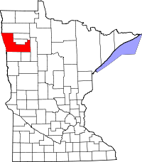 | |
| Townships |
| |
| Unincorporated communities | ||
| Indian reservation | ||
| Footnotes | ‡This populated place also has portions in an adjacent county or counties | |
| Counties | ||
|---|---|---|
| Main cities | ||
| Surrounding areas | ||
† - county seat | ||
Coordinates: 47°46′07″N 95°37′22″W / 47.76861°N 95.62278°W