East Grand Forks, Minnesota
| East Grand Forks, Minnesota | |
|---|---|
| City | |
| Nickname(s): The Grand Cities | |
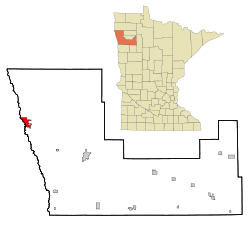
 Location of East Grand Forks within Polk County and state of Minnesota | |
| Coordinates: 47°55′48″N 97°1′27″W / 47.93000°N 97.02417°WCoordinates: 47°55′48″N 97°1′27″W / 47.93000°N 97.02417°W | |
| Country | United States |
| State | Minnesota |
| County | Polk |
| Metro | Greater Grand Forks |
| Founded | 1887 |
| Government | |
| • Mayor | Lynn Stauss |
| Area[1] | |
| • City | 5.91 sq mi (15.31 km2) |
| • Land | 5.91 sq mi (15.31 km2) |
| • Water | 0 sq mi (0 km2) |
| Elevation | 833 ft (254 m) |
| Population (2010)[2] | |
| • City | 8,601 |
| • Estimate (2015)[3] | 8,643 |
| • Density | 1,455.3/sq mi (561.9/km2) |
| • Metro | 102,449 |
| Time zone | CST (UTC-6) |
| • Summer (DST) | CDT (UTC-5) |
| ZIP code | 56721 |
| Area code(s) | 218 |
| FIPS code | 27-17612 |
| GNIS feature ID | 0643079[4] |
| Website | egf.mn |
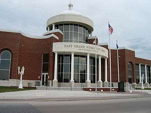
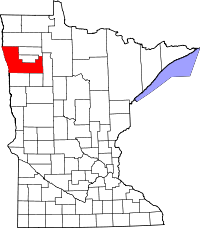
East Grand Forks (also known as EGF) is a city in Polk County, Minnesota, United States. The population was 8,601 at the 2010 Census, making it the largest community in Polk County.[5]
It is located in the Red River Valley region along the eastern bank of the Red River of the North, directly across from the larger city of Grand Forks, North Dakota. The cities of Grand Forks and East Grand Forks form the center of the Grand Forks, ND–MN Metropolitan Statistical Area, which is often called Greater Grand Forks. The metropolitan area had an estimated population of 102,449 on July 1, 2015.[6]
History
A post office called East Grand Forks has been in operation since 1883.[7] The city was named for its location east of Grand Forks, North Dakota.[8] East Grand Forks was incorporated in 1887.[8]
Flood of 1997

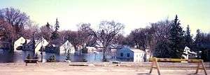
East Grand Forks, along with Grand Forks, was heavily damaged by a major flood in 1997. The entire city was under a mandatory evacuation and almost no homes were spared damage. After the flood, several neighborhoods had to be demolished because of damage. The city cleared development from the floodplain bordering the Red and Red Lake rivers. It developed a large park known as the Greater Grand Forks Greenway to provide a new recreation area for residents along the river. A similar park was developed in Grand Forks, North Dakota on the opposite side. The parklands, with trees and a variety of greenery, can absorb floodwaters and help protect the cities naturally. Moving residential and business development out of these areas also helps prevent future flood damage. In addition, a new system of dikes was constructed to protect the city from future flooding.
The city has rebuilt. New businesses attracted to the downtown include a Cabela's sporting goods store and movie theater complex.
Geography

East Grand Forks is located in the flat, fertile Red River Valley, formed by the ancient glacial Lake Agassiz.
East Grand Forks developed on both sides of the Red River. The main part of town is located north of the river; this was the original part that developed as the downtown area, as well as several early residential neighborhoods. The area south of the river is known as "The Point." The land narrows almost to a peninsula at the confluence of the Red and Red Lake rivers. "The Point" contains more residential development.
According to the United States Census Bureau, the city has a total area of 5.91 square miles (15.31 km2), all land.[1]
Four-lane U.S. Route 2; U.S. 2 Business Route; and Minnesota Highway 220 are three of the main routes in the city. Other nearby routes in the Grand Forks-East Grand Forks area include Interstate Highway 29, to the west of Grand Forks' downtown, and U.S. Highway 81.
Demographics
| Historical population | |||
|---|---|---|---|
| Census | Pop. | %± | |
| 1890 | 795 | — | |
| 1900 | 2,077 | 161.3% | |
| 1910 | 2,533 | 22.0% | |
| 1920 | 2,490 | −1.7% | |
| 1930 | 2,922 | 17.3% | |
| 1940 | 3,511 | 20.2% | |
| 1950 | 5,049 | 43.8% | |
| 1960 | 6,998 | 38.6% | |
| 1970 | 7,607 | 8.7% | |
| 1980 | 8,537 | 12.2% | |
| 1990 | 8,658 | 1.4% | |
| 2000 | 7,501 | −13.4% | |
| 2010 | 8,601 | 14.7% | |
| Est. 2015 | 8,643 | [9] | 0.5% |
| U.S. Decennial Census[10] 2015 Estimate[3] | |||

2010 census
As of the census[2] of 2010, there were 8,601 people, 3,488 households, and 2,258 families residing in the city. The population density was 1,455.3 inhabitants per square mile (561.9/km2). There were 3,626 housing units at an average density of 613.5 per square mile (236.9/km2). The racial makeup of the city was 91.1% White, 1.3% African American, 1.8% Native American, 0.6% Asian, 2.4% from other races, and 2.9% from two or more races. Hispanic or Latino of any race were 6.5% of the population.
There were 3,488 households of which 33.8% had children under the age of 18 living with them, 49.3% were married couples living together, 11.8% had a female householder with no husband present, 3.7% had a male householder with no wife present, and 35.3% were non-families. 28.7% of all households were made up of individuals and 12% had someone living alone who was 65 years of age or older. The average household size was 2.45 and the average family size was 3.03.
The median age in the city was 35 years. 25.8% of residents were under the age of 18; 10.5% were between the ages of 18 and 24; 25.8% were from 25 to 44; 24.8% were from 45 to 64; and 13.3% were 65 years of age or older. The gender makeup of the city was 49.2% male and 50.8% female.
2000 census
As of the census of 2000, there were 7,501 people, 2,929 households, and 1,933 families residing in the city. The population density was 1,501.5 people per square mile (579.2/km²). There were 3,108 housing units at an average density of 622.1 per square mile (240.0/km²). The racial makeup of the city was 90.97% White, 0.52% African American, 1.68% Native American, 0.33% Asian, 0.01% Pacific Islander, 4.47% from other races, and 2.01% from two or more races. Hispanic or Latino of any race were 7.53% of the population.
There were 2,929 households out of which 36.8% had children under the age of 18 living with them, 51.3% were married couples living together, 11.2% had a female householder with no husband present, and 34.0% were non-families. 28.1% of all households were made up of individuals and 10.8% had someone living alone who was 65 years of age or older. The average household size was 2.54 and the average family size was 3.16.
In the city the population was spread out with 28.8% under the age of 18, 10.8% from 18 to 24, 27.8% from 25 to 44, 20.9% from 45 to 64, and 11.7% who were 65 years of age or older. The median age was 34 years. For every 100 females there were 98.0 males. For every 100 females age 18 and over, there were 94.6 males.
The median income for a household in the city was $35,866, and the median income for a family was $47,846. Males had a median income of $33,134 versus $22,094 for females. The per capita income for the city was $16,599. About 8.2% of families and 12.4% of the population were below the poverty line, including 15.7% of those under age 18 and 8.6% of those age 65 or over.
Education
K–12
The East Grand Forks School District enrolls 1,758 students and operates two elementary schools (South Point Elementary and New Heights Elementary), Central Middle School, and East Grand Forks Senior High School. There are also two private Christian schools. Sacred Heart School is a Roman Catholic elementary, middle, and high school. Riverside Christian School is a nondeominational Christian elementary and middle school.
Higher education
The only higher educational institution in East Grand Forks is Northland Community & Technical College or "NCTC" for short, which also has a campus 50 miles northeast in Thief River Falls. It began in 1993 as Northwest Technical College, which has campus in other Minnesota towns, but eventually was bought by NCTC. The 2-year school has seen steady growth in enrollment in the past 5 years. Across the Red River in Grand Forks is the University of North Dakota.
Tourism
Most of the tourist activities can be found in neighboring Grand Forks. EGF has a downtown shopping district that includes a small shopping center, a 15-screen movie theater, a Cabela's sporting goods store, and several local restaurants.
After the Flood of 1997, the Federal Emergency Management Agency (FEMA) recommended against replacing residential or business development in the floodplain. The land on both sides of the river was developed as a park and state recreation area, known as the Red River State Recreation Area. This is a part of the Greater Grand Forks Greenway. It provides a place for residents to enjoy recreation near the river, as well as protecting the cities. The trees and greenery in this zone can help absorb future seasonal flooding. In the northern part of town is a private golf course, Valley Golf Course.
Local events
East Grand Forks has several annual local community events, such as the Catfish Days and the Frosty Bobber fishing tournaments, Heritage Days, and arts and crafts shows. EGF shares certain events with Grand Forks, such as the Potato Bowl parade and First Night, a New Year's celebration that's alcohol free. Catfish Days, based on an annual summer catfishing tournament, attracts people from all over the United States and Canada. It is one of the largest fishing tournaments in the region.
Each June, the Grand Cities Art Fest takes place in the downtowns of Grand Forks and East Grand Forks. The city holds an Art & Wine Walk one Saturday each month during the summer. A farmer's market is another popular event. Local produce and craft items are for sale in the Town Square on Saturdays, starting in late June and running until late September.
Media
East Grand Forks has a local weekly newspaper, The Exponent. Otherwise, the town is served by the media of Grand Forks. Grand Forks-based radio stations KGFK and KZLT-FM are licensed to East Grand Forks.
References
- 1 2 "US Gazetteer files 2010". United States Census Bureau. Retrieved 2012-11-13.
- 1 2 "American FactFinder". United States Census Bureau. Retrieved 2012-11-13.
- 1 2 "Population Estimates". United States Census Bureau. Retrieved June 17, 2016.
- ↑ "US Board on Geographic Names". United States Geological Survey. 2007-10-25. Retrieved 2008-01-31.
- ↑ "2010 Census Redistricting Data (Public Law 94-171) Summary File". American FactFinder. United States Census Bureau. Retrieved 27 April 2011.
- ↑ "Metropolitan and Micropolitan Statistical Areas: April 1, 2010 to July 1, 2015". U.S. Census Bureau. Retrieved June 17, 2016.
- ↑ "Polk County". Jim Forte Postal History. Retrieved 31 July 2015.
- 1 2 Upham, Warren (1920). Minnesota Geographic Names: Their Origin and Historic Significance. Minnesota Historical Society. p. 423.
- ↑ "Annual Estimates of the Resident Population for Incorporated Places: April 1, 2010 to July 1, 2015". Retrieved July 2, 2016.
- ↑ "U.S. Decennial Census". Census.gov. Retrieved May 26, 2013.
External links
- City of East Grand Forks
- Northland Community and Technical College website
- Grand Forks Herald, regional daily newspaper printed in Grand Forks, ND
