Hamakita Ward
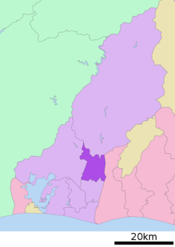
Hamakita-ku (浜北区) is one of the seven wards of the city of Hamamatsu, Shizuoka Prefecture, Japan. It is bordered by Tenryū-ku, Higashi-ku, Naka-ku and the city of Iwata. The Tenryū River and the Akaishi Mountains form natural boundaries for the ward.
Hamakita Ward was established on April 1, 2007. As of 2009, it had a population of 90,817 persons in an area of 66.51 km2, with a population density of 1370 persons per square kilometer.
Transportation
Railroads
Central Station: Hamakita Station
Bus
|
|
|
- Iwata City Bus - Toyooka Line
|
|
National Route
Prefectural Route
- Main Regional Routes
- Shizuoka Prefectural Route 45(Kasai Kaidō)
- Shizuoka Prefectural Route 61
- Shizuoka Prefectural Route 65
- Shizuoka Prefectural Route 68
|
- Ordinary Prefectural Roads
- Shizuoka Prefectural Route 296
- Shizuoka Prefectural Route 299
- Shizuoka Prefectural Route 304
- Shizuoka Prefectural Route 311
- Shizuoka Prefectural Route 344
- Shizuoka Prefectural Route 363
- Shizuoka Prefectural Route 391
|
Government
Hamakita Ward Office
The ward office is located at 6 Nishimisono. The hall is split into north and south halls and the south hall was previously used as Kitahama Village Hall. The north hall was built as a result of five municipalities merged to form the town of Hamakita and later become the city of Hamakita.

Hamakita Ward Office, Hamamatsu
Districts within Hamakita Ward
Hamana District (浜名地区)
Hamakita District (北浜地区)
- Aburaisshiki(油一色)
- Kamizenji(上善地)
- Kibune(貴布祢)
- Kobayashi(小林)
|
- Zenji(善地)
- Takasono(高薗)
- Takabatake(高畑)
- Terajima(寺島)
|
- Dōhon(道本)
- Nakajō(中条)
- Nagashima(永島)
- Niino(新野)
|
- Niibori(新堀)
- Nishimisono(西美薗)
- Numa(沼)
- Higashimisono(東美薗)
|
- Honzawai(本沢合)
- Yawata(八幡)
- Yokosuka(横須賀)
- Ryūnan(竜南)
|
Nakase District (中瀬地区)
Akasa District (赤佐地区)
Aratama District (麁玉地区)
- Oidaira(大平)
- Sandaichi(三大地)
|
|
|
|
External links