Hamilton, Kansas
| Hamilton, Kansas | |
|---|---|
| City | |
|
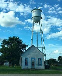
Water Tower | |
 Location within Greenwood County and Kansas | |
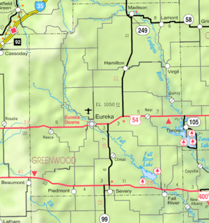 KDOT map of Greenwood County (legend) | |
| Coordinates: 37°58′52″N 96°9′45″W / 37.98111°N 96.16250°WCoordinates: 37°58′52″N 96°9′45″W / 37.98111°N 96.16250°W | |
| Country | United States |
| State | Kansas |
| County | Greenwood |
| Area[1] | |
| • Total | 0.31 sq mi (0.80 km2) |
| • Land | 0.31 sq mi (0.80 km2) |
| • Water | 0 sq mi (0 km2) |
| Elevation | 1,099 ft (335 m) |
| Population (2010)[2] | |
| • Total | 268 |
| • Estimate (2015)[3] | 252 |
| • Density | 860/sq mi (340/km2) |
| Time zone | Central (CST) (UTC-6) |
| • Summer (DST) | CDT (UTC-5) |
| ZIP code | 66853 |
| Area code | 620 |
| FIPS code | 20-29675 [4] |
| GNIS feature ID | 0474437 [5] |
Hamilton is a city in Greenwood County, Kansas, United States. As of the 2010 census, the city population was 268.[6]
History
Hamilton was founded about 1879.[7] The city was named in honor of Alexander Hamilton, first Secretary of the Treasury.[8]
Hamilton was a station and shipping point on the Atchison, Topeka and Santa Fe Railway.[9]
Geography
Hamilton is located at 37°58′52″N 96°9′45″W / 37.98111°N 96.16250°W (37.981244, -96.162605).[10] According to the United States Census Bureau, the city has a total area of 0.31 square miles (0.80 km2), all of it land.[1]
Climate
The climate in this area is characterized by hot, humid summers and generally mild to cool winters. According to the Köppen Climate Classification system, Hamilton has a humid subtropical climate, abbreviated "Cfa" on climate maps.[11]
Demographics
| Historical population | |||
|---|---|---|---|
| Census | Pop. | %± | |
| 1890 | 206 | — | |
| 1910 | 325 | — | |
| 1920 | 398 | 22.5% | |
| 1930 | 549 | 37.9% | |
| 1940 | 519 | −5.5% | |
| 1950 | 456 | −12.1% | |
| 1960 | 400 | −12.3% | |
| 1970 | 349 | −12.7% | |
| 1980 | 363 | 4.0% | |
| 1990 | 301 | −17.1% | |
| 2000 | 334 | 11.0% | |
| 2010 | 268 | −19.8% | |
| Est. 2015 | 252 | [3] | −6.0% |
| U.S. Decennial Census | |||
2010 census
As of the census[2] of 2010, there were 268 people, 117 households, and 72 families residing in the city. The population density was 864.5 inhabitants per square mile (333.8/km2). There were 161 housing units at an average density of 519.4 per square mile (200.5/km2). The racial makeup of the city was 94.4% White, 2.6% Native American, 0.4% Asian, and 2.6% from two or more races. Hispanic or Latino of any race were 0.4% of the population.
There were 117 households of which 29.9% had children under the age of 18 living with them, 38.5% were married couples living together, 12.0% had a female householder with no husband present, 11.1% had a male householder with no wife present, and 38.5% were non-families. 34.2% of all households were made up of individuals and 13.7% had someone living alone who was 65 years of age or older. The average household size was 2.29 and the average family size was 2.90.
The median age in the city was 40.3 years. 24.3% of residents were under the age of 18; 11.1% were between the ages of 18 and 24; 19.4% were from 25 to 44; 29.5% were from 45 to 64; and 15.7% were 65 years of age or older. The gender makeup of the city was 50.0% male and 50.0% female.
2000 census
As of the census[4] of 2000, there were 334 people, 140 households, and 98 families residing in the city. The population density was 1,069.8 people per square mile (416.0/km²). There were 164 housing units at an average density of 525.3 per square mile (204.3/km²). The racial makeup of the city was 97.90% White, 1.20% African American and 0.90% Native American. Hispanic or Latino of any race were 0.30% of the population.
There were 140 households out of which 32.1% had children under the age of 18 living with them, 55.0% were married couples living together, 10.7% had a female householder with no husband present, and 30.0% were non-families. 26.4% of all households were made up of individuals and 12.9% had someone living alone who was 65 years of age or older. The average household size was 2.39 and the average family size was 2.86.
In the city the population was spread out with 25.7% under the age of 18, 11.1% from 18 to 24, 24.6% from 25 to 44, 21.3% from 45 to 64, and 17.4% who were 65 years of age or older. The median age was 36 years. For every 100 females there were 96.5 males. For every 100 females age 18 and over, there were 96.8 males.
The median income for a household in the city was $30,781, and the median income for a family was $36,250. Males had a median income of $25,375 versus $21,696 for females. The per capita income for the city was $13,129. About 15.6% of families and 15.9% of the population were below the poverty line, including 16.9% of those under age 18 and 9.3% of those age 65 or over.
Further reading
References
- 1 2 "US Gazetteer files 2010". United States Census Bureau. Retrieved 2012-07-06.
- 1 2 "American FactFinder". United States Census Bureau. Retrieved 2012-07-06.
- 1 2 "Annual Estimates of the Resident Population for Incorporated Places: April 1, 2010 to July 1, 2015". Retrieved July 2, 2016.
- 1 2 "American FactFinder". United States Census Bureau. Retrieved 2008-01-31.
- ↑ "US Board on Geographic Names". United States Geological Survey. 2007-10-25. Retrieved 2008-01-31.
- ↑ "2010 City Population and Housing Occupancy Status". U.S. Census Bureau. Retrieved July 17, 2011.
- ↑ Kansas State Historical Society (1916). Biennial Report of the Board of Directors of the Kansas State Historical Society. Kansas State Printing Plant. p. 199.
- ↑ Kansas Place-Names, John Rydjord, University of Oklahoma Press, 1972, p. 353 ISBN 0-8061-0994-7
- ↑ Blackmar, Frank Wilson (1912). Kansas: A Cyclopedia of State History, Embracing Events, Institutions, Industries, Counties, Cities, Towns, Prominent Persons, Etc. Standard Publishing Company. p. 803.
- ↑ "US Gazetteer files: 2010, 2000, and 1990". United States Census Bureau. 2011-02-12. Retrieved 2011-04-23.
- ↑ Climate Summary for Hamilton, Kansas
External links
| Wikimedia Commons has media related to Hamilton, Kansas. |
- City
- Schools
- USD 390, local school district
- Maps
Municipalities and communities of Greenwood County, Kansas, United States | ||
|---|---|---|
| Cities | 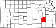 | |
| Unincorporated communities | ||
| Ghost towns | ||
| Townships | ||