Harari Region
| Harari Region ሐረሪ ሑስኒ | ||
|---|---|---|
| kilil | ||
| ||
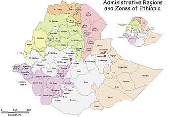
.svg.png) Map of Ethiopia showing Harari Region | ||
| Country | Ethiopia | |
| Capital | Harar | |
| Area | ||
| • Total | 334 km2 (129 sq mi) | |
| [1] | ||
| Population (2012) | ||
| • Total | 210,000 | |
| • Density | 630/km2 (1,600/sq mi) | |
| ISO 3166 code | ET-HA | |
Harari (Amharic: ሓረሪ?, Harari: ሐረሪ) officially Harari People's National Regional State (Amharic: የሓረሪ ሕዝብ ክልል?, Harari: ዚሐረሪ ኡምመት መሐዲያ ሑስኒ), is one of the nine ethnically-based regional states (kililoch) of Ethiopia, covering the homeland of the Harari people. Formerly named Region 13, its capital is Harar. It has the smallest land area of the Ethiopian regional states.
Demographics
Based on the 2007 Census conducted by the Central Statistical Agency of Ethiopia (CSA), Harari has a total population of 183,415, of whom 92,316 were men and 91,099 women. This region is the only one in Ethiopia where the majority of its population lives in urban area: 99,368 or 54.18% of the population are urban inhabitants. With an estimated area of 311.25 square kilometers, this region has an estimated density of 589.05 people per square kilometer. For the entire region 46,169 households were counted, which results in an average for the Region of 3.9 persons to a household, with urban households having on average 3.4 and rural households 4.6 people. Ethnic groups in the region include the Oromo (56.41%), Amhara (22.77%), Harari (8.65%), Gurage (4.34%), Somali (3.87%), Tigray (1.53%), and Argobba (1.26%). Languages spoke include Oromiffa (56.84%), Amharic (27.53%), Harari (7.33%), Somali (3.70%), and Gurage (2.91%). The religion with the most believers in the region is Muslim with 68.99%, 27.1% are Ethiopian Orthodox, 3.4% Protestant, 0.3% Catholic, and 0.2% followers of other religions.[2]
In the previous census, conducted in 1994, the Region's population was reported to be 131,139, of whom 65,550 were men and 65,589 women. At the time of that census, 76,378 or 58.24% of the population lived in urban areas. Ethnic groups in the region recorded in the earlier census included the Oromo (52.3%), Amhara (32.6%), Harari (7.1%), Gurage (3.2%), Tigray (1.71%), and Somali (1.68%). Languages recorded included Oromiffa (49.79%), Amharic (36.97%), Harari (7.61%), Gurage (1.13%) and Tigrinya (1.13%) The religious composition of the population of the region indicated that 60.28% were Muslim, 38.09% Ethiopian Orthodox, 0.94% Protestant, and 0.46% Catholic.[3]
According to the CSA, as of 2004, 73.28% of the total population had access to safe drinking water, of whom 39.83% were rural inhabitants and 95.28% were urban.[4] Values for other reported common indicators of the standard of living for the Afar Region as of 2005 include the following: 5.7% of the inhabitants fall into the lowest wealth quintile; adult literacy for men is 78.4% and for women 54.9%; and the Regional infant mortality rate is 66 infant deaths per 1,000 live births, which is less than the nationwide average of 77; at least half of these deaths occurred in the infants’ first month of life.[5]
Subdivisions
There are 19 numbered kebeles in Harar and a further 17 rural kebeles:[2]
- Sikul
- Hasengae
- Dire Teyara
- Aboker Muti
- Segcha
- Miyay
- Erer Weldya
- Erer Ulanula
- Erer Hawaye
- Erer Dodota
- Awu Umer
- Gelmeshra
- Awuberkele
- Sofi
- Harewae
- Kile
- Burka
Economy
The CSA of Ethiopia estimated in 2005 that farmers in Harari had a total 31,730 head of cattle (representing less than 0.1% of Ethiopia's total cattle), 3,440 sheep (less than 0.1%), 26,910 goats (0.21%), 6,320 asses (0.25%), 31,430 poultry of all species (0.1%), and 670 beehives (less than 0.1%).[6]
Presidents of the Executive Committee
- Ali Abdullahi Gutu 1990s
- Abdulahi Idris Ibrahim 199x – September 1999
- Ghazali Mohammed September 1999 – September 2000
- Nuria Abdulahi (female president) September – October 2000
- Fuad Ibrahim (HNL) October 2000 – 3 October 2005
- Murad Abdulhadi (HNL) 3 October 2005 – Present
(This list is based on information from Worldstatesmen.org.)
See also
Notes
- ↑ 2011 National Statistics
- 1 2 Census 2007 Tables: Harari, Tables 2.1, 2.5, 3.1, 3.2 and 3.4
- ↑ "The 1994 Population and Housing census of Harari Region Volume I", Tables 2.2, 2.8, and 2.9
- ↑ "Households by sources of drinking water, safe water sources" CSA Selected Basic Welfare Indicators (accessed 21 January 2009)
- ↑ Macro International Inc. "2008. Ethiopia Atlas of Key Demographic and Health Indicators, 2005." (Calverton: Macro International, 2008), pp. 2, 3, 10 (accessed 28 January 2009)
- ↑ "CSA 2005 National Statistics", Tables D.4 – D.7.
External links
Coordinates: 9°18′40″N 42°07′26″E / 9.3109946°N 42.1238136°E