Harris, Kansas
| Harris, Kansas | |
|---|---|
| Census-designated place | |
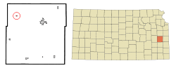 Location within Anderson County and Kansas | |
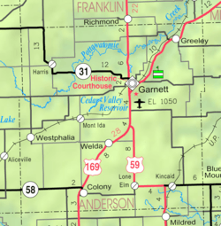 KDOT map of Anderson County (legend) | |
| Coordinates: 38°19′10″N 95°26′15″W / 38.31944°N 95.43750°WCoordinates: 38°19′10″N 95°26′15″W / 38.31944°N 95.43750°W | |
| Country | United States |
| State | Kansas |
| County | Anderson |
| Area[1] | |
| • Total | 0.36 sq mi (0.93 km2) |
| • Land | 0.35 sq mi (0.91 km2) |
| • Water | 0.01 sq mi (0.03 km2) |
| Population (2010)[2] | |
| • Total | 51 |
| • Density | 145.7/sq mi (56.3/km2) |
| Time zone | Central (CST) (UTC-6) |
| • Summer (DST) | CDT (UTC-5) |
| FIPS code | 20-30250[3] |
Harris is a census-designated place and former city in Anderson County, Kansas, United States. As of the 2010 census, the population was 51.[4]
History
Harris was founded in 1886.[5] It was a station on the Missouri Pacific Railroad.[6]
The post office in Harris was discontinued in 1971.[7]
Geography
Harris is located at 38°19′10″N 95°26′15″W / 38.31944°N 95.43750°W (38.319420, -95.437394).[8] According to the United States Census Bureau, the CDP has a total area of 0.36 square miles (0.93 km2), of which 0.35 square miles (0.91 km2) is land and 0.01 square miles (0.03 km2) is water.[1]
Demographics
| Historical population | |||
|---|---|---|---|
| Census | Pop. | %± | |
| 1990 | 39 | — | |
| 2000 | 53 | 35.9% | |
| 2010 | 51 | −3.8% | |
| U.S. Decennial Census | |||
2010 census
As of the census[2] of 2010, there were 51 people, 21 households, and 13 families residing in the CDP. The population density was 145.7 inhabitants per square mile (56.3/km2). There were 26 housing units at an average density of 74.3 per square mile (28.7/km2). The racial makeup of the CDP was 100.0% White. Hispanic or Latino of any race were 5.9% of the population.
There were 21 households of which 38.1% had children under the age of 18 living with them, 47.6% were married couples living together, 14.3% had a female householder with no husband present, and 38.1% were non-families. 33.3% of all households were made up of individuals and 9.5% had someone living alone who was 65 years of age or older. The average household size was 2.43 and the average family size was 3.15.
The median age in the CDP was 38.8 years. 29.4% of residents were under the age of 18; 5.9% were between the ages of 18 and 24; 23.5% were from 25 to 44; 25.5% were from 45 to 64; and 15.7% were 65 years of age or older. The gender makeup of the CDP was 51.0% male and 49.0% female.
2000 census
As of the census[3] of 2000, there were 53 people, 21 households, and 14 families residing in the city. The population density was 439.4 people per square mile (170.5/km²). There were 26 housing units at an average density of 215.6 per square mile (83.7/km²). The racial makeup of the city was 100.00% White.
There were 21 households out of which 33.3% had children under the age of 18 living with them, 66.7% were married couples living together, 4.8% had a female householder with no husband present, and 28.6% were non-families. 28.6% of all households were made up of individuals and 14.3% had someone living alone who was 65 years of age or older. The average household size was 2.52 and the average family size was 3.07.
In the city the population was spread out with 28.3% under the age of 18, 1.9% from 18 to 24, 30.2% from 25 to 44, 22.6% from 45 to 64, and 17.0% who were 65 years of age or older. The median age was 38 years. For every 100 females there were 103.8 males. For every 100 females age 18 and over, there were 81.0 males.
The median income for a household in the city was $34,375, and the median income for a family was $33,125. Males had a median income of $30,625 versus $17,917 for females. The per capita income for the city was $13,259. There were 23.1% of families and 15.2% of the population living below the poverty line, including no under eighteens and 10.5% of those over 64.
See also
Further reading
- The History Of Anderson County, Kansas, From Its First Settlement To The Fourth Of July, 1876; W.A. Johnson; Kauffman & Iler; 1877.[9]
- Plat Book Of Anderson County, Kansas, Compiled From County Records And Actual Survey; Northwest Publishing Co; 1901.[10]
- Kansas: A Cyclopedia Of State History, Embracing Events, Institutions, Industries, Counties, Cities, Towns, Prominent Persons, Etc; Frank W. Blackmar; Standard Publishing Co; 1912.[11][12][13]
- History Of The State of Kansas; William G. Cutler; A.T. Andreas Publisher; 1883.[14]
References
- 1 2 "US Gazetteer files 2010". United States Census Bureau. Retrieved 2012-07-06.
- 1 2 "American FactFinder". United States Census Bureau. Retrieved 2012-07-06.
- 1 2 "American FactFinder". United States Census Bureau. Retrieved 2008-01-31.
- ↑ "2010 City Population and Housing Occupancy Status". U.S. Census Bureau. Retrieved March 6, 2011.
- ↑ "County Towns". Anderson County Historical Society. Retrieved 4 June 2014.
- ↑ Blackmar, Frank Wilson (1912). Kansas: A Cyclopedia of State History, Embracing Events, Institutions, Industries, Counties, Cities, Towns, Prominent Persons, Etc. Standard Publishing Company. p. 811.
- ↑ "Kansas Post Offices, 1828-1961". Kansas Historical Society. Archived from the original on April 10, 2013. Retrieved 29 June 2014.
- ↑ "US Gazetteer files: 2010, 2000, and 1990". United States Census Bureau. 2011-02-12. Retrieved 2011-04-23.
- ↑ The History Of Anderson County, Kansas, From Its First Settlement To The Fourth Of July, 1876; 1877.
- ↑ Plat Book Of Anderson County, Kansas, Compiled From County Records And Actual Survey; 1901.
- ↑ Kansas: A Cyclopedia Of State History, Embracing Events, Institutions, Industries, Counties, Cities, Towns, Prominent Persons, Etc - Vol 1; 1912.
- ↑ Kansas: A Cyclopedia Of State History, Embracing Events, Institutions, Industries, Counties, Cities, Towns, Prominent Persons, Etc - Vol 2; 1912.
- ↑ Kansas: A Cyclopedia Of State History, Embracing Events, Institutions, Industries, Counties, Cities, Towns, Prominent Persons, Etc - Vol 3; 1912.
- ↑ History Of The State of Kansas; 1883.
External links
| Wikimedia Commons has media related to Harris, Kansas. |
- Schools
- USD 365, local school district
- Maps
- Anderson County Map, KDOT
Municipalities and communities of Anderson County, Kansas, United States | ||
|---|---|---|
| Cities | 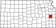 | |
| CDPs | ||
| Unincorporated communities | ||
| Ghost town | ||
| Townships | ||