Colony, Kansas
| Colony, Kansas | |
|---|---|
| City | |
 Location within Anderson County and Kansas | |
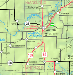 KDOT map of Anderson County (legend) | |
| Coordinates: 38°4′15″N 95°21′58″W / 38.07083°N 95.36611°WCoordinates: 38°4′15″N 95°21′58″W / 38.07083°N 95.36611°W | |
| Country | United States |
| State | Kansas |
| County | Anderson |
| Area[1] | |
| • Total | 0.52 sq mi (1.35 km2) |
| • Land | 0.52 sq mi (1.35 km2) |
| • Water | 0 sq mi (0 km2) |
| Elevation | 1,129 ft (344 m) |
| Population (2010)[2] | |
| • Total | 408 |
| • Estimate (2015)[3] | 404 |
| • Density | 780/sq mi (300/km2) |
| Time zone | Central (CST) (UTC-6) |
| • Summer (DST) | CDT (UTC-5) |
| ZIP code | 66015 |
| Area code(s) | 620 |
| FIPS code | 20-14950 [4] |
| GNIS feature ID | 0478124 [5] |
Colony is a city in Anderson County, Kansas, United States. As of the 2010 census, the city population was 408.[6]
History
Colony had its start in the year 1872 by the building of the railroad through that territory.[7] It was named for a colony from Ohio and Indiana, which settled in the neighborhood.[8]
The railroad tracks in Colony have since been converted to a rail trail. The trail is part of the Prairie Spirit Trail State Park.[9]
Geography
Colony is located at 38°4′15″N 95°21′58″W / 38.07083°N 95.36611°W (38.070803, -95.366109).[10] According to the United States Census Bureau, the city has a total area of 0.52 square miles (1.35 km2), all of it land.[1]
Climate
The climate in this area is characterized by hot, humid summers and generally mild to cool winters. According to the Köppen Climate Classification system, Colony has a humid subtropical climate, abbreviated "Cfa" on climate maps.[11]
Demographics
| Historical population | |||
|---|---|---|---|
| Census | Pop. | %± | |
| 1880 | 114 | — | |
| 1890 | 474 | 315.8% | |
| 1900 | 483 | 1.9% | |
| 1910 | 530 | 9.7% | |
| 1920 | 997 | 88.1% | |
| 1930 | 596 | −40.2% | |
| 1940 | 420 | −29.5% | |
| 1950 | 386 | −8.1% | |
| 1960 | 419 | 8.5% | |
| 1970 | 382 | −8.8% | |
| 1980 | 474 | 24.1% | |
| 1990 | 447 | −5.7% | |
| 2000 | 397 | −11.2% | |
| 2010 | 408 | 2.8% | |
| Est. 2015 | 404 | [3] | −1.0% |
| U.S. Decennial Census | |||
2010 census
As of the census[2] of 2010, there were 408 people, 177 households, and 112 families residing in the city. The population density was 784.6 inhabitants per square mile (302.9/km2). There were 192 housing units at an average density of 369.2 per square mile (142.5/km2). The racial makeup of the city was 94.4% White, 1.7% African American, 0.2% Native American, 0.2% Asian, and 3.4% from two or more races. Hispanic or Latino of any race were 0.2% of the population.
There were 177 households of which 26.0% had children under the age of 18 living with them, 50.3% were married couples living together, 9.0% had a female householder with no husband present, 4.0% had a male householder with no wife present, and 36.7% were non-families. 34.5% of all households were made up of individuals and 19.7% had someone living alone who was 65 years of age or older. The average household size was 2.31 and the average family size was 2.98.
The median age in the city was 44.5 years. 24% of residents were under the age of 18; 7.6% were between the ages of 18 and 24; 19.1% were from 25 to 44; 24% were from 45 to 64; and 25.2% were 65 years of age or older. The gender makeup of the city was 49.5% male and 50.5% female.
2000 census
As of the census[4] of 2000, there were 397 people, 160 households, and 120 families residing in the city. The population density was 794.7 people per square mile (306.6/km²). There were 186 housing units at an average density of 372.3 per square mile (143.6/km²). The racial makeup of the city was 94.96% White, 0.25% African American, 0.76% Native American, 0.25% Asian, and 3.78% from two or more races. Hispanic or Latino of any race were 2.02% of the population.
There were 160 households out of which 30.0% had children under the age of 18 living with them, 62.5% were married couples living together, 9.4% had a female householder with no husband present, and 24.4% were non-families. 24.4% of all households were made up of individuals and 15.0% had someone living alone who was 65 years of age or older. The average household size was 2.48 and the average family size was 2.90.
In the city the population was spread out with 26.4% under the age of 18, 6.0% from 18 to 24, 21.9% from 25 to 44, 19.4% from 45 to 64, and 26.2% who were 65 years of age or older. The median age was 42 years. For every 100 females there were 78.8 males. For every 100 females age 18 and over, there were 88.4 males.
The median income for a household in the city was $25,167, and the median income for a family was $27,708. Males had a median income of $27,917 versus $20,000 for females. The per capita income for the city was $11,398. About 13.8% of families and 16.6% of the population were below the poverty line, including 21.5% of those under age 18 and 21.6% of those age 65 or over.
Education
Notable people
- Dean Brooks, psychiatrist and actor
Further reading
- The History Of Anderson County, Kansas, From Its First Settlement To The Fourth Of July, 1876; W.A. Johnson; Kauffman & Iler; 1877.[12]
- Plat Book Of Anderson County, Kansas, Compiled From County Records And Actual Survey; Northwest Publishing Co; 1901.[13]
- Kansas: A Cyclopedia Of State History, Embracing Events, Institutions, Industries, Counties, Cities, Towns, Prominent Persons, Etc; Frank W. Blackmar; Standard Publishing Co; 1912.[14][15][16]
- History Of The State of Kansas; William G. Cutler; A.T. Andreas Publisher; 1883.[17]
References
- 1 2 "US Gazetteer files 2010". United States Census Bureau. Archived from the original on 2012-06-26. Retrieved 2012-07-06.
- 1 2 "American FactFinder". United States Census Bureau. Retrieved 2012-07-06.
- 1 2 "Annual Estimates of the Resident Population for Incorporated Places: April 1, 2010 to July 1, 2015". Retrieved July 2, 2016.
- 1 2 "American FactFinder". United States Census Bureau. Archived from the original on 2013-09-11. Retrieved 2008-01-31.
- ↑ "US Board on Geographic Names". United States Geological Survey. 2007-10-25. Retrieved 2008-01-31.
- ↑ "2010 City Population and Housing Occupancy Status". U.S. Census Bureau. Archived from the original on July 21, 2011. Retrieved March 6, 2011.
- ↑ Blackmar, Frank Wilson (1912). Kansas: A Cyclopedia of State History, Embracing Events, Institutions, Industries, Counties, Cities, Towns, Prominent Persons, Etc. Standard Publishing Company. p. 391.
- ↑ Gannett, Henry (1905). The Origin of Certain Place Names in the United States. Govt. Print. Off. p. 88.
- ↑ "Homepage". BikePrairieSpirit.com. Retrieved 17 May 2014.
- ↑ "US Gazetteer files: 2010, 2000, and 1990". United States Census Bureau. 2011-02-12. Retrieved 2011-04-23.
- ↑ Climate Summary for Colony, Kansas
- ↑ The History Of Anderson County, Kansas, From Its First Settlement To The Fourth Of July, 1876; 1877.
- ↑ Plat Book Of Anderson County, Kansas, Compiled From County Records And Actual Survey; 1901.
- ↑ Kansas: A Cyclopedia Of State History, Embracing Events, Institutions, Industries, Counties, Cities, Towns, Prominent Persons, Etc - Vol 1; 1912.
- ↑ Kansas: A Cyclopedia Of State History, Embracing Events, Institutions, Industries, Counties, Cities, Towns, Prominent Persons, Etc - Vol 2; 1912.
- ↑ Kansas: A Cyclopedia Of State History, Embracing Events, Institutions, Industries, Counties, Cities, Towns, Prominent Persons, Etc - Vol 3; 1912.
- ↑ History Of The State of Kansas; 1883.
External links
| Wikimedia Commons has media related to Colony, Kansas. |
- City
- School
- Historical
- Colony History, Anderson County Historical Society
- Numerous Anderson County documents and photos
- Maps
- Colony City Map, KDOT
Municipalities and communities of Anderson County, Kansas, United States | ||
|---|---|---|
| Cities | 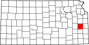 | |
| CDPs | ||
| Unincorporated communities | ||
| Ghost town | ||
| Townships | ||