Harrisburg, Oregon
| Harrisburg, Oregon | |
|---|---|
| City | |
|
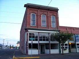
Odd Fellows Hall in the city | |
 Location in Oregon | |
| Coordinates: 44°16′16″N 123°10′7″W / 44.27111°N 123.16861°WCoordinates: 44°16′16″N 123°10′7″W / 44.27111°N 123.16861°W | |
| Country | United States |
| State | Oregon |
| County | Linn |
| Incorporated | 1866 |
| Government | |
| • Mayor | Robert Duncan |
| Area[1] | |
| • Total | 1.45 sq mi (3.76 km2) |
| • Land | 1.40 sq mi (3.63 km2) |
| • Water | 0.05 sq mi (0.13 km2) |
| Elevation | 309 ft (94 m) |
| Population (2010)[2] | |
| • Total | 3,567 |
| • Estimate (2012[3]) | 3,639 |
| • Density | 2,547.9/sq mi (983.7/km2) |
| Time zone | Pacific (UTC-8) |
| • Summer (DST) | Pacific (UTC-7) |
| ZIP code | 97446 |
| Area code(s) | 541 |
| FIPS code | 41-32550[4] |
| GNIS feature ID | 1121627[5] |
| Website | ci.harrisburg.or.us |
Harrisburg is a city in Linn County, Oregon, United States. The population was 3,567 at the 2010 census.[6]
Geography
According to the United States Census Bureau, the city has a total area of 1.45 square miles (3.76 km2), of which 1.40 square miles (3.63 km2) is land and 0.05 square miles (0.13 km2) is water.[1]
Demographics
| Historical population | |||
|---|---|---|---|
| Census | Pop. | %± | |
| 1880 | 422 | — | |
| 1890 | 413 | −2.1% | |
| 1900 | 502 | 21.5% | |
| 1910 | 453 | −9.8% | |
| 1920 | 573 | 26.5% | |
| 1930 | 575 | 0.3% | |
| 1940 | 622 | 8.2% | |
| 1950 | 862 | 38.6% | |
| 1960 | 939 | 8.9% | |
| 1970 | 1,311 | 39.6% | |
| 1980 | 1,881 | 43.5% | |
| 1990 | 1,939 | 3.1% | |
| 2000 | 2,795 | 44.1% | |
| 2010 | 3,567 | 27.6% | |
| Est. 2015 | 3,704 | [7] | 3.8% |
2010 census
As of the census[2] of 2010, there were 3,567 people, 1,238 households, and 966 families residing in the city. The population density was 2,547.9 inhabitants per square mile (983.7/km2). There were 1,318 housing units at an average density of 941.4 per square mile (363.5/km2). The racial makeup of the city was 91.3% White, 0.5% African American, 1.0% Native American, 0.3% Asian, 0.1% Pacific Islander, 3.2% from other races, and 3.4% from two or more races. Hispanic or Latino of any race were 8.0% of the population.
There were 1,238 households of which 44.3% had children under the age of 18 living with them, 60.3% were married couples living together, 12.8% had a female householder with no husband present, 4.8% had a male householder with no wife present, and 22.0% were non-families. 17.2% of all households were made up of individuals and 5.8% had someone living alone who was 65 years of age or older. The average household size was 2.88 and the average family size was 3.21.
The median age in the city was 33.7 years. 30.4% of residents were under the age of 18; 7.3% were between the ages of 18 and 24; 29.5% were from 25 to 44; 24.2% were from 45 to 64; and 8.6% were 65 years of age or older. The gender makeup of the city was 49.4% male and 50.6% female.
2000 census
As of the census[4] of 2000, there were 2,795 people, 989 households, and 751 families residing in the city. The population density was 1,748.8 people per square mile (674.5/km²). There were 1,038 housing units at an average density of 649.5 per square mile (250.5/km²). The racial makeup of the city was 92.99% White, 0.11% African American, 1.22% Native American, 0.57% Asian, 2.86% from other races, and 2.25% from two or more races. Hispanic or Latino of any race were 5.69% of the population.
There were 989 households out of which 43.2% had children under the age of 18 living with them, 60.0% were married couples living together, 11.0% had a female householder with no husband present, and 24.0% were non-families. 17.6% of all households were made up of individuals and 6.1% had someone living alone who was 65 years of age or older. The average household size was 2.83 and the average family size was 3.19.
In the city the population was spread out with 31.4% under the age of 18, 9.2% from 18 to 24, 32.5% from 25 to 44, 18.1% from 45 to 64, and 8.8% who were 65 years of age or older. The median age was 31 years. For every 100 females there were 104.0 males. For every 100 females age 18 and over, there were 99.3 males.
The median income for a household in the city was $40,106, and the median income for a family was $41,953. Males had a median income of $34,509 versus $25,298 for females. The per capita income for the city was $15,822. About 6.4% of families and 9.7% of the population were below the poverty line, including 11.8% of those under age 18 and 6.0% of those age 65 or over.
See also
- Harrisburg circa 1920
References
- 1 2 "US Gazetteer files 2010". United States Census Bureau. Retrieved 2012-12-21.
- 1 2 "American FactFinder". United States Census Bureau. Retrieved 2012-12-21.
- ↑ "Population Estimates". United States Census Bureau. Retrieved 2013-06-02.
- 1 2 "American FactFinder". United States Census Bureau. Retrieved 2008-01-31.
- ↑ "US Board on Geographic Names". United States Geological Survey. 2007-10-25. Retrieved 2008-01-31.
- ↑ "2010 Census profiles: Oregon cities alphabetically H-L" (PDF). Portland State University, Population Research Center. Retrieved 2012-08-02.
- ↑ "Annual Estimates of the Resident Population for Incorporated Places: April 1, 2010 to July 1, 2015". Retrieved July 2, 2016.
- ↑ "Census of Population and Housing". Census.gov. Retrieved June 4, 2015.
External links
| Wikimedia Commons has media related to Harrisburg, Oregon. |
- Entry for Harrisburg in the Oregon Blue Book
- Historic images of Harrisburg from Flickr
Municipalities and communities of Linn County, Oregon, United States | ||
|---|---|---|
| Cities | 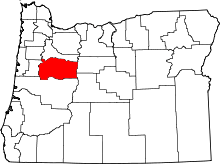 | |
| CDPs | ||
| Other unincorporated communities | ||
| Ghost towns | ||
| Footnotes | ‡This populated place also has portions in an adjacent county or counties | |