Hayward, Missouri
| Hayward, Missouri | |
|---|---|
| Census-designated place | |
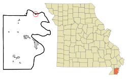 Location of Hayward, Missouri | |
| Coordinates: 36°23′46″N 89°39′58″W / 36.39611°N 89.66611°WCoordinates: 36°23′46″N 89°39′58″W / 36.39611°N 89.66611°W | |
| Country | United States |
| State | Missouri |
| County | Pemiscot |
| Area[1] | |
| • Total | 0.25 sq mi (0.65 km2) |
| • Land | 0.25 sq mi (0.65 km2) |
| • Water | 0 sq mi (0 km2) |
| Elevation | 282 ft (86 m) |
| Population (2010)[2] | |
| • Total | 131 |
| • Density | 524.0/sq mi (202.3/km2) |
| Time zone | Central (CST) (UTC-6) |
| • Summer (DST) | CDT (UTC-5) |
| FIPS code | 29-31186[3] |
| GNIS feature ID | 0719270[4] |
Hayward is a census-designated place and former village in Pemiscot County, Missouri, United States. The population was 131 at the 2010 census.
History
An early variant name was "Fisher", after John J. Fisher, an early settler.[5] A post office called Fisher was established in 1880.[6] The present name is after one Mr. Hayward, another early citizen.[5] A post office called Hayward has been in operation since 1895.[6]
The village disincorporated in 2000.[7] Hayward is now an unincorporated community classified by the Census Bureau as a census-designated place.[8]
Geography
Hayward is located at 36°23′46″N 89°39′58″W / 36.396184°N 89.666114°W.[9]
According to the United States Census Bureau, the CDP has a total area of 0.25 square miles (0.65 km2), all of it land.[1]
Demographics
2010 census
As of the census[2] of 2010, there were 131 people, 49 households, and 39 families residing in the CDP. The population density was 524.0 inhabitants per square mile (202.3/km2). There were 56 housing units at an average density of 224.0 per square mile (86.5/km2). The racial makeup of the CDP was 99.24% White and 0.76% from two or more races.
There were 49 households of which 36.7% had children under the age of 18 living with them, 59.2% were married couples living together, 12.2% had a female householder with no husband present, 8.2% had a male householder with no wife present, and 20.4% were non-families. 18.4% of all households were made up of individuals and 6.1% had someone living alone who was 65 years of age or older. The average household size was 2.67 and the average family size was 2.92.
The median age in the CDP was 38.5 years. 24.4% of residents were under the age of 18; 9.2% were between the ages of 18 and 24; 21.4% were from 25 to 44; 33.6% were from 45 to 64; and 11.5% were 65 years of age or older. The gender makeup of the CDP was 46.6% male and 53.4% female.
2000 census
As of the census[3] of 2000, there were 123 people, 45 households, and 31 families residing in the town. The population density was 521.2 people per square mile (197.9/km²). There were 48 housing units at an average density of 203.4 per square mile (77.2/km²). The racial makeup of the town was 100.00% White.
There were 45 households out of which 26.7% had children under the age of 18 living with them, 68.9% were married couples living together, 2.2% had a female householder with no husband present, and 28.9% were non-families. 24.4% of all households were made up of individuals and 15.6% had someone living alone who was 65 years of age or older. The average household size was 2.73 and the average family size was 3.16.
In the town the population was spread out with 24.4% under the age of 18, 10.6% from 18 to 24, 31.7% from 25 to 44, 19.5% from 45 to 64, and 13.8% who were 65 years of age or older. The median age was 37 years. For every 100 females there were 75.7 males. For every 100 females age 18 and over, there were 78.8 males.
The median income for a household in the town was $34,375, and the median income for a family was $43,750. Males had a median income of $29,583 versus $17,031 for females. The per capita income for the town was $12,720. There were no families and 1.6% of the population living below the poverty line, including no under eighteens and 13.3% of those over 64.
References
- 1 2 "US Gazetteer files 2010". United States Census Bureau. Retrieved 2012-07-08.
- 1 2 "American FactFinder". United States Census Bureau. Retrieved 2012-07-08.
- 1 2 "American FactFinder". United States Census Bureau. Retrieved 2008-01-31.
- ↑ "US Board on Geographic Names". United States Geological Survey. 2007-10-25. Retrieved 2008-01-31.
- 1 2 "Pemiscot County Place Names, 1928–1945". The State Historical Society of Missouri. Archived from the original on June 24, 2016. Retrieved November 29, 2016.
- 1 2 "Post Offices". Jim Forte Postal History. Retrieved 29 November 2016.
- ↑ "Boundary Changes".
- ↑ U.S. Geological Survey Geographic Names Information System: Hayward Census Designated Place
- ↑ "US Gazetteer files: 2010, 2000, and 1990". United States Census Bureau. 2011-02-12. Retrieved 2011-04-23.
Municipalities and communities of Pemiscot County, Missouri, United States | ||
|---|---|---|
| Cities | 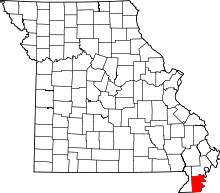 | |
| Villages | ||
| Townships | ||
| CDP | ||
| Other unincorporated communities | ||
| Ghost towns | ||
| Footnotes | ‡This populated place also has portions in an adjacent county or counties | |