Hayti, Missouri
| Hayti, Missouri | |
|---|---|
| City | |
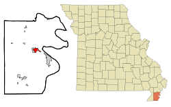 Location of Hayti, Missouri | |
| Coordinates: 36°14′1″N 89°44′55″W / 36.23361°N 89.74861°WCoordinates: 36°14′1″N 89°44′55″W / 36.23361°N 89.74861°W | |
| Country | United States |
| State | Missouri |
| County | Pemiscot |
| Area[1] | |
| • Total | 2.31 sq mi (5.98 km2) |
| • Land | 2.30 sq mi (5.96 km2) |
| • Water | 0.01 sq mi (0.03 km2) |
| Elevation | 269 ft (82 m) |
| Population (2010)[2] | |
| • Total | 2,939 |
| • Estimate (2012[3]) | 2,899 |
| • Density | 1,277.8/sq mi (493.4/km2) |
| Time zone | Central (CST) (UTC-6) |
| • Summer (DST) | CDT (UTC-5) |
| ZIP code | 63851 |
| Area code(s) | 573 |
| FIPS code | 29-31132[4] |
| GNIS feature ID | 0719268[5] |
Hayti (pronounced Hay-Tie) is a city in Pemiscot County, Missouri, United States. The population was 2,939 at the 2010 census.
History
Hayti was platted in 1894, when the railroad was extended to that point.[6] According to one tradition, the name honors Dr. G. Hayes, an original owner of the site.[6] It is also claimed the name is derived from the country of Haiti.[7] A post office called Hayti has been in operation since 1895.[8]
Geography
Hayti is located at 36°14′1″N 89°44′55″W / 36.23361°N 89.74861°W (36.233526, -89.748578).[9]
According to the United States Census Bureau, the city has a total area of 2.31 square miles (5.98 km2), of which 2.30 square miles (5.96 km2) is land and 0.01 square miles (0.03 km2) is water.[1]
Hayti is located north of the junction of Interstate 55 and U.S. Route 412
Demographics
| Historical population | |||
|---|---|---|---|
| Census | Pop. | %± | |
| 1900 | 419 | — | |
| 1910 | 1,057 | 152.3% | |
| 1920 | 1,507 | 42.6% | |
| 1930 | 1,620 | 7.5% | |
| 1940 | 2,628 | 62.2% | |
| 1950 | 3,302 | 25.6% | |
| 1960 | 3,737 | 13.2% | |
| 1970 | 3,841 | 2.8% | |
| 1980 | 3,964 | 3.2% | |
| 1990 | 3,280 | −17.3% | |
| 2000 | 3,207 | −2.2% | |
| 2010 | 2,939 | −8.4% | |
| Est. 2015 | 2,787 | [10] | −5.2% |
2010 census
As of the census[2] of 2010, there were 2,939 people, 1,258 households, and 739 families residing in the city. The population density was 1,277.8 inhabitants per square mile (493.4/km2). There were 1,376 housing units at an average density of 598.3 per square mile (231.0/km2). The racial makeup of the city was 52.23% White, 45.12% Black or African American, 0.31% Native American, 0.31% Asian, 0.51% from other races, and 1.53% from two or more races. Hispanic or Latino of any race were 0.99% of the population.
There were 1,258 households of which 31.2% had children under the age of 18 living with them, 28.1% were married couples living together, 25.4% had a female householder with no husband present, 5.3% had a male householder with no wife present, and 41.3% were non-families. 36.6% of all households were made up of individuals and 15.7% had someone living alone who was 65 years of age or older. The average household size was 2.30 and the average family size was 3.01.
The median age in the city was 38.2 years. 26.9% of residents were under the age of 18; 9.9% were between the ages of 18 and 24; 21.6% were from 25 to 44; 25.3% were from 45 to 64; and 16.4% were 65 years of age or older. The gender makeup of the city was 45.8% male and 54.2% female.
2000 census
As of the census[4] of 2000, there were 3,207 people, 1,318 households, and 809 families residing in the city. The population density was 1,450.1 people per square mile (560.3/km²). There were 1,436 housing units at an average density of 649.3 per square mile (250.9/km²). The racial makeup of the city was 54.66% White, 43.75% African American, 0.44% Native American, 0.19% Asian, 0.12% from other races, and 0.84% from two or more races. Hispanic or Latino of any race were 1.31% of the population.
There were 1,318 households out of which 30.1% had children under the age of 18 living with them, 33.8% were married couples living together, 23.9% had a female householder with no husband present, and 38.6% were non-families. 36.1% of all households were made up of individuals and 19.2% had someone living alone who was 65 years of age or older. The average household size was 2.33 and the average family size was 3.06.
In the city the population was spread out with 30.1% under the age of 18, 8.0% from 18 to 24, 23.3% from 25 to 44, 19.4% from 45 to 64, and 19.3% who were 65 years of age or older. The median age was 35 years. For every 100 females there were 79.9 males. For every 100 females age 18 and over, there were 73.0 males.
The median income for a household in the city was $15,384, and the median income for a family was $23,720. Males had a median income of $24,028 versus $15,486 for females. The per capita income for the city was $13,265. About 35.7% of families and 38.3% of the population were below the poverty line, including 54.7% of those under age 18 and 29.5% of those age 65 or over.
Notable people
- Lew Carpenter, NFL running back
- Wendell Mayes, an Oscar nominated Hollywood writer was born in Hayti.[12]
- Rita Johnson-Mills, CEO & President of United Healthcare Community and State Plan of Tennessee.
- William Moore, a former Missouri Tiger college safety.
- Keith Palmer, country musician.
- Mildred Pulliam Whitehorn, singer who recorded for Stax Records in the 1970s under the name Veda Brown
- Ralph Peterson, 1944-2009. President, Chairman, and CEO of CH2M HILL, building it into a Fortune 500, global engineering company, overseeing such projects as expansion of the Panama Canal, constructing U.S. Army facilities in Korea, clean-up of the Rocky Flats nuclear site. He was a visionary for environmental sustainability, and served as a consultant and advisor for many national and international organizations. [13]
- Bob Stroger, blues musician
References
- 1 2 "US Gazetteer files 2010". United States Census Bureau. Retrieved 2012-07-08.
- 1 2 "American FactFinder". United States Census Bureau. Retrieved 2012-07-08.
- ↑ "Population Estimates". United States Census Bureau. Retrieved 2013-05-30.
- 1 2 "American FactFinder". United States Census Bureau. Retrieved 2008-01-31.
- ↑ "US Board on Geographic Names". United States Geological Survey. 2007-10-25. Retrieved 2008-01-31.
- 1 2 "Pemiscot County Place Names, 1928–1945". The State Historical Society of Missouri. Archived from the original on June 24, 2016. Retrieved November 29, 2016.
- ↑ Ramsay, Robert L. (1952). Our Storehouse of Missouri Place Names. University of Missouri Press. p. 28.
- ↑ "Post Offices". Jim Forte Postal History. Retrieved 29 November 2016.
- ↑ "US Gazetteer files: 2010, 2000, and 1990". United States Census Bureau. 2011-02-12. Retrieved 2011-04-23.
- ↑ "Annual Estimates of the Resident Population for Incorporated Places: April 1, 2010 to July 1, 2015". Retrieved July 2, 2016.
- ↑ "Census of Population and Housing". Census.gov. Retrieved June 4, 2015.
- ↑ "Wendell Mayes (1918–1992)". IMDb.com. Retrieved 2016-10-30.
- ↑
Municipalities and communities of Pemiscot County, Missouri, United States | ||
|---|---|---|
| Cities | 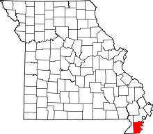 | |
| Villages | ||
| Townships | ||
| CDP | ||
| Other unincorporated communities | ||
| Ghost towns | ||
| Footnotes | ‡This populated place also has portions in an adjacent county or counties | |