Hennebont
| Hennebont Henbont | ||
|---|---|---|
|
A general view of Hennebont | ||
| ||
 Hennebont | ||
|
Location within Brittany region  Hennebont | ||
| Coordinates: 47°48′18″N 3°16′39″W / 47.805°N 3.2775°WCoordinates: 47°48′18″N 3°16′39″W / 47.805°N 3.2775°W | ||
| Country | France | |
| Region | Brittany | |
| Department | Morbihan | |
| Arrondissement | Lorient | |
| Canton | Hennebont | |
| Intercommunality | Pays de Lorient | |
| Government | ||
| • Mayor (2008—2014) | Gérard Perron | |
| Area1 | 18.57 km2 (7.17 sq mi) | |
| Population (1999)2 | 13,412 | |
| • Density | 720/km2 (1,900/sq mi) | |
| Time zone | CET (UTC+1) | |
| • Summer (DST) | CEST (UTC+2) | |
| INSEE/Postal code | 56083 / 56700 | |
| Elevation |
0–82 m (0–269 ft) (avg. 5 m or 16 ft) | |
|
1 French Land Register data, which excludes lakes, ponds, glaciers > 1 km² (0.386 sq mi or 247 acres) and river estuaries. 2 Population without double counting: residents of multiple communes (e.g., students and military personnel) only counted once. | ||
Hennebont (Breton: Henbont) is a commune in the Morbihan department in the region of Brittany in north-western France.
Geography
Hennebont is situated about ten miles from the mouth of the River Blavet, which divides it into two parts: the Ville Close, the medieval walled town, and the 17th century Ville Neuve on the left bank and the oldest site: the Vieille Ville on the right. The old walled town (Ville Close) still has traces of its medieval ramparts dating from the 13th to 15th centuries as well as a large fortified 15th century gatehouse complete with double-doors with drawbridge slots, known as the Porte du Broërec.
History

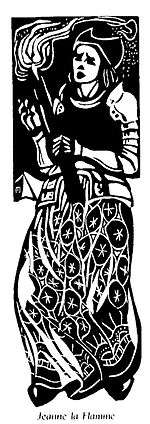
Hennebont is famed for its resistance, under Joanna of Flanders, the widow of Jean de Montfort, to the armies of Philip of Valois and Charles of Blois when besieged in 1342 during the War of the Breton Succession. A century before Joan of Arc, Jeanne dressed herself in armour and led the resistance to the besiegers. She personally led an attack on the enemy camp, setting fire to it and earning the nickname "Jeanne la Flamme" ("Joan the Fiery").
In August 1944, during the Allied invasion of Brittany, a large section of the old walled town, especially the ramparts, towers and medieval buildings, sustained major damage during the bombing of German positions entrenched in the downtown area.
Points of interest
Demographics
Inhabitants of Hennebont are called Hennebontais.
Breton language
In 2008, 5.45% of the children of Hennebont attended bilingual primary schools.[1]
Twin towns
Hennebont is twinned with:
See also
References
- ↑ (French) Ofis ar Brezhoneg: Enseignement bilingue
 This article incorporates text from a publication now in the public domain: Chisholm, Hugh, ed. (1911). "article name needed". Encyclopædia Britannica (11th ed.). Cambridge University Press.
- INSEE commune file
External links
| Wikimedia Commons has media related to Hennebont. |
- French Ministry of Culture list for Hennebont (French)
- Map of Hennebont on Michelin (English)
- Pictures of Hennebont Basilica: ,
.svg.png)