Plumelin
| Plumelin Pluverin | ||
|---|---|---|
|
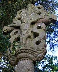
The Cross of Kercloarec | ||
| ||
 Plumelin | ||
|
Location within Brittany region  Plumelin | ||
| Coordinates: 47°51′45″N 2°53′12″W / 47.8625°N 2.8866°WCoordinates: 47°51′45″N 2°53′12″W / 47.8625°N 2.8866°W | ||
| Country | France | |
| Region | Brittany | |
| Department | Morbihan | |
| Arrondissement | Pontivy | |
| Canton | Locminé | |
| Intercommunality | Pays de Locminé | |
| Government | ||
| • Mayor (2008—2014) | Agnès Le Gougaud | |
| Area1 | 31.33 km2 (12.10 sq mi) | |
| Population (2007)2 | 2,295 | |
| • Density | 73/km2 (190/sq mi) | |
| Time zone | CET (UTC+1) | |
| • Summer (DST) | CEST (UTC+2) | |
| INSEE/Postal code | 56174 / 56500 | |
| Elevation | 42–153 m (138–502 ft) | |
|
1 French Land Register data, which excludes lakes, ponds, glaciers > 1 km² (0.386 sq mi or 247 acres) and river estuaries. 2 Population without double counting: residents of multiple communes (e.g., students and military personnel) only counted once. | ||

Plumelin (Breton: Pluverin) is a commune in the Morbihan department of Brittany in north-western France.
Demographics
Inhabitants of Plumelin are called in French Plumelinois.
Breton language
In 2008, there was 20.61% of the children attended the bilingual schools in primary education.[1]
See also
References
- ↑ (French) Ofis ar Brezhoneg: Enseignement bilingue
External links
| Wikimedia Commons has media related to Plumelin. |
- French Ministry of Culture list for Plumelin (French)
- Map of Plumelin on Michelin (English)
This article is issued from Wikipedia - version of the 2/11/2016. The text is available under the Creative Commons Attribution/Share Alike but additional terms may apply for the media files.