Hezekiah S. Ramsdell Farm
|
Hezekiah S. Ramsdell Farm | |
|
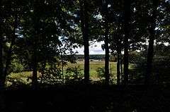
View from the farm site to West Thompson Reservoir | |
  | |
| Location | West Thompson Reservoir lands, formerly Ramsdell Rd., Thompson, Connecticut |
|---|---|
| Coordinates | 41°57′7″N 71°54′39″W / 41.95194°N 71.91083°WCoordinates: 41°57′7″N 71°54′39″W / 41.95194°N 71.91083°W |
| Area | 10 acres (4.0 ha) |
| Architectural style | Greek Revival, Federal, Pennsylvania style |
| NRHP Reference # | 90000442[1] |
| Added to NRHP | August 23, 1990 |
The Hezekiah S. Ramsdell Farm was a historic farm in Thompson, Connecticut. It was located on what was once known as Ramsdell Road, but is now a hiking trail on the lands surrounding West Thompson Reservoir. The property was made famous by a standoff between the United States Army Corps of Engineers (USACE) and Alice Ramsdell, the feisty owner of the property who refused to leave after USACE acquired it by eminent domain as part of a flood control project. The dispute, highlighted by an incident in which Mrs. Ramsdell met government officials holding a shotgun, was ended when the government acquiesced to her demand to stay on the property.
The farm was added to the National Register of Historic Places in 1990. Following the death of Alice Ramsdell in 1995, the USACE announced plans to demolish the farm. The buildings were rescued and moved to a nearby farm on County Home Road.[2] The original farm site is now accessible via a hiking trail.[3]
See also
References
- ↑ National Park Service (2009-03-13). "National Register Information System". National Register of Historic Places. National Park Service.
- ↑ "Thompson Historical Society Newsletter, Winter 2001" (PDF). Thompson Historical Society. Retrieved 2015-01-16.
- ↑ "West Thompson Lake". United States Army Corps of Engineer. Retrieved 2015-01-16.
- Thompson Historical Society Winter 2001 Newsletter
- US Army Corps of Engineers: West Thompson Lake
- The 1955 Flood and its changes
