Highland, Vermillion County, Indiana
| Highland | |
|---|---|
| Unincorporated community | |
 Vermillion County's location in Indiana | |
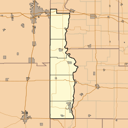 Highland Highland's location in Vermillion County | |
| Coordinates: 39°47′40″N 87°23′45″W / 39.79444°N 87.39583°WCoordinates: 39°47′40″N 87°23′45″W / 39.79444°N 87.39583°W | |
| Country |
|
| State |
|
| County | Vermillion County |
| Township | Helt Township |
| Elevation[1] | 191 m (627 ft) |
| ZIP code | 47854 |
| GNIS feature ID | 436148 |
Highland is an unincorporated community in Helt Township, Vermillion County, in the U.S. state of Indiana.[2]
History
Highland was probably so named on account of its lofty elevation.[3] A post office was established at Highland in 1838, and remained in operation until 1868.[4] With the construction of the railroad, business activity shifted to nearby Hillsdale, and the town of Highland declined.[5]
Geography
Highland is located at 39°47′40″N 87°23′44″W / 39.79444°N 87.39556°W (39.794444, -87.395556), one mile west of the Wabash River and the Parke County town of Montezuma, and less than a mile northwest of Hillsdale.
References
- ↑ "US Board on Geographic Names". United States Geological Survey. October 25, 2007. Retrieved 2016-07-15.
- ↑ "Highland, Indiana". Geographic Names Information System. United States Geological Survey. Retrieved 2010-08-19.
- ↑ Baker, Ronald L. (October 1995). From Needmore to Prosperity: Hoosier Place Names in Folklore and History. Indiana University Press. p. 164. ISBN 978-0-253-32866-3.
...because it is the highest spot in that area.
- ↑ "Vermillion County". Jim Forte Postal History. Retrieved 1 October 2015.
- ↑ History of Parke and Vermillion Counties, Indiana. B.F. Bowen & Cos. 1913. p. 414.
Municipalities and communities of Vermillion County, Indiana, United States | ||
|---|---|---|
| City | ||
| Towns | ||
| Townships | ||
| CDPs | ||
| Other unincorporated communities | ||
| Ghost towns | ||
| Footnotes | ‡This populated place also has portions in an adjacent county or counties | |
This article is issued from Wikipedia - version of the 10/24/2016. The text is available under the Creative Commons Attribution/Share Alike but additional terms may apply for the media files.