Dana, Indiana
| Dana | |
|---|---|
| Town | |
 Vermillion County's location in Indiana | |
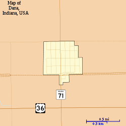 Map of Dana | |
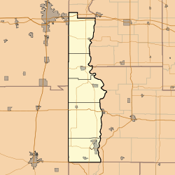 Dana Dana's location in Vermillion County | |
| Coordinates: 39°48′24″N 87°29′39″W / 39.80667°N 87.49417°WCoordinates: 39°48′24″N 87°29′39″W / 39.80667°N 87.49417°W | |
| Country | United States |
| State | Indiana |
| County | Vermillion |
| Township | Helt |
| Established | 1874 |
| Area[1] | |
| • Total | 0.29 sq mi (0.75 km2) |
| • Land | 0.29 sq mi (0.75 km2) |
| • Water | 0 sq mi (0 km2) |
| Elevation[2] | 640 ft (195 m) |
| Population (2010)[3] | |
| • Total | 608 |
| • Estimate (2012[4]) | 600 |
| • Density | 2,096.6/sq mi (809.5/km2) |
| Time zone | EST (UTC-5) |
| • Summer (DST) | EST (UTC-5) |
| ZIP code | 47847 |
| Area code(s) | 765 |
| FIPS code | 18-16732[5] |
| GNIS feature ID | 433305 |
Dana is a town in Helt Township, Vermillion County, Indiana, United States.[6] The population was 608 at the 2010 census. It is primarily a farming community.
History
Dana was platted in 1874 when the railroad was extended to that point.[7] The town was named for Charles Dana, a railroad promoter.[8] A post office has been in operation at Dana since 1874.[9] Dana was incorporated in 1886.[7]
Geography
Dana is located in the central part of the county, on Indiana State Road 71 less than 0.5 miles (0.80 km) north of U.S. Route 36.
According to the 2010 census, Dana has a total area of 0.29 square miles (0.75 km2), all land.[1]
Demographics
| Historical population | |||
|---|---|---|---|
| Census | Pop. | %± | |
| 1880 | 183 | — | |
| 1890 | 495 | 170.5% | |
| 1900 | 893 | 80.4% | |
| 1910 | 748 | −16.2% | |
| 1920 | 884 | 18.2% | |
| 1930 | 859 | −2.8% | |
| 1940 | 845 | −1.6% | |
| 1950 | 854 | 1.1% | |
| 1960 | 811 | −5.0% | |
| 1970 | 720 | −11.2% | |
| 1980 | 803 | 11.5% | |
| 1990 | 612 | −23.8% | |
| 2000 | 662 | 8.2% | |
| 2010 | 608 | −8.2% | |
| Est. 2015 | 581 | [10] | −4.4% |
2010 census
As of the census[3] of 2010, there were 608 people, 241 households, and 173 families residing in the town. The population density was 2,096.6 inhabitants per square mile (809.5/km2). There were 290 housing units at an average density of 1,000.0 per square mile (386.1/km2). The racial makeup of the town was 97.5% White, 0.2% African American, 0.5% Native American, 0.2% Asian, 0.7% from other races, and 1.0% from two or more races. Hispanic or Latino of any race were 1.3% of the population.
There were 241 households of which 34.0% had children under the age of 18 living with them, 59.8% were married couples living together, 9.5% had a female householder with no husband present, 2.5% had a male householder with no wife present, and 28.2% were non-families. 25.7% of all households were made up of individuals and 14.5% had someone living alone who was 65 years of age or older. The average household size was 2.52 and the average family size was 3.00.
The median age in the town was 40.7 years. 24.2% of residents were under the age of 18; 6.8% were between the ages of 18 and 24; 25% were from 25 to 44; 25.4% were from 45 to 64; and 18.6% were 65 years of age or older. The gender makeup of the town was 46.2% male and 53.8% female.
2000 census
As of the census[5] of 2000, there were 662 people, 252 households, and 187 families residing in the town. The population density was 2,255.4 people per square mile (881.4/km²). There were 288 housing units at an average density of 981.2 per square mile (383.4/km²). The racial makeup of the town was 97.58% White, 0.60% African American, 0.30% Asian, 0.76% from other races, and 0.76% from two or more races. Hispanic or Latino of any race were 1.66% of the population.
There were 252 households out of which 33.7% had children under the age of 18 living with them, 62.7% were married couples living together, 8.7% had a female householder with no husband present, and 25.4% were non-families. 23.0% of all households were made up of individuals and 9.9% had someone living alone who was 65 years of age or older. The average household size was 2.63 and the average family size was 3.05.
In the town the population was spread out with 28.4% under the age of 18, 6.8% from 18 to 24, 28.7% from 25 to 44, 23.9% from 45 to 64, and 12.2% who were 65 years of age or older. The median age was 36 years. For every 100 females there were 95.9 males. For every 100 females age 18 and over, there were 94.3 males.
The median income for a household in the town was $34,750, and the median income for a family was $38,182. Males had a median income of $30,313 versus $21,875 for females. The per capita income for the town was $15,603. About 6.6% of families and 9.9% of the population were below the poverty line, including 14.4% of those under age 18 and 9.5% of those age 65 or over.
Notable people
Famed World War II war correspondent Ernie Pyle was born on a tenant farm near Dana. Bert Shepard, a Major League Baseball pitcher for the Washington Senators who had lost his leg in WWII, was also born in Dana.
References
- 1 2 "G001 - Geographic Identifiers - 2010 Census Summary File 1". United States Census Bureau. Retrieved 2015-07-16.
- ↑ "US Board on Geographic Names". United States Geological Survey. 2007-10-25. Retrieved 2008-01-31.
- 1 2 "American FactFinder". United States Census Bureau. Retrieved 2012-12-11.
- ↑ "Population Estimates". United States Census Bureau. Archived from the original on June 17, 2013. Retrieved 2013-06-25.
- 1 2 "American FactFinder". United States Census Bureau. Archived from the original on September 11, 2013. Retrieved 2008-01-31.
- ↑ "Dana, Indiana". Geographic Names Information System. United States Geological Survey. Retrieved 2016-07-15.
- 1 2 History of Parke and Vermillion Counties, Indiana. B.F. Bowen & Cos. 1913. p. 415.
- ↑ Baker, Ronald L. (October 1995). From Needmore to Prosperity: Hoosier Place Names in Folklore and History. Indiana University Press. p. 109. ISBN 978-0-253-32866-3.
.The name honors Charles Dana, a stockholder...
- ↑ "Vermillion County". Jim Forte Postal History. Retrieved 1 October 2015.
- ↑ "Annual Estimates of the Resident Population for Incorporated Places: April 1, 2010 to July 1, 2015". Retrieved July 2, 2016.
- ↑ "Census of Population and Housing". Census.gov. Archived from the original on May 11, 2015. Retrieved June 4, 2015.
External links
Municipalities and communities of Vermillion County, Indiana, United States | ||
|---|---|---|
| City | ||
| Towns | ||
| Townships | ||
| CDPs | ||
| Other unincorporated communities | ||
| Ghost towns | ||
| Footnotes | ‡This populated place also has portions in an adjacent county or counties | |