Highway 3 (Israel)
| |
|---|---|
|
כביש 3 Kvish Shalosh | |
 | |
| Route information | |
|
Part of (Ratified by Palestine but not by Israel) | |
| Length: | 53 km (33 mi) |
| Major junctions | |
| West end: |
|
| |
| East end: |
|
| Location | |
| Major cities: | Ashkelon, Hodaya, Kiryat Malakhi, Yad Binyamin, Yesodot, Hulda, Nachshon, Latrun, Modi'in |
| Highway system | |
| Highways | |

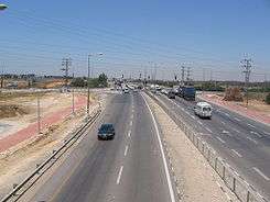
Highway 3 is a highway in Israel. It begins at Highway 4 on the outskirts of Ashkelon, running east-northeast, passing through Kiryat Malakhi and Latrun, and ending just short of Modi'in.
Plan for the future
The Israeli Ministry of Transportation plans for Highway 3 to be a major route that will connect the South District to Jerusalem via Latrun Interchange and Highway 1. The National Roads Company of Israel is converting the road to a multi-lane divided highway. Despite this, the road will not become an expressway because it is the only means of entrance to many nearby communities.
Israel Railways is constructing flying junctions between Highway 3 and the rail tracks that cross it.
Path of Highway 3 from northeast to southwest
The northeast part of Highway 3 begins at Beit Horon Junction near Modi'in. It intersects Highways 1 and 6 and then passes several kibbutzim and moshavim until Re'em Junction where it joins Highway 40, running concurrently for 4 km until Malakhi Junction in Kiryat Malakhi. The Latrun–Nahshon section (between the intersections with highways 1 and 44) is the first concrete highway in Israel.[1]
After the roads split, Highway 3 continues in Kiryat Malakhi and past more kibbutzim and moshavim until Abba Hillel Silver Junction east of Ashkelon, which intersects with Highway 4.
In the past, Highway 3 reached Ramallah and Jericho and terminated at Allenby bridge across the Jordan river.[2] After the Oslo Accords in 1993, the portion of the road that passes through Ramallah and Jericho was transferred to Palestinian control (as with Highway 60), and portions of the road that remained under Israeli control were renamed as local roads.
Junctions and Interchanges
| km | Name | Type | Meaning | Location | Intersecting roads |
|---|---|---|---|---|---|
| 0 | צומת אבא הלל סילבר (Abba Hillel Silver Junction) |
|
Ashkelon, Kfar Silver |
| |
| 0.5 | |
Kfar Silver | entrance road | ||
| 2 | צומת ניר ישראל (Nir Yisrael Junction) |
|
Yisrael's Meadow | Nir Yisrael, Hodaya |
|
| 4 | צומת הודיה (Hodaya Junction) |
|
(Prayer of) Thanksgiving | Hodaya | |
| 7 | צומת נגבה (Negba Junction) |
|
Southward (biblical Hebrew) | Negba | local road |
| 8 | צומת משואות יצחק (Masu'ot Yizhak Junction) |
|
Torches of Isaac | Masu'ot Yizhak | local road |
| 9 | צומת מרכז שפירא (Merkaz Shapira Junction) |
|
Shapira Center named after Haim-Moshe Shapira |
Merkaz Shapira | entrance road |
| 10 | צומת עין צורים (Ein Tzurim Junction) |
|
Rocks' Spring | Ein Tzurim | entrance road |
| 11 | צומת שפיר (Shaffir Junction) |
|
Beautiful (biblical Hebrew) | Shafir | |
| 13 | צומת כפר ורבורג-אביגדור (Kfar Varburg-Avigdor Junction) |
|
named for Felix M. Warburg Henry d'Avigdor-Goldsmid |
Kfar Warburg, Avigdor |
local roads |
| 14.5 | צומת טוביה (Tuvia Junction) |
|
named for Tuvia's Well |
Be'er Tuvia, Kiryat Malakhi South |
Yigal Hurwitz Blvd. |
| 15 | |
Kiryat Malakhi Center, Be'er Tuvia Industrial Zone |
Ben Gurion Blvd. The Well Street | ||
| 15.5 | |
Kiryat Malakhi North | Menachem Begin Blvd. | ||
| 16 | צומת מלאכי (Malakhi Junction) |
|
(Prophet) Malakhi My Angel |
| |
| 16.7 | (eastbound only) | |
Arugot | local road | |
| 18 | צומת אחים (Ahim Junction) |
|
Brothers (Zvi and Efraim Guber) |
Kfar Ahim, Talmei Yehiel, Yinon Achva Arugot |
local road |
| 20 | צומת ראם (Re'em Junction) |
|
Rebbe Avraham Mordechai | Bnei Re'em | |
| 21 | צומת שערי אברהם (Shearei Avraham Junction) |
|
Gates of Abraham | Sha'arei Avraham | |
| 22 | צומת רבדים (Revadim Junction) |
|
Echelons | Revadim | entrance road |
| 24 | צומת בית חלקיה (Beit Helkiya Junction) |
|
House of My Portion of the Lord |
Beit Hilkia | |
| 25 | צומת יד בנימין (Yad Binyamin Junction) |
|
Benjamin's Memorial | Yad Binyamin | entrance road |
| 26 | מחלף שורק (Sorek Interchange) and railway overpass[3] |
|
named for nearby Sorek River Choice Vine |
Yad Binyamin, Lod - Beer Sheva Railway Line |
|
| 27.5 | צומת כביש 7 (Highway 7 Junction) |
|
Highway 7 | | |
| 29 | צומת יסודות (Yesodot Junction) |
|
Foundations | Yesodot | entrance road |
| 30.2 | railway underpass[4] | |
Jerusalem - Tel Aviv Railway Line |
||
| 33 | צומת חולדה (Hulda Junction) |
|
The Perpetual | Hulda, Mishmar David, Tal Shahar |
|
| 35 | צומת נחשון (Nahshon Junction) |
|
Pioneer (literary Hebrew) named after Operation Nachshon |
Nachshon | |
| 36 | מחלף בקוע (Beko'a Interchange) |
|
Splitting | Beko'a | entrance road |
| 38 | מחלף נחשון / נווה שלום (Nahshon / Neve Shalom Interchange) |
|
Pioneer / Oasis of Peace |
Nahshon, Neve Shalom |
local road |
| 41 | צומת חטיבה שבע (Hativa Sheva Junction) |
|
7th (Armored) Brigade | Latrun Monastery, Mini Israel Theme Park Yad La-Shiryon |
|
| 41.1 | Green Line | ||||
| 42 | מחלף לטרון (Latrun Interchange) |
|
The Castle (of the Knights) or (The House of the Good) Thief |
Latrun, Emmaus Nicopolis |
|
| 43 | |
Canada Park | entrance road | ||
| 44.8 | railway underpass[5] | |
Jerusalem - Tel Aviv High-Speed Rail |
||
| 45 | |
Modi'in, Nof Ayalon, Sha'alvim |
HaHashmonaim Blvd. | ||
| 47 | צומת מבוא חורון (Mevo Horon Junction) |
|
Horon Gateway | Mevo Horon | Ayalon Blvd. |
| 48 | |
Beit Likiya | | ||
| 52 | |
Beit Sira | | ||
| 53 | צומת בית חורון (Beit Horon Junction) |
|
House of Horon | Modi'in | |
Hazardous road
15 km of highway 3 had been declared as a red road by the Israeli police in 2015.[6]
References
- ↑ "Infrastructure projects which went wrong - deviating from funding and schedules" (PDF). Calcalist. Retrieved 2013-10-25.(Hebrew)
- ↑ "Disputed villages in the Latrun area". Ma'ariv. 1948-08-12. Retrieved 2013-10-25.(Hebrew)
- ↑ Street View: Highway 3 overpassing Highway 6 and the Lod - Beer Sheva Railway Line (Map). Google Maps. 2012-03. Retrieved 2013-12-24. Check date values in:
|date=(help) - ↑ Highway 3 seen across center under Jerusalem - Tel Aviv Railway Line (Map). Panoramio via Google Maps. 2009-10-15. Retrieved 2013-12-24.
- ↑ Highway 3 seen below-center under Jerusalem - Tel Aviv High-Speed Rail (Map). Panoramio via Google Maps. 2009-10-15. Retrieved 2013-12-24.
- ↑ http://www.mako.co.il/cars-cars-news/safety/Article-72d89ccb78fca31006.htm
See also
| Roads |
| ||||||
|---|---|---|---|---|---|---|---|
| Bus operators | |||||||
| Rail transport |
| ||||||
| Sea ports | |||||||
| Aviation |
| ||||||
| Cable cars | |||||||
| By city | |||||||
| Smart cards | |||||||
Coordinates: 31°46′29″N 34°48′28″E / 31.77472°N 34.80778°E